Tour of the Combe de Gex

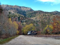
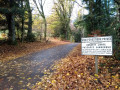
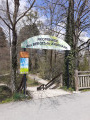
In summer, you can stick to the forest track a little less and head closer to the banks of the Grand Journans to seek shelter under the trees.

Details

1631699
Creation:
Last update:
Last review:
  • Walking
    Activity: Walking
  • ↔
    Distance: 3.84 mi
  • ◔
    Average duration: 2h 15 
  • ▲
    Difficulty: Moderate

  • ⚐
    Back to start: Yes
  • ↗
    Ascent: + 564 ft
  • ↘
    Descent: - 538 ft

  • ▲
    Highest point: 2,454 ft
  • ▼
    Lowest point: 1,936 ft

Photos

Description of the walk

Park in one of the car parks near the school in Perdtemps.

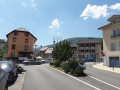
(S/E) Head towards the square and cross the road (D1005) leading up to the Col de la Faucille.
Follow the signs for Echevenex – Branveau – Colomby (marked in yellow, hiking route).
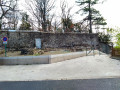
Walk past the old Château de Gex.

(1) Then head down the old rampart path.
When the alley widens, turn right to go down the steps towards Rue Léone de Joinville and reach it.

(2) Head up Rue Léone de Joinville on the right and continue along it until you reach the junction with the Chemin des Petits Contes.

(3) Here you have two options; see the alternative route in the ‘Practical Information’ section.
Carry on for a few metres to the left, then turn sharply right onto the farm track that climbs uphill.
Further up, join the Chemin des Petits Contes. This is a dead-end track that turns into a footpath. Follow it to the forest road “Chemin des Galas”.

(4) Follow the Chemin des Galas and pass a car park. Continue along the forest track, facing the Jura, and reach the Creux de l’Envers via a hairpin bend.

(5) Head back down, keeping to the road. This is now the Chemin de la Noyelle, which joins the junction with the Chemin de Baumes.

(6) Turn right onto it; the track runs below the main road. Follow it until you reach Rue de Rogeland further down.

(7) Turn right onto it, head downhill and you’ll reach Rue de Paris. Follow this street, then turn left at the junction onto Avenue de Perdtemps to return to the car park where you started (S/E).


Waypoints

  1. S/E : mi 0 - alt. 2,106 ft - Car park near the school in Perdtemps
  2. 1 : mi 0.19 - alt. 2,106 ft - Gex Castle
  3. 2 : mi 0.33 - alt. 1,949 ft - Rue Léone de Joinville
  4. 3 : mi 0.67 - alt. 2,051 ft - Chemin des Petits Contes
  5. 4 : mi 1.35 - alt. 2,402 ft - Chemin des Galas
  6. 5 : mi 1.99 - alt. 2,375 ft - Creux de l’Envers
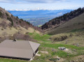
  7. 6 : mi 2.78 - alt. 2,438 ft - Chemin de Baumes – View of the - Lac Léman
  8. 7 : mi 3.41 - alt. 2,238 ft - Rue de Rogeland
  9. S/E : mi 3.84 - alt. 2,106 ft - Car park near the school in Perdtemps

Notes

Alternative routes:
(3) Turn right and follow the Chemin des Petits Contes.

Between (5) and (S/E) Alternative routes via the footpaths, closer to the Grand Journans stream, which is a shorter and cooler route in summer.

This route runs wholly or partly through the Haute Chaîne du Jura National Nature Reserve. Please respect the regulations: https://www.rnn-hautechainedujura.fr/reg...

This route passes through a protected area, which may be subject to special regulations:

Worth a visit

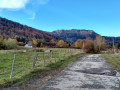
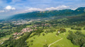
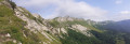
Views of the Jura, Lake Geneva and the Combe de Gex (actually the Combe du Journans).
A route close to the town but which very quickly takes you away from the noise of the town.

Reviews and comments

3.9 / 5
Based on 4 reviews

Reliability of the description
4 / 5
Ease of following the route
4 / 5
Route interest
3.8 / 5
User 20702911

A mostly shaded, easy walk through the forest, but far too much tarmac

Machine-translated

User 20702911

Overall rating : 3.7 / 5

Date of your route : Jun 29, 2026
Reliability of the description : ★★★★☆ Good
Ease of following the route : ★★★★☆ Good
Route interest : ★★★☆☆ Average
Very busy route : No

A mostly shaded route with no difficulties, but far too much tarmac

Machine-translated

Fête nationale
Fête nationale

Overall rating : 4.7 / 5

Date of your route : Jul 15, 2024
Reliability of the description : ★★★★★ Very good
Ease of following the route : ★★★★★ Very good
Route interest : ★★★★☆ Good
Very busy route : No

It’s a shame we had to rush back because of a heavy downpour. Otherwise, it was a lovely walk through the forest.

Machine-translated

Françoise P8.
Françoise P8.

There was a safety barrier blocking the way at the castle before heading down the ramparts path. We rejoined the route further down in the town, using a sat-nav (which we used throughout the journey) to find the names of the streets and paths (which are really just roads). We’d seen the yellow markings at the start, but after that there were none, or very few, on the forest track. Perhaps we missed something. Otherwise, the scenery was lovely, just as described. As a warm-up, we enjoyed the route overall as there were lots of children (though I’d just be a bit critical about safety in the town).
Best regards
Françoise

Machine-translated

Netra
Netra ★

Hello Françoise,

When you mention the “route that was closed”, are you referring to the entire walk or just one section of it? Was there any explanation on site as to why it was closed, or any indication of the actual dates of closure, etc.?

Thank you in advance for any further details on this matter.

Machine-translated

Françoise P8.
Françoise P8.
• Edited:

Overall rating : 2.3 / 5

Date of your route : Aug 28, 2019
Reliability of the description : ★★☆☆☆ Disappointing
Ease of following the route : ★★☆☆☆ Disappointing
Route interest : ★★★☆☆ Average

Right from the start we were lost, because the route was closed. It was difficult to find our way. There were too many roads and not enough paths.

Machine-translated

Erwin M.
Erwin M.

Overall rating : 5 / 5

Date of your route : Aug 10, 2019
Reliability of the description : ★★★★★ Very good
Ease of following the route : ★★★★★ Very good
Route interest : ★★★★★ Very good

We went for this walk with our dog, who has to be kept on a lead on the upper part of the route.
We extended the walk just a little, continuing on to the forest track, then heading back down a narrow path that follows the stream.
We then took the alternative route through the woods as soon as we saw the signpost (although according to the IGN map it’s a dead end, there’s a well-maintained path which, at one point, leads back to the road via some steps). We carried on to the Portes Sarrazines, two gorges, which we bypassed via the riverbed, hopping from rock to rock, before coming onto a lovely path.

We really enjoyed this walk, especially the return journey through the woods.
Thank you for suggesting this walk!

Machine-translated

Other walks in the area

For more walks, use our search engine .

The GPS track and description are the property of this route's author. Please do not copy them without permission.