The Génie Trail in Gex

The walk is so named because part of it was laid out by the military engineering corps to provide a link in the country’s defence system prior to theSecond World War. This circular route runs mainly through woodland, which provides shade in summer, and offers a few views over Lake Geneva and the Alps. The route follows unmarked tracks and paths, with a few steep sections and a short stretch across a path in poor condition. It is accessible outside the snow season.

Details

7710431
Creation:
Last update:
Last review:
  • Walking
    Activity: Walking
  • ↔
    Distance: 5.73 mi
  • ◔
    Average duration: 4h 05 
  • ▲
    Difficulty: Moderate

  • ⚐
    Back to start: Yes
  • ↗
    Ascent: + 1,650 ft
  • ↘
    Descent: - 1,640 ft

  • ▲
    Highest point: 3,694 ft
  • ▼
    Lowest point: 2,073 ft

Description of the walk

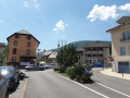
From the centre of Gex, head towards Rue de Gex la Ville and take Rue de la Forêt de Disse until you reach a small bridge where you can park.

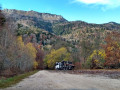
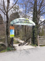
(S/E) Cross the bridge and follow the road to the first houses, at a place called Chaumois. You’ll notice a very colourful wooden building on the right; this is one of the oldest apiaries in the Pays de Gex.

(1) Take the path on the left, at an acute angle, towards Le Turet. At the crossroads about 150 metres further on, take the middle path. Head uphill in a north-north-westerly direction.

(2) You’ll come out onto a wide forest track; follow it to the left, keeping to the signposts.

(3) After about 500 m, leave the track and take a path on the left (at the corner of logging area no. 86). Immediately afterwards, leave the Turet route and take the path climbing steeply to the right (Yellow Cross), which runs alongside logging area 86 until it reaches a level track; cross this and emerge onto the Creux du Cerf forest road at a bend.

(4) Then take the Génie path, a track that branches off to the right (north), following the contour line. After a short while, the track turns into a path that cuts across a steep slope through the trees (this is the most worn-out section of the route) to join the Vesancy forest road.

(5) Follow the road to the right and take a hairpin bend to the left. About 700 m after this bend, you’ll reach a junction with the Toupinet path, which crosses the road (no signposting but obvious).

(6) Head down to the right along this steep path. You’ll come out onto a forest road; follow it to the right and take a hairpin bend to the left.

(7) Shortly afterwards, take the path branching off to the right. Walk through a fir forest, part of which was recently devastated by a storm. Keep heading south-west and ignore the side paths.

(8) You’ll come out onto a track; follow it to the right.

(9) At the junction at a place called La Pinière, turn left and head downhill.

(10) At the next junction, turn right and follow the road to Chaumois.

(1) Continue left along the road to return to the starting point (S/E).

Waypoints

  1. S/E : mi 0 - alt. 2,077 ft - Péroset – Before the bridge over the Oudar
  2. 1 : mi 0.3 - alt. 2,192 ft - Chaumois – Junction of the circular loop
  3. 2 : mi 1.07 - alt. 2,700 ft - Forest track
  4. 3 : mi 1.42 - alt. 2,930 ft - Junction
  5. 4 : mi 1.98 - alt. 3,684 ft - Creux du Cerf Track x Sentier du Génie
  6. 5 : mi 2.65 - alt. 3,583 ft - Vesancy forest track
  7. 6 : mi 3.22 - alt. 3,274 ft - Toupinet Trail
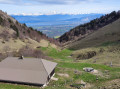
  8. 7 : mi 3.9 - alt. 2,674 ft - Junction – View of the - Lac Léman
  9. 8 : mi 4.54 - alt. 2,533 ft - Junction
  10. 9 : mi 4.79 - alt. 2,516 ft - La Pinière
  11. 10 : mi 5.13 - alt. 2,313 ft - Pré Richard
  12. S/E : mi 5.73 - alt. 2,077 ft - Péroset – Before the bridge over the Oudar

Notes

Between points (3) and (6), the IGN and OSM maps differ slightly regarding the trails; I have based this on the IGN map.

There are several possible starting points, including from Gex itself.
You can reduce the elevation gain slightly by setting off from the end of the Route de la Forêt de Disse (8) and either following the main forest track to reach (2), or taking a shortcut via the steeper track that passes to the left of a water catchment and leads directly to (3).

Sturdy footwear is recommended; walking poles are not essential but are useful on steep sections.

The route runs wholly or partly through the Haute Chaîne du Jura National Nature Reserve. Please respect the reserve’s regulations: https://www.rnn-hautechainedujura.fr/reg...

This route passes through multiple protected areas, which may be subject to special regulations:

Worth a visit

Between points (3) and (4), you can see for yourself the damage caused by the bark beetles attacking the fir trees. The ONF has carried out felling to contain the infestation, creating numerous clearings in the landscape.

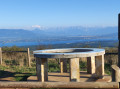
Accessible from (7) via a short detour, the Riamont Chapel, perched on its hill, offers a magnificent view and is an ideal spot for meditation (with an orientation table).
To get there, walk down the road to a gate, then follow the track that climbs up through the pasture on the left to the cluster of fir trees sheltering the chapel.
Return via the same route; at the gate, take the path opposite and, after a short climb, rejoin the route leading back to Saint-Martin upstream of the Ganguillette.

Reviews and comments

3.8 / 5
Based on 4 reviews

Reliability of the description
4.5 / 5
Ease of following the route
3.8 / 5
Route interest
3 / 5
User 22183132

Overall rating : 4 / 5

Date of your route : Apr 27, 2026
Reliability of the description : ★★★★★ Very good
Ease of following the route : ★★★★☆ Good
Route interest : ★★★☆☆ Average
Very busy route : No

A lovely walk; allow about two and a half hours to complete the circuit at a leisurely pace (45-year-old man). The GPX track is incorrect at one point, but if you follow the signs (Yellow Cross path), you’ll find your way. There aren’t any spectacular views, but it’s a very peaceful trail; I didn’t come across anyone, so you can enjoy the birdsong and the tranquillity.

Machine-translated

Franzi
Franzi

Overall rating : 4 / 5

Date of your route : Nov 23, 2025
Reliability of the description : ★★★★★ Very good
Ease of following the route : ★★★☆☆ Average
Route interest : ★★★★☆ Good
Very busy route : Yes

A beautiful walk taken on 22 December 2025 after snowfall (up to 20 cm at an altitude of 1,000 m).
After the leaves have fallen, there are many places with unobstructed views of the Geneva basin and the Alps.
A few uprooted trees were lying across the path on the upper part of the route, but they were easy to step over.
The walk is safe for most of the route. However, between 4 and 5 (Génie trails), caution is advised as the path is narrow and crosses a steep slope.
In several places, the signage is not abundant, so we relied on the GPX track and our position in the app.

Machine-translated

Christian 55
Christian 55

Overall rating : 4.7 / 5

Date of your route : Mar 08, 2024
Reliability of the description : ★★★★★ Very good
Ease of following the route : ★★★★★ Very good
Route interest : ★★★★☆ Good
Very busy route : No

A very good description of the route, which is extremely useful as the route often doesn’t follow signposted paths. The walk is very easy to complete in under four hours.

Machine-translated

swat
swat

Overall rating : 2.3 / 5

Date of your route : Aug 09, 2021
Reliability of the description : ★★★☆☆ Average
Ease of following the route : ★★★☆☆ Average
Route interest : ★☆☆☆☆ Very disappointing
Very busy route : No

I was a bit disappointed by this walk, which includes some rather uninteresting sections through the woods. There were no views, even where they were supposed to be. We ended up altering a few sections to avoid the monotonous bits.

Machine-translated

Other walks in the area

For more walks, use our search engine .

The GPS track and description are the property of this route's author. Please do not copy them without permission.