Country:

 City:
City:


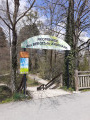
Start from the car park at the Parc des Berges du Journans, Rue de la Poudrerie.
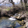
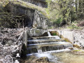
(S/E) Cross Rue de la Poudrerie, which leads to the car park, to explore the upper part of Parc du Journans. Walk to the far end of the park to see the Journans resurgence, which seems to emerge from the depths of Gex.
(1) Turn round and head back towards the starting point.
(S/E) From the car park, walk past the snack bar and follow the path leading to the lower part of the park. 100 metres further on, take the path that branches off to the right.
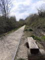
A little further on, take the path on the right which joins the old railway line that has been converted. Follow it to the right, cross Rue de la Folatière and continue straight ahead.
(2) Cross the road (D15C), go round the old gatekeeper’s house on the left and take the path that runs alongside the railway line, which has been reclaimed by overgrown vegetation.
(3) Further on, cross the Route de Chenaz and carry on straight ahead along the railway line. Cross a path at the Echenevex gatekeeper’s house (PN 37) and continue for about a hundred metres.
(4) Leave the railway line and take the path leading down to the left. Follow this path, which is partly muddy due to surface runoff, until you reach the Chemin des Crossettes.
(5) Turn right, then left 50 metres further on (signposted Segny-Chevry) and continue to Chemin des Bêchettes (road). On this stretch, keep to the left and ignore the two paths branching off to the right.
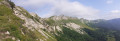
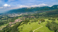
(6) Take the road on the right for about fifty metres, then turn left onto the path that climbs up through the trees. Soon the path opens out, offering lovely views on both sides of the Jura and Alpine ranges. At the very top of this path, just after passing under the power line, take a hairpin bend to the left to follow the path down towards the Journans.
Cross the bridge and immediately take the path on your right.
(7) Follow this path which runs alongside the River Journans, which becomes the Grand Journans.
(8) Just under a kilometre further on, cross the bridge on the right over the Grand Journans, which is supported by old electricity pylons.
Continue along the wide track leading to Veraz. At the end of this track – which is tarmacked in its final section – turn left and follow the Route des Deux Journans for 200 metres until you reach the bridge.
(9) Cross the road after the bridge and take the path that winds its way under the trees. It runs alongside the Grand Journans on your right.
(10) 300 m further on, do not take the path that follows the river to the right (it’s a dead end a little further on) but continue along the sandy, stony track that veers away from the river. It serves as a track for the horses from the neighbouring stud farm.
(11) Ignore the track coming from your left which leads to the Saint-Georges stud farm. Continue along the track on the right, which narrows and then becomes a farm track again before opening out into a lovely clearing.
(12) Do not cross the bridge over the Grand Journans but take the path that branches off to the left just before it. Follow this path as it runs alongside the river. Ignore the paths that cut across it to the right and left and continue along the river until you reach the edge of the woodland, where the riding arena of the Prégnin pony club comes into view.
(13) Take the path under the power line which branches off to the right alongside the riding centre. After 100 metres, turn left onto the Route des Ceytines. It ends in a dead end at the bridge over the Lion, but a path branches off just before it, diagonally to the left.
(14) Wooden gates mark the entrance to this path. Walk along the back of CERN and, at the very end, you’ll find more wooden gates. Then turn left onto the Promenade de la Manchette towards Brétigny. This lovely stretch runs alongside the Golf de la Manchette, offering some lovely views.
(15) At the end of the Promenade de la Manchette, turn left onto the path running alongside the road (D78). Enter Brétigny. At the roundabout, turn left and cross the small bridge over the Petit Journans. Just before the ‘Village Exit’ sign, take the path branching off to the right.
(16) Follow this for 200 metres, then follow the high-voltage power line running overhead for just under a hundred metres before veering slightly left onto a path running parallel to the power line. Further on, it joins a more clearly marked path; take this on the left, which will quickly bring you back to the footbridge.
(8) Continue to the right along the Grand Journans, following the same route as on the way there, to reach the other bridge.
(7) Take the wide path on your right. As you emerge from the woods, the track becomes Chemin de Borrax.
(17) At the end of this street, turn left onto Rue des Claisets. Walk past the cemetery, then take Rue des Pommeries, which veers slightly to the right.
(18) At the end of the street, turn left for 20 metres, then right into a leafy lane that winds its way up through the neighbourhood between the detached houses. It crosses two streets along its route.
(19) Once you’ve left this green corridor, continue along the road opposite to reach the roundabout in the Journans area (Fiat dealership opposite).
(20) Take the first road on the left, cross the bridge over the Grand Journans, and enter Chenaz. Pass the wash house on the left-hand side of the road, then the chicane, and join the road on the right, Chemin de Champ-Millet.
(21) Follow this road, passing a mobile phone mast, then follow the course of the Journans for 1.5 km. At the end of this track, carefully cross the Route de Mury (D15C).
(22) On the other side of the road, walk along the right-hand side of the building materials shop’s fence, go behind the crash barrier, then head down this path which leads to the Parc des Berges du Journans. Follow this path along the riverbank, go through the narrow tunnel under the old railway line, turn right and head to the car park at the Parc des Berges du Journans (S/E).

 Tourist office
 Very difficult
 Moderate
 Easy
Easy  Visorando Member