Country:

 City:
City:


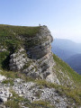
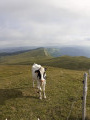
Chemin des Galas car park. From the centre of Gex, take Rue Léone de Joinville towards Miribel, then turn right onto Chemin des Galas and park in a forest car park on the left, about 500 metres further up.
(S/E) From the car park, walk back down towards Les Hutins for about 300 m along Chemin des Galas. Ignore a road on your right and continue to the next junction.
(1) Take the road leading uphill on the right. It soon becomes a forest track. After a few hundred metres, you’ll reach thefirst signpost.
(2) At the sign, head towards Chalet de Branveau / Colomby de Gex via a path that climbs to the right. The path crosses the Chanais forest track.
(3) Turn left onto it for a few metres, then rejoin the path climbing to the right (signpost); the path crosses the Pays de Gex forest track.
(4) Follow it for a few metres to your right, then rejoin the path leading uphill to your left (signposted). After a left-hand bend, the path joins another forest road (Route du Jet de la Reine).
(5) Continue along the Sentier des Gardes straight ahead. It comes to a cross-path.
(6) Take this track on the left for nearly 1 km on level ground. It follows the Route Forestière de Branvaux, which branches off to the right (signposted). Various pastoral improvements have been carried out along this section. You’ll come to a hairpin bend to the right.
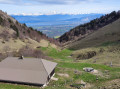
(7) Leave the forest road for a short while and take a steep path that plunges into the forest. A little further on, it rejoins the forest road. Very soon, the Branveau hollow opens up before you, like a cirque with the chalet at its foot.
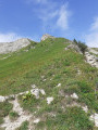
(8) After passing the chalet, take the path that climbs to the left (signposted ‘Colomby de Gex’). Follow it; 500 metres further on, you’ll catch a glimpse of the Colomby de Gex Cross, the highest point of the walk, and the path turns westwards.
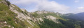
(9) Once you reach Colomby de Gex (1,688 m), you’ll be treated to superb panoramic views of the Jura, the Col de la Faucille and the Lake Geneva basin in all directions. From there, take theGR®9, a path that runs along the ridges, heading north-east towards La Faucille.
(10) Once you reach the Pas de l’Échine and its promontory, leave theGR®9and take the path on the right which descends into the Creux de Branveau and its chalet. It is very steep for the first 150 metres, with loose stones underfoot, so take care.
(11) Before reaching the chalet, turn left to follow the path that leads into the Creux de l’Envers. The view of this cirque is superb from this spot. Further down, it joins a forest track known as the Chemin Neuf.
(12) Follow this for a few metres to the left before taking a path that you can just make out on the right. It descends towards Gex, running alongside the Journans (a small torrent), with damp sections in places. Much further down, it crosses the Journans and emerges onto a forest track (Route des Fontanettes).
(13) Take this track to the right; the path descends gently to the gate. See ‘During the walk or nearby’.
(14) You’ll come to a fork in the road; take the right-hand path, the Route du Creux de l’Envers. Further on, it splits into two; take the path leading down to the left, the Chemin des Galas, which will take you back to the car park where you started (S/E).

 Visorando Member

 Tourist office
 Easy
Easy 
 Moderate
 Very difficult