From Gex to Vesancy via La Chapelle Riantmont

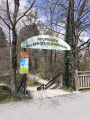
Starting from Gex, this pleasant circular walk takes you through the picturesque village of Vesancy, dominated by the Riantmont Chapel. A lovely family outing with gentle gradients, allowing you to soak up the authenticity of the local heritage and architecture.

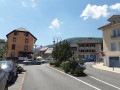
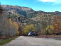
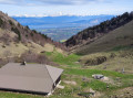
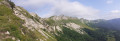
From the centre of Gex, the route winds through rural landscapes before reaching the village of Vesancy, with its restored old farmhouses, fountains and Saint-Christophe Church. The climb up to Riantmont offers magnificent views over the valley and the Geneva basin. Built in 1868, the chapel is a place of pilgrimage for the region’s faithful on Whit Monday. After a pleasant descent through the surrounding hamlets, the return journey to Gex gives you the chance to appreciate one last time the diversity of landscapes on this walk with its authentic charm.

Details

n°37071690
Creation:
Last update:
Last review:
  • Walking
    Activity: Walking
  • ↔
    Distance: 6.51 mi
  • ◔
    Average duration: 3h 45 
  • ▲
    Difficulty: Moderate

  • ⚐
    Back to start: Yes
  • ↗
    Ascent: + 863 ft
  • ↘
    Descent: - 860 ft

  • ▲
    Highest point: 2,700 ft
  • ▼
    Lowest point: 2,011 ft

Photos

Description of the walk

The walk starts in Gex at the car park on Place du Perthemps.

(S/E) With your back to the square, head down Avenue du Perdtemps towards Vesancy. Keep to the right at the junction after the cemetery, following the downhill road until you reach the next junction. Then turn right and carry on straight ahead. Continue to the end of the street.

(1) First turn left then right to follow Rue de la Forêt et de Disse, which then leads out of the residential area. You’ll then arrive at Péroset.

(2) Just before the bend (and just after the Stop sign), leave the main road and go straight on along a small tarmac road for a few metres. Cross the bridge and, at the next junction, turn left: follow the signs for Vesancy. Carry on straight ahead until you reach the road.

(3) Continue along the road which follows on from the footpath. Keep going straight on at the junction. Pass through the village of Vesancy, continuing straight on until you reach the cross, passing the wash houses on the way.

(4) Turn right uphill to a car park. Turn left onto a track leading to the Riantmont Chapel.

(5) After a short climb, carry on straight ahead until you reach the road. Take the grassy path opposite and cross the mountain pasture until you reach a wide track.

(6) Cross the road and continue along the path. Cross a stream, then pass through a turnstile. Continue straight on along a track. You’ll reach a place called La Combette (signposted). Continue through the woodland to the right, up a slight incline, and you’ll reach Saint-Martin.

(7) Cross the large square and take a dirt track flanked by a large house on the left, heading towards Sous-Disse. Follow the track to the next junction.

(8) Turn left onto a small path that leads downhill. Follow this path through the woodland until you reach the junction with the tarmac road.

(9) Turn right and continue to the hamlet of Péroset, which you passed on the way out.

(2) Keep to the right and follow the route back in the opposite direction to return to the car park (S/E).

Waypoints

  1. S/E : mi 0 - alt. 2,103 ft - Place du Perthemps in Gex
  2. 1 : mi 0.42 - alt. 2,011 ft - Common starting and finishing point
  3. 2 : mi 0.67 - alt. 2,054 ft - Péroset. Junction of the circular loop
  4. 3 : mi 1.5 - alt. 2,129 ft - Road
  5. 4 : mi 2.26 - alt. 2,241 ft - Cross
  6. 5 : mi 2.73 - alt. 2,530 ft - Riantmont Chapel
  7. 6 : mi 3.05 - alt. 2,441 ft - Road
  8. 7 : mi 4.2 - alt. 2,520 ft - Saint Martin
  9. 8 : mi 4.7 - alt. 2,700 ft - Crossroads
  10. 9 : mi 5.46 - alt. 2,182 ft - Road junction
  11. S/E : mi 6.51 - alt. 2,103 ft - Place du Perthemps, Gex

Notes

There is an alternative route that avoids passing through the Nature Reserve.

In this case: on the return leg, at the ‘Saint-Martin’ landmark, 6.9 km along the edge of the forest: head straight down for 40 metres to rejoin the tarmac road (Rue de la Forêt de Disse), which descends to the junction with the path at ‘Chaumois’ (a large house). The rest of the route is the same for returning to Gex (as on the outward journey).

  1. Safety instructions:

Part of this route passes through the Haute Chaîne du Jura National Nature Reserve; please observe the regulations.
https://www.rnn-hautechainedujura.fr/

Among these rules: Dogs are not permitted, even on a lead!

  1. Before setting off:

- Check the general and local weather forecast to ensure there is no rain

- Find out about the approach walk, the altitude of the route, the walking time and possible escape routes (IGN map, GPS, guidebook, etc.)

- Assess potential risks by consulting mountain professionals, mountain huts and lodges

- Inform a friend or family member of your plans and contact them again if there are any changes: departure and return times, number of participants with each person’s telephone number, vehicle(s), car park.

- Avoid setting off alone; use equipment suitable for the activity, properly adjusted and in good condition, such as a head torch, a fully stocked first-aid kit, a survival blanket, etc.

In the event of a problem, call 112 (the European emergency number).

Worth a visit

Reviews and comments

4.2 / 5
Based on 2 reviews

Reliability of the description
5 / 5
Ease of following the route
4.5 / 5
Route interest
3 / 5
PapaOurs179
PapaOurs179

Overall rating : 4.3 / 5

Date of your route : Oct 17, 2026
Reliability of the description : ★★★★★ Very good
Ease of following the route : ★★★★☆ Good
Route interest : ★★★★☆ Good
Very busy route : No

A pleasant walk with lovely scenery. One small point to note: about 1 km past the chapel, the path shown on the GPX track is no longer really visible. Another path seems to have formed naturally and is now the most obvious route. Also, be careful on the descent, which is about 1 km long; it can be tricky and I wouldn’t recommend it in wet weather due to the risk of slipping. A lovely walk overall.

Machine-translated

Damien Lautard
Damien Lautard

Overall rating : 4 / 5

Date of your route : Aug 13, 2023
Reliability of the description : ★★★★★ Very good
Ease of following the route : ★★★★★ Very good
Route interest : ★★☆☆☆ Disappointing
Very busy route : No

Good evening,

Having completed this walk on Sunday, here are my thoughts:

Pros:

  • Description and ease of following the route
  • Stunning views from the chapel, with the orientation board divided into three sections. You can walk all the way round the chapel – it’s brilliant.
  • Few walkers out early in the morning
  • Pleasant sections through the woods; it’s cool
  • The villages you pass through are lovely to see, with beautiful views over the fields and surrounding valleys

- :

  • Far too much road; over half the route is on tarmac, which isn’t great.
  • Few unusual viewpoints apart from the one by the chapel
  • The descent in the final section (Jura Nature Reserve) is quite steep; not to be attempted in wet weather.
  • Don’t wear barefoot-style shoes; not recommended given the type of stones
  • Not to be attempted in very hot weather

A walk to pass the time; we completed it in 2 hours, including breaks to take photos and have a drink.

Machine-translated

Other walks in the area

For more walks, use our search engine .

The GPS track and description are the property of this route's author. Please do not copy them without permission.