


Tour de l'Agglomération Montargoise Et rives du Loing de commune en commune

District urbain en 1959, devenu Agglomération Montargoise Et rives du Loing en 2001 (AME) pour une superficie de 231 km² et une population de 64 000 habitants.
Parcours au travers des 15 communes de la Communauté et de son patrimoine culturel et historique.
Après un départ urbain, partez à la découverte du charme de la campagne gâtinaise et de la quiétude de ses villages au milieu d’espaces naturels préservés alternant forêts, canaux, lacs et rivières.
Details
Creation:
Last update:
Last review:
–
–
-
 Activity: Walking
 -
 Distance: 64.23 mi
 -
 Average duration: 14 days
 -
 Difficulty: Moderate
 -
-
 Back to start: Yes
 -
 Ascent: + 574 ft
 -
 Descent: - 591 ft
 -
-
 Highest point: 407 ft
 -
 Lowest point: 253 ft
 Country:
 City:
City:


Photos
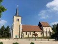
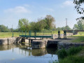
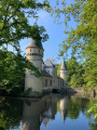
Stages of the route
This route needs several days, find the details below:
Other walks in the area
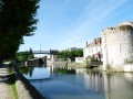
Montargis, the Venice of Gâtinais
 Visorando Member
 4.79 mi
+89 ft
-89 ft
2h 15
4.79 mi
+89 ft
-89 ft
2h 15
 Easy
Easy
 Departure from Montargis (Loiret)
Ranked among the most beautiful sites in France, explore Montargis through its streets on the water with 131 bridges and footbridges. A gastronomic and lakeside town nicknamed the Venice of Gâtinais.
Between rivers and canals in the heart of the Montargis conurbation.
 12.14 mi
+92 ft
-92 ft
5h 40
12.14 mi
+92 ft
-92 ft
5h 40
 Difficult
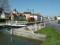
Departure from Montargis (Loiret)
Difficult
Departure from Montargis (Loiret)
Circular starting from the lakeside town of Montargis, known as the Venice of Gatinais. The junctions of the Briare, Orléans and Loing canals made it a veritable river crossroads between the Loire and Seine basins until the Orléans canal was decommissioned in 1954. Follow the waterways through the Loing valley, passing rivers, canals and lakes.
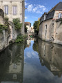
The Briare Canal between Montargis and the Moulin Bardin
 4.79 mi
+30 ft
-30 ft
2h 15
Easy
Departure from Montargis (Loiret)
4.79 mi
+30 ft
-30 ft
2h 15
Easy
Departure from Montargis (Loiret)
A stroll along the Briare Canal, passing through the lakes area of the Savoies and Népruns Nature Reserve, ending at Lac des Closiers and a circular route through the beautifully restored Pêcherie district.
Peace and quiet, nature, barges, birds and a few beautiful old houses – this is what awaits you.
Discover the mills starting from Montargis
6.99 mi
+82 ft
-82 ft
3h 15
Moderate
Departure from Montargis (Loiret)
A route taking you along the Loing, past ponds, castles, mills and the old village of Amilly, then on to Lac des Closiers, the perfect spot for a picnic. The two locks: the Passerelle de la Marolles lock, followed by the Écluse de la Tuilerie lock.
Passing through the locks and mills via Lac des Closiers
 6.57 mi
+125 ft
-69 ft
3h 10
Easy
Departure from Montargis (Loiret)
6.57 mi
+125 ft
-69 ft
3h 10
Easy
Departure from Montargis (Loiret)
A walk to explore the Loing, along the Briare Canal via the GR®13, starting from the Marolle Footbridge, passing through the Lac des Closiers peninsula – an ideal spot for a picnic. Discover the mills, ponds and locks at La Tuilerie and La Marolle, then pass through the old village of Amilly.
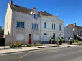
Suburban walking route from Villemandeur to Saint-Maurice-sur-Fessard
 6.48 mi
+20 ft
-26 ft
3h 00
Moderate
Departure from Villemandeur (Loiret)
6.48 mi
+20 ft
-26 ft
3h 00
Moderate
Departure from Villemandeur (Loiret)
Starting from Saint-Didier Church in the welcoming village of Villemandeur, with its many shops, this route will take you due west towards the peaceful village of Saint-Maurice-sur-Fessard, following the old towpath of the Canal d’Orléans, which has been converted into a cycle route. The route passes Machot Lock and follows various paths through the countryside, offering magnificent scenery that alternates between farmland and wooded areas.
A tour around Paucourt
 7.89 mi
+131 ft
-121 ft
3h 45
Moderate
Departure from Paucourt (Loiret)
7.89 mi
+131 ft
-121 ft
3h 45
Moderate
Departure from Paucourt (Loiret)
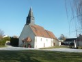
Discover the village of Paucourt and its forest, a veritable green lung in the heart of the Montargis national forest.
The Canal d’Orléans, starting from Chevillon-sur-Huillard
 10.32 mi
+66 ft
-66 ft
4h 50
Moderate
Departure from Chevillon-sur-Huillard (Loiret)
10.32 mi
+66 ft
-66 ft
4h 50
Moderate
Departure from Chevillon-sur-Huillard (Loiret)
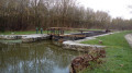
A walk that follows the Canal d’Orléans towpath for a third of its length. The remaining two-thirds follow quiet country lanes and paths through fields or woods, in peaceful countryside.
For more walks, use our search engine .
The GPS track and description are the property of this route's author. Please do not copy them without permission.

