Country:

 City:
City:


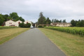
The car park is located at the Blanquefort Youth Hostel (Le Maurian).
(S/E) Take the north-south path that runs alongside the Youth Hostel on your right. At the junction of two paths in front of the building, take the path on the right which runs alongside the building towards the south and goes round it. Follow the path which goes round the grounds of the Bordeaux-Blanquefort Agricultural College. Continue until you reach Avenue du Général de Gaulle D2 (at number 93).
(1) Cross it with great care (there is a pedestrian crossing about thirty metres to the left), then take Rue Arlot de Saint Saud opposite. Follow it carefully until you reach the junction with a road in front of Château Dillon. At the junction, turn right and continue for about sixty metres.
(2) Turn left along the side of Château Dillon. After about sixty metres, turn right onto a farm track heading north. This track is soon flanked by trees on both sides. Further on, cross Route de Linas with care and continue straight ahead. Further on, the track crosses a stream and eventually leads onto Avenue de Tanais.
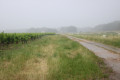
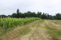
(3) Turn left and follow Avenue de Tanais with care. At the next junction, with Route Michel de Montaigne on the left and Route de Queyron on the right, carry on straight ahead. Turn right onto the first farm track approximately one hundred and fifty metres from the junction. The track runs alongside properties on the right and a vineyard plot on the left. At the corner of the plot, turn left to go round it.
(4) At the next junction of farm tracks, turn right onto a track that runs alongside a vineyard plot on the left. Carry on straight ahead until you reach Rue de Madères. Turn left and follow Rue de Madères carefully as far as the hamlet known as Le Grand Clapeau.
(5) When you reach the Château du Grand Clapeau, walk past it and continue along the Route de Madères, which runs alongside it, until you reach the Route du Clapeau. Turn right and follow this road carefullyfor about four hundred metres. You are now on the tarmac-surfaced Chemin Communal 029, known as Rue du Clapeau.
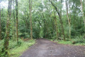
(6) Turn left onto the track which cuts straight through the Bois de Mongeau heading westwards. Further on, it crosses a clearing before continuing through the woods.
(7) Turn left onto Chemin Rural 014. The route then follows the GR® 81. Follow it for about one hundred and fifty metres before turning left onto the path that crosses the woods heading south-east. The Chemin de la Lande passes through the Agraulon area. After about two hundred metres, it passes by a telecoms mast. Carry on straight ahead to the north-western corner of the Société Hippique de Blanquefort. Turn right onto rural track no. 022, which runs alongside the Société Hippique’s grounds. The track leads out onto Rue du Manège.
(8) Cross it carefully and carry on straight ahead along the small road which joins Avenue de la Salle de Breillan. Turn left to follow this avenue, passing the Stade Émile Miart on your right. Further on, cross Rue de Jacques with care and continue straight ahead. Take the cycle path on the left which runs alongside Avenue de la Salle de Breillan. Go round the roundabout on the north side and continue along the avenue.
(9) When you reach Rue du Bechon on your right, carry on straight ahead on the pavement on the left-hand side of the avenue. Go round the roundabout at the junction with Avenue du Général de Gaulle (D2) on the left-hand (northern) side and follow the fence along Rue Jean Duvert. Turn left after passing the Youth Hostel building and return to the starting point (S/E).
 Visorando Member

 Difficult