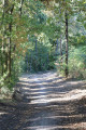
Across the Mirepied moor from Saint-Seurin Church

A pleasant route in the Lande de Mirepied, starting from Saint-Seurin Church. The route is very natural, with long stretches through woodland. For a short while, it follows a small section of the GR®81. A short part of the route follows the Jalle de Ludon.

Details

92806436
Creation:
Last update:
Last review:
  • Walking
    Activity: Walking
  • ↔
    Distance: 5.43 mi
  • ◔
    Average duration: 2h 30 
  • ▲
    Difficulty: Easy

  • ⚐
    Back to start: Yes
  • ↗
    Ascent: + 30 ft
  • ↘
    Descent: - 30 ft

  • ▲
    Highest point: 89 ft
  • ▼
    Lowest point: 46 ft

Photos

Description of the walk

The car park is situated next to Saint-Seurin Church (there are two options: in front of the west gate, behind the nave on the east side, or even on the south side of the church). Alternatively, you can park at the Lamourous hermitage.

(S/E) Leave Saint-Seurin Church towards the junction with the D211, turn left and follow the D211 northwards with care for about 300 metres until you reach the Peyquem vineyard on the right-hand side of the road.

(1) Turn left onto the farm track heading north (unpaved track). After about 150 metres, the track turns left. Shortly afterwards, at a bend to the right of the track, leave the track and continue straight on towards the woodland.

(2) At the edge of the woodland, turn right and follow the track that runs alongside the woodland on your left. A little further on, on the right and slightly set back, is the hamlet of Camparian. Shortly afterwards, about sixty metres on, the track turns left and enters the woodland. At the crossroads immediately after this, turn right and follow the path heading north until you reach the next crossroads some 400 metres further on.

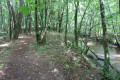
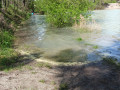
(3) Turn left and follow the straight path which crosses the woodland heading south-west. Initially, the path runs alongside a seasonal stream. When you reach the edge of the woods, cross the path running at right angles and continue straight on towards the south-west. Further on, the path runs past the Pian-Médoc Skate Park by Daco & Co on your left before reaching the junction with Allée Balzac.

(4) Cross it and continue straight ahead towards the west until you reach the next junction with the GR®81.

(5) Turn left and follow the GR®81 south-west, then quickly south, until you reach Allée Saint Seurin.

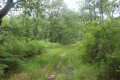
(6) Cross it and carry on straight ahead on the GR®81 heading due south. The path then runs alongside a clearing dotted with a few trees on the left and the woodland on the right. It then enters the woodland; a few dozen metres further on, it reaches a three-way junction.

(7) Take the path on the left, which branches off from the other path and then turns left towards the east. Follow it to the junction with Allée Balzac.

(8) Cross it and continue straight ahead along the path that runs through the woods towards the east. Further on, it runs alongside the Jalle du Ludon on the right-hand side, before eventually joining the Chemin de Gossemin.

(9) Turn left and follow the Chemin de Gossemin as far as the Allée de l’Église de Saint-Seurin. There, turn left and carefully follow the Allée de l’Église de Saint-Seurin (road) for around a hundred metres.

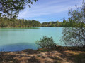
(10) Turn right onto the path heading north, which soon runs alongside a pond on your left. After walking a good hundred metres from the road, turn right onto the path leading into the woods. A little further on, the path crosses a seasonal stream. At the next junction, continue straight on until you reach a Fork in the road.

(11) Take the left-hand fork, which leads north-east then south-east. Ignore a cross-path to reach the edge of the woods shortly afterwards.

(12) Turn right onto the path that runs alongside a vineyard plot heading south. After about a hundred metres, a tree marks a crossroads; carry on straight ahead until you reach the Allée de l’Église de Saint-Seurin. Turn left and follow the road carefully as far as Saint-Seurin Church and the car park (S/E).

Waypoints

  1. S/E : mi 0 - alt. 75 ft - Car park at Saint-Seurin Church - Eglise Saint-Seurin Pian Médoc
  2. 1 : mi 0.2 - alt. 79 ft - Junction of Allée des Bruyères and Chemin blanc
  3. 2 : mi 0.39 - alt. 75 ft - Crossroads at the edge of the woods
  4. 3 : mi 0.7 - alt. 66 ft - Junction with a path on the left
  5. 4 : mi 1.93 - alt. 85 ft - Chemin - Allée Balzac
  6. 5 : mi 2.17 - alt. 89 ft - Crossroads
  7. 6 : mi 2.58 - alt. 85 ft - Chemin – Allée Saint-Seurin (road)
  8. 7 : mi 2.8 - alt. 69 ft - Three-way junction
  9. 8 : mi 3.1 - alt. 59 ft - Crossroads – Allée Balzac
  10. 9 : mi 3.52 - alt. 49 ft - Crossroads – Allée de Gossemin
  11. 10 : mi 3.96 - alt. 75 ft - Allée de l’église Saint-Seurin – Path on the right
  12. 11 : mi 4.76 - alt. 62 ft - Crossroads
  13. 12 : mi 5.09 - alt. 75 ft - Crossroads at the edge of the woods
  14. S/E : mi 5.43 - alt. 75 ft - Church car park

Notes

The route follows good paths and small roads of various types. Nevertheless, it is best to wear suitable footwear.

This walk presents no difficulty in terms of navigation. In addition, it is advisable to follow the instructions in the route description and on the map, whilst also paying close attention to the landscape. The waypoints, with their GPS coordinates and the distance from the starting point, are helpful for walkers exploring the route for the first time.

Hike completed by the author on 2 June 2026

Worth a visit

Saint Seurin Church in Pian-Médoc

The church at Le Pian-Médoc was built in the 12th century. Its location on an isolated plateau, some 3 km from the town hall, raises many questions. In the Middle Ages, churches were not built outside villages… Quite the contrary, as this allowed residents to attend services easily. Graves were arranged within its grounds (the cemetery was moved in 1888), so we can assume that Le Pian was no exception to this rule. Why, then, did the village disappear? An epidemic, an invasion…? To date, we can only put forward hypotheses.

This Romanesque-style church has undergone numerous alterations and undergone several restorations in the 19th and 20th centuries. It is surrounded by Malleret Castle and the Lamourous hermitage. The former presbytery, now owned by Malleret Castle, is situated opposite the church, on the other side of Allée Saint Seurin, and is thought to date from the 18th century.

It is the oldest building in the parish. The Romanesque chancel (12th and 13th centuries) features a ribbed vault resting on corbels decorated with animal or human heads, some of which have retained their polychrome colouring. In the 15th century, a sacristy was built against the east wall of the choir, thereby blocking the Romanesque window. The interior retains a ‘litre’ (a black painted band affixed upon the death of the lord) bearing the coat of arms of the D’Alesme family, lords of Le Pian.

Source: Paroisse Portes du Médoc

Lamourous Hermitage

Buildings and monuments on the estate and in the surrounding area.

The Lamourous Hermitage is a complex of buildings situated to the south and below the Church of Saint Seurin in Le Pian, formerly known as ‘Le Porge’.

The original estate belonged to the de Vincens de Cezac family. Under a deed of partition in 1760, it was bequeathed to Élisabeth de Vincens, wife of Louis-Marc-Antoine de Lamourous. The de Lamourous family were then living in Barsac.

The property covers many hectares of woodland, meadows and vineyards… amongst which stand the family home, a single-storey house with one upper floor, as well as a small house known as the ‘Maison du Berger’. As the estate cultivated vines, there are farm buildings on the site, as well as wine cellars and vats, which were likely converted when new activities were introduced.

According to the heritage inventory work carried out by Florian Grollimund, the main construction dates of the old buildings are thought to be the late18th and 19th centuries .

The other buildings are:

  • The chapel, built in 1846 by her nephew, the Abbé de Maignol (1796–1874), parish priest of Le Pian and chaplain at L’Ermitage, following the death of Marie-Thérèse de Lamourous.
  • A building originally intended as a laundry bears a plaque inscribed with the words ‘To Mr Perié, in gratitude, 1878’. This may refer to Auguste Perié, an architect in Bordeaux.
  • A reception building and the sisters’ quarters.

The buildings were altered inthe 20th centuryto keep pace with the educational development of the Ermitage.

The ‘shepherd’s house’ contains a small museum dedicated to Marie-Thérèse de Lamourous.

Other features of the estate include the springs. There are three of them. The ‘Mamizelle’ spring, near the great oak tree where Marie-Thérèse used to come to meditate and pray, supplies water to the communal house. Another lies below in the vegetable garden near the present-day road, and the third, known as the ‘Rusty Fountain’, used to supply a washhouse.

In the vicinity of the estate are:

  • A cross: the stone cross by the roadside leading up from the Hermitage to the church, known as the ‘Mamizelle’ cross. It was erected at the junction of two paths, where Marie-Thérèse found an arm of the Christ statue from the church that had been desecrated during the Reign of Terror. She used to come here every evening to recite her rosary.
  • A hut in the middle of the vineyards, which is currently being restored. Legend has it: “In this hut, Marie-Thérèse, alerted by winegrowers worried about the approaching storm, came to pray in response to their pleas. The storm moved on, just like all storms…” The plot of vineyard surrounding this hut is owned by the Ermitage, which leases it to Château Malleret.

From the Atelier Histoire du Pian, source: the book ‘Le Pian-Médoc as told by its inhabitants… and other curious souls!’

Always be cautious and plan ahead when you're outdoors. Visorando and the author of this route cannot be held responsible for any accidents occurring on this route.

The GR® and PR® markings are the intellectual property of the Fédération Française de Randonnée Pédestre.

Other walks in the area

For more walks, use our search engine .

The GPS track and description are the property of this route's author. Please do not copy them without permission.