


Refine your search for walks in Thil (Haute-Garonne)
Thil (Haute-Garonne) walks


 A refreshing circular loop on the outskirts of Thil
 Visorando Member
 2.16 mi
 +171 ft
 -171 ft
 1h 10
1h 10
 Easy
Easy
 Departure from Thil (Haute-Garonne) (Haute-Garonne)
Fancy a quick walk to stretch your legs? This route is perfect for you! Mostly through woodland, it offers shelter from the sun in summer.
 Bretx circular
 7.09 mi
+92 ft
-92 ft
1 hr
Easy
Departure from Bretx (Haute-Garonne)
7.09 mi
+92 ft
-92 ft
1 hr
Easy
Departure from Bretx (Haute-Garonne)
At the beginning ofthe 12th century, the village belonged to the Counts of Isle Jourdain. A fortified village, which later became the property of the Kings of France, Bretx came under the control of various lords: the Faudoas family inthe 16th century, the Le Mazuyer family inthe 18th century and the Belbèze family before the Revolution. Bretx enjoyed prosperity in the19th century, as evidenced by most of the buildings in the village. After declining in the last century, the village is now experiencing a new boom as it welcomes new residents.
Short circular loop around Launac
4.44 mi
+138 ft
-125 ft
2h 10
Easy
Departure from Launac (Haute-Garonne)
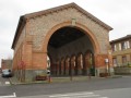
In the 12th century, a castle and a fortified village were built by the Viscounts of Gimoes. The castle became the property of the Counts of L'Isle Jourdain. Launac was the site of the bloody Battle of Palot. After a period of calm, the seigneury passed into the hands of Toulouse parliamentarians, sparking a conflict over feudal rights. The inhabitants resisted and even emigrated for years. After the Revolution, the market hall and church were rebuilt, a school was created and the ramparts were demolished.
Circular loop around Launac
 8.62 mi
+151 ft
-141 ft
4h 05
8.62 mi
+151 ft
-141 ft
4h 05
 Moderate
Departure from Launac (Haute-Garonne)
Moderate
Departure from Launac (Haute-Garonne)
A beautiful circular route steeped in history, where you will discover a castle and a fortified village in the village of Launac, which was also the site of the bloody Battle of Palot.
The Calvaire walk from the Abbaye du Désert
 Tourism professional
 1.57 mi
+171 ft
-194 ft
0h 50
Easy
Departure from Bellegarde-Sainte-Marie (Haute-Garonne)
1.57 mi
+171 ft
-194 ft
0h 50
Easy
Departure from Bellegarde-Sainte-Marie (Haute-Garonne)
A short, easy walk starting from the Abbey of Sainte-Marie du Désert, ideal for families. This circular route takes you on a journey of discovery, featuring a Way of the Cross, a calvary offering a lovely view, a path through the woods and a pilgrimage chapel. A short, varied and rejuvenating walk.
Around the Abbey of Sainte-Marie-du-Désert
9.36 mi
+850 ft
-850 ft
5h 05
Moderate
Departure from Bellegarde-Sainte-Marie (Haute-Garonne)
A hike in the countryside on the border between Gers and Haute Garonne, starting from the Abbey of Sainte-Marie-du-Désert and passing through two pretty little villages, Vignaux and Garac.
Menville loop
 4.78 mi
+338 ft
-325 ft
2h 30
Easy
Departure from Menville (Haute-Garonne)
4.78 mi
+338 ft
-325 ft
2h 30
Easy
Departure from Menville (Haute-Garonne)
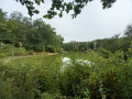
Menville is a pleasant little village on the left bank of the Save. The river meanders lazily through green meadows. Pretty houses with carefully tended gardens are grouped around the bell tower. The residents of Menville enjoy the peace and quiet and proximity to nature. Country roads lead to beautiful old farms, which everyone takes pride in maintaining and improving.
Circular north of Larra.
5.70 mi
+197 ft
-217 ft
2h 50
Easy
Departure from Larra (Haute-Garonne)
On the west bank of the Save, a passageway through the Pyrenees, marked by evidence of ancient occupation: carved and polished stones, jewellery, coins from the Gallo-Roman period.
In the 12th century, Larra became an agricultural estate owned by the Cistercian abbey of Grandselve. The fairs in Grenade allowed the farmers of Larra to sell their produce. The Avocat dairy farm produced wine that rivalled the best vintages of Fronton. In 1955, Larra became an independent commune.
Short circular loop around Larra
2.89 mi
+174 ft
-180 ft
1h 30
Easy
Departure from Larra (Haute-Garonne)
A short walk through woodland and open countryside, with a brief detour to the village of Larra. Arrival at the hamlet of Bordevieille and its well, then a descent into the woodland. You’ll reach the Cavaillé sports complex: fitness trail, disc golf course, pétanque courts, sports hall, football pitches and pump track. Take a short detour to see Larra Castle and its grounds, then head through the village square with its café, wash houses, town hall and church. For those with a sweet tooth, don’t forget to visit the chocolate shop.
Saint-Cézert circular
8.34 mi
+180 ft
-161 ft
4h 00
Moderate
Departure from Saint-Cézert (Haute-Garonne)
This village, typical of the Toulouse region with its bell tower featuring a triangular gable and its brick houses clustered around the village square, was endowed with a Benedictine priory in 940 and subsequently became the property of the Jourdain de l’Isle family in the 12th century. The church, rebuilt in the 19th century using a ‘sandwich’ construction of bricks and pebbles, was dedicated to Saint Orens, Bishop of Auch in the 4th century. At that time, Abbot Gilard immortalised the faces of the parishioners in the church’s frescoes.
Grand circular of Le Burgaud
 8.65 mi
+538 ft
-518 ft
4h 25
Moderate
Departure from Le Burgaud (Haute-Garonne)
8.65 mi
+538 ft
-518 ft
4h 25
Moderate
Departure from Le Burgaud (Haute-Garonne)
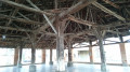
Le Burgaud, a name that recalls the heather that once covered its territory, is a rural commune where the first hillsides of Gascony begin. Traces of six Gallo-Roman villas have been found in the village. It was founded in 1124 by Lord Bertrand de Cobirac, who ceded the territory to the Knights of St John of Jerusalem, who held a commandery there until 1789. The fortified village was clustered around the church and the Commande fortified house.
Loop in Bouconne Forest via the leisure centre and Lac de la Bordette
8.03 mi
+148 ft
-148 ft
3h 50
Moderate
Departure from Lévignac (Haute-Garonne)
Route through the Bouconne National Forest. No particular difficulty as this hike has very little elevation gain. Very shaded route, perfect for summer family hikes.
Burgaud Circular - Knights of Malta Route
 4.22 mi
+351 ft
-364 ft
2h 15
Easy
Departure from Le Burgaud (Haute-Garonne)
4.22 mi
+351 ft
-364 ft
2h 15
Easy
Departure from Le Burgaud (Haute-Garonne)
Le Burgaud, a name that recalls the heather that once covered its territory, is a rural municipality where the first hillsides of Gascony begin. Traces of six Gallo-Roman villas have been found in the village. It was founded in 1124 by Lord Bertrand de Cobirac, who ceded the territory to the Knights of Saint John of Jerusalem, who held a commandery there until 1789. The fortified village was clustered around the church and the Commanders' fortified house.
From L’Isle-Jourdain to Gimont via the Way of St James
 15.10 mi
+810 ft
-830 ft
7h 40
15.10 mi
+810 ft
-830 ft
7h 40
 Difficult
Departure from L'Isle-Jourdain (Gers)
Difficult
Departure from L'Isle-Jourdain (Gers)
A day on the Arles route of the Way of St James, mainly following theGR® 653, which is better signposted than the Camino. The walk starts and ends in front of a railway station, so you can return by train on the same day.
Circular of Grenade - Le Canalet
 6.76 mi
+39 ft
-43 ft
3h 10
Easy
Departure from Haute-Garonne
6.76 mi
+39 ft
-43 ft
3h 10
Easy
Departure from Haute-Garonne
Founded in 1290 on the initiative of Eustache de Beaumarchais, Seneschal of the King of France and Prior of the Cistercian Abbey of Grandselve, the town of Grenade was built in a grid pattern, with a market hall and church. It prospered as the population cleared the surrounding wooded areas. Often pillaged during the Hundred Years' War and the Wars of Religion, calm and prosperity returned under Henry IV. In 1790, Grenade became the capital of the canton of Haute-Garonne.
Grenade and L'Avocat circular loop
 9.27 mi
+148 ft
-157 ft
4h 25
Moderate
Departure from Haute-Garonne
9.27 mi
+148 ft
-157 ft
4h 25
Moderate
Departure from Haute-Garonne
Grenade, founded in 1290 on the initiative of Eustache de Beaumarchais, Seneschal to the King of France, and the Cistercian Abbey of Grandselve, is laid out in a grid pattern, featuring the market hall and its church. It prospered as the inhabitants cleared the surrounding wooded areas, which were often plundered during the Hundred Years’ War and the Wars of Religion. Calm and prosperity returned under Henry IV. In 1790, Grenade became the county town of Haute-Garonne.
From the Bouconne Forest to Pujaudran
 5.43 mi
+358 ft
-361 ft
2h 50
Moderate
Departure from Pujaudran (Gers)
5.43 mi
+358 ft
-361 ft
2h 50
Moderate
Departure from Pujaudran (Gers)
Circular starting from the forest house car park, mainly on paths with beautiful views. The start follows part of the Way of St James via Arles. The route to Pujaudran largely follows the GTP (Grand Tour de Pujaudran).
The southern section of the Bouconne Forest trail
 4.84 mi
+220 ft
-213 ft
2h 25
Easy
Departure from Pujaudran (Gers)
4.84 mi
+220 ft
-213 ft
2h 25
Easy
Departure from Pujaudran (Gers)
Starting from the Maison Forestière Saint-Louis, a short, rectangular route through the Bouconne Forest and the Bois de l’Isle-Jourdain, with no tarmac roads and no difficulty.
The Bouconne Forest, following part of the GR®653
 7.69 mi
+315 ft
-325 ft
3h 50
Moderate
Departure from Pujaudran (Gers)
7.69 mi
+315 ft
-325 ft
3h 50
Moderate
Departure from Pujaudran (Gers)
A circular path in the Bouconne Forest that will show you that the forest isn’t actually flat.
On the way there, the route largely follows theGR®653towards Toulouse.
TheGR®653is the Way of St James via Arles. From Toulouse (31) to Borce (64) towards Somport. See: During the hike or nearby
A double circular loop starting from Ardizas
8.21 mi
+581 ft
-607 ft
4h 15
Moderate
Departure from Ardizas (Gers)
This walk will allow you to discover three villages, mainly along paths.
Lac de la Bordette in the Bouconne Forest
 9.19 mi
+200 ft
-213 ft
4h 25
Moderate
Departure from Pujaudran (Gers)
9.19 mi
+200 ft
-213 ft
4h 25
Moderate
Departure from Pujaudran (Gers)
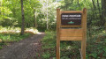
A walk for everyone in the Bouconne Forest, starting from the car park at the Saint-Louis forest house in Pujaudran and heading towards the pretty Lac de la Bordette
Places of interest in the southern part of the Bouconne National Forest
 8.61 mi
+318 ft
-338 ft
4h 15
Moderate
Departure from Pujaudran (Gers)
8.61 mi
+318 ft
-338 ft
4h 15
Moderate
Departure from Pujaudran (Gers)
A circular route to discover all the highlights of the southern part of the Bouconne State Forest.
Around Pujaudran on the Grand Tour de Pujaudran
 7.60 mi
+397 ft
-420 ft
3h 50
Moderate
Departure from Pujaudran (Gers)
7.60 mi
+397 ft
-420 ft
3h 50
Moderate
Departure from Pujaudran (Gers)
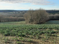
This route is based on the Grand Tour de Pujaudra (GTP), a circular walk starting from the car park at the Maison Forestière de Saint-Louis, featuring a mix of footpaths and roads and offering beautiful views.
The start follows part of the Way of St James via the Arles route.
The ‘Route du Chien’ in the Bouconne State Forest
 4.93 mi
+207 ft
-226 ft
2h 25
Easy
Departure from Pujaudran (Gers)
4.93 mi
+207 ft
-226 ft
2h 25
Easy
Departure from Pujaudran (Gers)
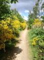
With a bit of imagination, the route’s layout might remind you of a ‘sitting dog’.
The route starts and ends at the car park of the Maison Forestière Saint-Louis in Pujaudran.
An easy route that does not follow any roads – and is therefore car-free – running through the southern part of the forest.
The Wolf Route in the Bouconne Forest
 4.14 mi
+207 ft
-210 ft
2h 05
Easy
Departure from Pujaudran (Gers)
4.14 mi
+207 ft
-210 ft
2h 05
Easy
Departure from Pujaudran (Gers)
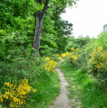
With a little imagination, the route of the circuit might resemble a wolf.
The route starts and ends at the car park of the Maison Forestière Saint-Louis in Pujaudran.
A easy route that does not follow any roads and is therefore car-free, running through the southern part of the forest.
A short walk around Saint-Cricq
 5.94 mi
+302 ft
-299 ft
3h 00
Easy
Departure from Saint-Cricq (Gers)
5.94 mi
+302 ft
-299 ft
3h 00
Easy
Departure from Saint-Cricq (Gers)
A short, easy route, accessible to all.
There is little traffic, beautiful views, the lake shore... 30% of the route is paved.
A peaceful walk in Savenès
 6.76 mi
+213 ft
-210 ft
3h 20
Easy
Departure from Savenès (Tarn-et-Garonne)
6.76 mi
+213 ft
-210 ft
3h 20
Easy
Departure from Savenès (Tarn-et-Garonne)
This yellow-marked hike is not difficult. However, be careful when crossing the D6 road twice.
The path to the Pont des Mascarades
 4.80 mi
+381 ft
-381 ft
2h 30
Easy
Departure from Pujaudran (Gers)
4.80 mi
+381 ft
-381 ft
2h 30
Easy
Departure from Pujaudran (Gers)
A short, easy walk starting from the small Gers village of Pujaudran, in its beautiful countryside, around charming little woods. Lovely views of the Pyrenees and the Toulouse metropolitan area, which is just a few kilometres away.
The Bouconne Forest from Pujaudran
 4.62 mi
+315 ft
-318 ft
2h 25
Easy
Departure from Pujaudran (Gers)
4.62 mi
+315 ft
-318 ft
2h 25
Easy
Departure from Pujaudran (Gers)
Among the hiking routes available from Pujaudran is the CR2, the Bouconne Forest route.
This is a circular route to the north-east of Pujaudran, which crosses part of the forest via a forest track and continues along theGR®653trail, the Saint-Jacques path, almost to the Saint-Louis entrance, before returning up a small valley, following the central stream.
Chemin du Pont de Saint-Antoine
 2.69 mi
+338 ft
-341 ft
1h 30
Easy
Departure from Pujaudran (Gers)
2.69 mi
+338 ft
-341 ft
1h 30
Easy
Departure from Pujaudran (Gers)
A fairly short walk with a lovely stretch through woodland alongside the little Ruisseau de Saint-Antoine
Vallons Gersois between Pujaudran and Lias
 7.00 mi
+400 ft
-390 ft
3h 35
Moderate
Departure from Pujaudran (Gers)
7.00 mi
+400 ft
-390 ft
3h 35
Moderate
Departure from Pujaudran (Gers)
Starting from the church in Pujaudran, route between Pujaudran and Lias with a detour to Fontenilles.
CR1 marked route from Pujaudran.
Chemin du Fusté
 4.65 mi
+581 ft
-604 ft
2h 40
Easy
Departure from Pujaudran (Gers)
4.65 mi
+581 ft
-604 ft
2h 40
Easy
Departure from Pujaudran (Gers)
A lovely little circular walk starting from the church in the village of Pujaudran. The route winds through valleys and over hillsides.
The Bouconne forest starting from Léguevin
 7.39 mi
+95 ft
-95 ft
3h 30
Moderate
Departure from Léguevin (Haute-Garonne)
7.39 mi
+95 ft
-95 ft
3h 30
Moderate
Departure from Léguevin (Haute-Garonne)
Starting from the Léguevin skate park, this circular route takes you to the Bouconne forest via the town's green spaces.
Around Pibrac via the Bouconne Forest
11.14 mi
+200 ft
-203 ft
5h 20
Moderate
Departure from Pibrac (Haute-Garonne)
Walk starting from Pibrac, Tambourettes park and playground near the Sainte-Germaine fountain, passing through the Bouconne forest, Lac de la Bordette, the Basilica and the historic centre of Pibrac.
Sainte-Germaine trail starting from Pibrac
 4.64 mi
+131 ft
-108 ft
2h 15
Easy
Departure from Pibrac (Haute-Garonne)
4.64 mi
+131 ft
-108 ft
2h 15
Easy
Departure from Pibrac (Haute-Garonne)
Route of Sainte-Germaine, the Basilica, the house, the fountain.
The countryside around Pibrac and the edge of the Forest of Bouconne
6.81 mi
+112 ft
-112 ft
3h 15
Moderate
Departure from Pibrac (Haute-Garonne)
This walk, with very little tarmac, takes you from Pibrac to the Bouconne Forest via a series of small paths through the countryside. With no particular difficulties, it is suitable for walkers of all ages.
The countryside around Bouillac
 8.87 mi
+1,037 ft
-1,050 ft
5h 00
Moderate
Departure from Bouillac (Tarn-et-Garonne) (Tarn-et-Garonne)
8.87 mi
+1,037 ft
-1,050 ft
5h 00
Moderate
Departure from Bouillac (Tarn-et-Garonne) (Tarn-et-Garonne)
A few small roads at the start and finish, but above all plenty of sections through fields and woods on this walk in the Bouillac countryside, in Tarn-et-Garonne.
The Bois de Monturon in Colomiers
5.20 mi
+138 ft
-138 ft
2h 30
Easy
Departure from Colomiers (Haute-Garonne)
This walk close to the city remains mostly rural and allows you to discover the pretty Pont Saint Jean bridge and the small Bois de Monturon forest. An ideal family walk with no difficulty.
Via the paths north of Colomiers
3.84 mi
+108 ft
-108 ft
1h 50
Easy
Departure from Colomiers (Haute-Garonne)
A walk north of Colomiers that allows you to get away from it all in a very natural setting – open countryside, fields, a bit of woodland – and, above all, following the course of the River Aussonnelle for part of the way.
Between the canal and the hillsides of the Frontonnais
 Local authority14.26 mi
+643 ft
-643 ft
1.5 hrs
Difficult
Departure from Castelnau-d'Estrétefonds (Haute-Garonne)
Local authority14.26 mi
+643 ft
-643 ft
1.5 hrs
Difficult
Departure from Castelnau-d'Estrétefonds (Haute-Garonne)
Starting along the canal, the route then winds through the hillsides of the Fronton region, offering breathtaking views over the Garonne plain. This circular route is best suited to fit and active walkers, due to the elevation changes and gradients encountered.
Through the fields and woods of Pompignan
6.54 mi
+433 ft
-427 ft
3h 25
Moderate
Departure from Pompignan (Tarn-et-Garonne) (Tarn-et-Garonne)
A walk through woods and fields in the hills above Pompignan (82), where the app’s GPS positioning is essential in some places.
Different perspectives on the Garonne side canal
4.66 mi
+404 ft
-381 ft
2h 30
Easy
Departure from Saint-Rustice (Haute-Garonne)
Starting from the village of Saint-Rustice, you cross the magnificent Pompignan communal wood and join the greenway along the Garonne side canal.
Be careful at the start as there is a short steep slope!
The woods and vineyards of Frontonnais from Grisolles
6.44 mi
+564 ft
-535 ft
3h 25
Moderate
Departure from Grisolles (Tarn-et-Garonne) (Tarn-et-Garonne)
An easy hike through the woods and vineyards of Frontonnais, once you have completed thefirst climb.
From Lake Oustalet to the heights of Tournefeuille
2.73 mi
+89 ft
-89 ft
1h 20
Easy
Departure from Tournefeuille (Haute-Garonne)
Nature just a stone's throw from the city. A pleasant walk for everyone, uncrowded and adaptable. A pretty little lake surrounding two small islands, which provide refuge for local wildlife.
The banks of the Touch from Plaisance to Saint-Martin du Touch
 6.71 mi
+43 ft
-72 ft
3h 05
Moderate
Departure from Plaisance-du-Touch (Haute-Garonne)
6.71 mi
+43 ft
-72 ft
3h 05
Moderate
Departure from Plaisance-du-Touch (Haute-Garonne)
This long walk along the Touch, between the river, lakes, woods and meadows, is very pleasant, varied, often shaded and well laid out. It can also be done by bike. And, of course, you can walk shorter sections.
 From the Touch to the Saint-Martory Canal via the Bidot Lakes
15.81 mi
+49 ft
-49 ft
1.5 hrs
Difficult
Departure from Tournefeuille (Haute-Garonne)
You cycle up the Touch to Lac de Bidot and then return to Tournefeuille by following the Canal de Saint-Martory.
The Two Bridges Walk in Tournefeuille
1.82 mi
+10 ft
-10 ft
0h 50
Easy
Departure from Tournefeuille (Haute-Garonne)
Pleasant circular loop along the Touch. On the left bank, the path is well-maintained and shared with cyclists. On the right bank, the walk is more unspoilt, with the path winding through meadows, woods and clearings. You may spot roe deer, foxes, coypu, common cranes, ducks and other birds, as well as rare and protected plant species. A lovely immersion in nature, just a stone’s throw from the town.