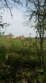
The countryside around Aucamville

An easy walk through the countryside north of Toulouse

Details

n°18791911
Creation:
Last update:
Last review:
  • Walking
    Activity: Walking
  • ↔
    Distance: 6.55 mi
  • ◔
    Average duration: 3h 15 
  • ▲
    Difficulty: Moderate

  • ⚐
    Back to start: Yes
  • ↗
    Ascent: + 249 ft
  • ↘
    Descent: - 272 ft

  • ▲
    Highest point: 535 ft
  • ▼
    Lowest point: 390 ft

Description of the walk

Park in the cemetery car park in Aucamville.

(S/E) Walk past the cemetery, keeping it on your right, and follow the road to thefirst bend.

(1) At the bend, carry on straight ahead along the grassy path until you reach a tarmac road. Take this road to the left to join the D52.

(2) Follow it to the left, then, after about 300 m, turn into thefirst road on the right. 300 m further on, take thefirst right again at thefirst house. The road bends to the left; follow it and, at the end, continue straight on along the path that leads down towards the forest.

(3) In the forest, at the bottom of the slope, continue along the path to the left. Walk past a poplar grove until you reach a tarmac road. Continue to the junction.

(4) At the junction, turn right, then rightagain to head down the road. Cross the bridge over the Ruisseau de Marguestaud and, atthe first junction, opposite the “Chien Assis”, take the path on the left and follow it straight on until you reach the D3.

(5) Do not take the D3 but the road that climbs immediately to the right and, at thefirst bend, carry on straight ahead along a track. Pass an S-bend and, at the next one, carry on straight ahead to cross the forest and rejoin a road.

(6) When you reach the “Pas de Long” house, take the tree-lined path on the left until you reach the D3. Cross the road (caution: danger – heavy traffic) and continue along the road opposite. Pass thefirst junction and you’ll arrive at the Saint-Jean-Baptiste Chapel.

(7) Carry on straight ahead again, cross the bridge over the stream and continue to the first road on the left after thefirst house.

(8) Take this road, turn right at the bend and, at thefirst junction, carry on straight ahead to join the D52.

(9) Turn left onto it and carry on straight ahead until you reach the village centre.

(11) Cross the D3 to take the road opposite and carry on straight ahead along Rue Du Carrelot until you reach the junction.

(11) Turn right, pass the water tower and continue straight on to your starting point, the cemetery car park (S/E).

Waypoints

  1. S/E : mi 0 - alt. 502 ft - Cemetery car park
  2. 1 : mi 0.23 - alt. 509 ft - Grassy path
  3. 2 : mi 0.86 - alt. 531 ft - D52 road
  4. 3 : mi 1.6 - alt. 453 ft - Path at the foot of the forest
  5. 4 : mi 2.36 - alt. 495 ft - ‘La Tranchée’ junction
  6. 5 : mi 3.54 - alt. 397 ft - D3 road
  7. 6 : mi 4.17 - alt. 420 ft - Pas De Long
  8. 7 : mi 4.81 - alt. 397 ft - Chapelle Saint-Jean-Baptiste (Aucamville)
  9. 8 : mi 5.01 - alt. 390 ft - Beillaud
  10. 9 : mi 5.58 - alt. 430 ft - Bergougnou
  11. 10 : mi 6.03 - alt. 482 ft - Église Saint-Martin (Aucamville)
  12. 11 : mi 6.3 - alt. 509 ft - Water Tower Path
  13. S/E : mi 6.55 - alt. 505 ft - Cemetery car park

Worth a visit

Reviews and comments

4.2 / 5
Based on 2 reviews

Reliability of the description
5 / 5
Ease of following the route
3.5 / 5
Route interest
4 / 5
Beaujouan
Beaujouan

Overall rating : 3.7 / 5

Date of your route : Mar 03, 2025
Reliability of the description : ★★★★★ Very good
Ease of following the route : ★★☆☆☆ Disappointing
Route interest : ★★★★☆ Good
Very busy route : No

The only downside is the signposting – it isn’t maintained and is missing in some places.
As we take a road in some places, a high-visibility vest is recommended.
The route is a lovely way to explore the countryside around Aucamville.

Machine-translated

vsteller
vsteller

Overall rating : 4.7 / 5

Date of your route : Feb 10, 2023
Reliability of the description : ★★★★★ Very good
Ease of following the route : ★★★★★ Very good
Route interest : ★★★★☆ Good
Very busy route : No

Enjoy the walk... we did it 45 minutes faster... at a leisurely pace.

Machine-translated

Other walks in the area

For more walks, use our search engine .

The GPS track and description are the property of this route's author. Please do not copy them without permission.