A refreshing circular loop on the outskirts of Thil

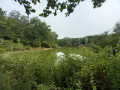
Fancy a quick walk to stretch your legs? This route is perfect for you! Mostly through woodland, it offers shelter from the sun in summer.

Details

n°50567671
Creation:
Last update:
Last review:
  • Walking
    Activity: Walking
  • ↔
    Distance: 2.16 mi
  • ◔
    Average duration: 1h 10 
  • ▲
    Difficulty: Easy

  • ⚐
    Back to start: Yes
  • ↗
    Ascent: + 171 ft
  • ↘
    Descent: - 171 ft

  • ▲
    Highest point: 689 ft
  • ▼
    Lowest point: 515 ft

Description of the walk

On the D89, heading towards Lévignac when coming from Thil, there is a parking area on the right, right next to a sewage treatment plant. There is space for two cars (or even three, but you’ll need to plan your manoeuvres carefully!).

(S/E) With your back to the car park, set off along the road, cross the Rivière and the Arsène, and carry on until you reach a path starting on the left.

(1) Turn onto this gently sloping, stony track and follow it (there are no signposts, but it’s very easy to follow). Carry on to the next junction.

(2) Carry on along the path straight ahead, slightly to your left, and keep going straight ahead, ignoring any side paths, until you reach the next junction.

(3) Turn right; you’ll need to look carefully for the very narrow path to find it. It’s mainly used by mountain bikers and is sometimes overgrown with tall grass. (If you miss it, don’t worry! Carry on along the maintained track until you reach Chemin Buffevent. If you take this route, continue to the junction with Impasse de la Houero and the hamlet of Graoué, on your right, which is still tarmac. Keep going straight on.) This narrow track leads to Impasse de la Houero.

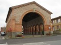
(4) Turn right onto this tarmac road, which leads to a pig farm and a building made of large red bricks. Keep slightly to your left after this red building, then to your right to head straight across the meadow. Right at the start of this path, on your left, you’ll find a large shelter (for tractors, I imagine?). Carry on straight ahead until you reach the forest.

(5) Turn right onto the stony track you encountered at the start of the walk and return to the junction you passed on the way out.

(2) Turn left and, following the route in the opposite direction to the way out, return to your car park (S/E).

Waypoints

  1. S/E : mi 0 - alt. 518 ft - Car park – Wastewater treatment plant - Arsène (rivière) - Affluent de la Save
  2. 1 : mi 0.07 - alt. 528 ft - Junction. Road/stony track
  3. 2 : mi 0.38 - alt. 627 ft - Junction of the circular loop
  4. 3 : mi 0.96 - alt. 607 ft - Junction
  5. 4 : mi 1.13 - alt. 646 ft - Impasse de la Houero
  6. 5 : mi 1.56 - alt. 686 ft - Back into the forest
  7. S/E : mi 2.16 - alt. 518 ft - Car park – Wastewater treatment plant

Notes

Wear walking shoes or wellington boots if the weather is wet or if it has just rained. Stay alert as the path can be very slippery in places.
If the path is not well maintained between the sections (3) and (4), you may have to make your way through tall grass. It’s not impossible, but do make sure you wear protective clothing.
This is a circular walk that is fairly easy to follow, despite the lack of signposting.

The walk is suitable for families with children.
It’s also a playground for mountain bikers.

Reviews and comments

4.3 / 5
Based on 2 reviews

Reliability of the description
5 / 5
Ease of following the route
4.5 / 5
Route interest
3.5 / 5
soulierAN
soulierAN

Overall rating : 4.3 / 5

Date of your route : Jul 09, 2024
Reliability of the description : ★★★★★ Very good
Ease of following the route : ★★★★☆ Good
Route interest : ★★★★☆ Good
Very busy route : No

A lovely walking route with plenty of shade. Brilliant if the temperature rises above 30°.
There are no particular difficulties apart from finding the car park, which is well hidden amongst the leafy trees and difficult to access due to local cars driving at high speed!
Apart from the tricky access to and departure from the car park, it’s a brilliant route that could be extended!
CDT

Machine-translated

CANAL ROBERT
CANAL ROBERT

Overall rating : 4.3 / 5

Date of your route : Jun 16, 2024
Reliability of the description : ★★★★★ Very good
Ease of following the route : ★★★★★ Very good
Route interest : ★★★☆☆ Average
Very busy route : No

An easy route, with many muddy sections along the way.

Machine-translated

Other walks in the area

For more walks, use our search engine .

The GPS track and description are the property of this route's author. Please do not copy them without permission.