


Refine your search for walks in Thiennes
Thiennes walks
 Between Lys and the Canal
 Local authority
 6.64 mi
 +13 ft
 -13 ft
 3h 05
3h 05
 Moderate
 Departure from Aire-sur-la-Lys (Pas-de-Calais)
The town of Aire-sur-la-Lys is crossed by the Lys river. It is bordered by the Neuffossé Canal, which takes the name Canal d'Aire at La Bassée, from this town onwards. The Bassin des Quatre Faces (Four Faces Basin) once allowed boats to turn around and sail in the desired direction: towards the town, the Lys, the canal towards Saint-Omer or Béthune. It is a signposted trail in the Pays de Saint-Omer urban community.
Molinghem
 Visorando Member
 9.95 mi
+180 ft
-177 ft
4h 45
Moderate
Departure from Isbergues (Pas-de-Calais)
9.95 mi
+180 ft
-177 ft
4h 45
Moderate
Departure from Isbergues (Pas-de-Calais)
Walk starting from the square in front of Saint Maurice Church in Molinghem.
Located in the countryside between Isbergues, Lambres, Mazinghem and Molinghem. In the Moulin plain and along the Lambres marsh.
Tour of the 3 bell towers in the heart of Flanders
 6.76 mi
+7 ft
-7 ft
3h 05
6.76 mi
+7 ft
-7 ft
3h 05
 Easy
Departure from Haverskerque (Nord)
Easy
Departure from Haverskerque (Nord)
The forest edge, the canal banks and the agricultural plain give the trail its contrasting moods. Keep your eyes peeled for birds in the undergrowth, insects on leaves and trees, and the mushrooms that grow here in late spring.
Tannay path
 3.65 mi
+3 ft
-3 ft
1h 40
Easy
Departure from Haverskerque (Nord)
3.65 mi
+3 ft
-3 ft
1h 40
Easy
Departure from Haverskerque (Nord)
This tour will introduce you to three different settings: the Domaniale de Nieppe forest, the wooded countryside and the Lys river.
Le Bruveau
6.95 mi
+52 ft
-52 ft
3h 15
Moderate
Departure from Aire-sur-la-Lys (Pas-de-Calais)
During this walk, you will discover the Lys valley. On the way back, you will follow the course of the Lys before it is channelled in the eastern part of Aire. This is a signposted trail maintained by the Pays de Saint-Omer Urban Community.
La Melde from Wittes
5.94 mi
+43 ft
-43 ft
2h 45
Easy
Departure from Wittes (Pas-de-Calais)
This route will allow you to discover the diversity of water in Wittes and Aire-sur-la-Lys. In Wittes, you will find the Melde, a tributary of the Lys. In Aire-sur-la-Lys, you will walk along the Lys, the Bassin des Quatre-Faces, the Ballastière ponds and the Canal de Neuffossé. This is a signposted trail maintained by the Communauté d'Agglomération du Pays de Saint-Omer.
Mont d’Hiver and the Neufossé Canal in Blaringhem
6.96 mi
+180 ft
-177 ft
3h 20
Moderate
Departure from Blaringhem (Nord)
A pleasant walk around the Brasserie du Pays Flamand in Blaringhem. With views over the Lys valley. Discover local agriculture and the hedgerow landscape.
A bucolic escape between Aire and Mametz
6.47 mi
+62 ft
-62 ft
3h 00
Easy
Departure from Aire-sur-la-Lys (Pas-de-Calais)
This route follows the path known as the Bruveau d’Aire-sur-la-Lys, with a few variations. It takes you to the Church of Saint-Vaast in Mametz via the Glomenghem marshes, then back to the hamlet of Moulin-le-Comte via the Chemin de Fauquenthun in the hamlet of Rincq.
The Bietz tour in Aire-sur-Lys
4.89 mi
+59 ft
-59 ft
2h 20
Easy
Departure from Aire-sur-la-Lys (Pas-de-Calais)
A pleasant and very easy hike around Le Bietz. You will pass through two hamlets in Aire-sur-la-Lys before returning to Moulin le Comte, following the Lys at the end of the route.
Path from the château to Morbecque
4.97 mi
+10 ft
-10 ft
2h 20
Easy
Departure from Morbecque (Nord)
Short walk in the Flamingue woods and along the Canal de la Nieppe.
Exploring the orchards from Wallon-Cappel
5.94 mi
+98 ft
-98 ft
2h 50
Easy
Departure from Wallon-Cappel (Nord)
A walk combining dirt tracks and small tarmac roads, taking in a chapel. Magnificent views of Mont Cassel.
Hugo Trail in Racquinghem
6.53 mi
+197 ft
-187 ft
3h 10
Easy
Departure from Racquinghem (Pas-de-Calais)
This route will take you through several different types of landscape: the Plateau des Landes regional nature reserve, the plain and the Neuffossé Canal. The latter separates the Pas-de-Calais department from the Nord department.
It is a marked trail maintained by the Pays de Saint-Omer Urban Community.
Upper Nave Valley
12.42 mi
+413 ft
-397 ft
6h 05
Moderate
Departure from Bourecq (Pas-de-Calais)
A long walk in an area that is very well signposted thanks to the excellent work of the Urban Community. The route follows as many paths as possible and remains very rural, with little elevation gain.
Les T'chiens starting from Robecq
 4.99 mi
+33 ft
-36 ft
2h 20
Easy
Departure from Robecq (Pas-de-Calais)
4.99 mi
+33 ft
-36 ft
2h 20
Easy
Departure from Robecq (Pas-de-Calais)
A walk that allows you to enjoy the village’s green surroundings. Walkers will discover a variety of paths during their stroll, including the Busnes stream and a wealth of diverse landscapes, rich in flora and fauna. This walk can be found on Randofiche 48, published by the FFRP and the CABBALR.
Val de Lys and woods
 13.79 mi
+282 ft
-299 ft
6h 35
13.79 mi
+282 ft
-299 ft
6h 35
 Difficult
Departure from Mametz (Pas-de-Calais)
Difficult
Departure from Mametz (Pas-de-Calais)
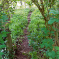
After following the River Lys and passing near the Étangs de Crecques, you’ll cross through two woods before finishing the walk along the paths and small roads of the plain.
A route without any major difficulties, apart from its length. Best undertaken in dry weather.
In wet weather, the two woods are quite tricky and, this winter, the path between Glomenghem and Mametz was flooded (it was fine on 25 April 2024, but the ditches are full to the brim and are just waiting to overflow).
The Ponds Trail
 3.99 mi
+23 ft
-23 ft
1h 50
Easy
Departure from Mametz (Pas-de-Calais)
3.99 mi
+23 ft
-23 ft
1h 50
Easy
Departure from Mametz (Pas-de-Calais)
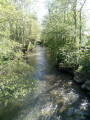
A short 6 km walk to explore the Étangs de la Sauvagine in Mametz and the Étangs de Rebecques.
A circular route starting from Calonne-sur-la-Lys
11.97 mi
+16 ft
-16 ft
5h 30
Moderate
Departure from Calonne-sur-la-Lys (Pas-de-Calais)
This route will allow you to explore the countryside north of Béthune and enjoy the canals via the towpaths.
The Gorges Bleues trail in Mont-Bernanchon
 5.42 mi
+16 ft
-16 ft
2h 30
Easy
Departure from Mont-Bernanchon (Pas-de-Calais)
5.42 mi
+16 ft
-16 ft
2h 30
Easy
Departure from Mont-Bernanchon (Pas-de-Calais)
A short, peaceful stroll along a grassy path beside the Canal d'Aire à la Bassée, taking you past the observation hut at the Mont-Bernanchon bird sanctuary. Stables and a short stretch through the forest.
This walk is marked in yellow from start to finish.
Merville, along the water
 2.75 mi
+13 ft
-13 ft
1h 15
Easy
Departure from Merville (Nord) (Nord)
2.75 mi
+13 ft
-13 ft
1h 15
Easy
Departure from Merville (Nord) (Nord)
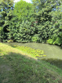
Here is a short walk that will take you along the River Lys and then through the flower-filled Les Prés de la Ville park.
Circuit d'Ecques par les landes
14.19 mi
+407 ft
-407 ft
6h 50
Difficult
Departure from Ecques (Pas-de-Calais)
Leave Ecques via the same route, then take a long, flat walk through the fields to reach Heuringhem. Continue across the moors of Blendecques, Rietz de l'Église and Bibrou before reaching Quiestède via Les Bruyères. Return via the Bois d'Ecques.
The route is relatively flat, but there are a few wet areas (more depending on the weather). During hunting season, avoid Sundays, as some communal woods are rented to hunting clubs!
Route modified and improved in September 2024 to avoid the D 190.
From Burbure to the Bois de Saint-Pierre
10.93 mi
+548 ft
-548 ft
5h 30
Difficult
Departure from Burbure (Pas-de-Calais)
There are very few roads on this fairly standard route, as it follows sections of marked trails. Quite hilly, it crosses the Terril de Burbure, the Bois de Saint-Pierre and follows part of the Scyrendale.
Le Chemin des Voyettes Poulouches
 3.02 mi
+20 ft
-20 ft
1h 25
Easy
Departure from Allouagne (Pas-de-Calais)
3.02 mi
+20 ft
-20 ft
1h 25
Easy
Departure from Allouagne (Pas-de-Calais)
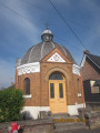
The Chemin des Voyettes Poulouches, which you will take, will lead you from one voyette (small lane) to another and allow you to discover or rediscover our village.
The Sentier de l’Alouette in Enquin-les-Mines
2.90 mi
+262 ft
-256 ft
1h 35
Easy
Departure from Enquin-les-Mines (Pas-de-Calais)
This walking trail, designed for school groups as well as families, allows you to discover, through educational information boards, life in the mining settlements, the Fléchinelle slag heap, wind power and agriculture in rural areas.
The Surgeon hills
 6.86 mi
+610 ft
-584 ft
3h 40
Moderate
Departure from Enquin-les-Mines (Pas-de-Calais)
6.86 mi
+610 ft
-584 ft
3h 40
Moderate
Departure from Enquin-les-Mines (Pas-de-Calais)
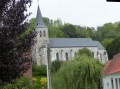
A short, undulating route offering beautiful views.
Hillsides of La Laquette
 13.45 mi
+810 ft
-830 ft
6h 55
Difficult
Departure from Enquin-les-Mines (Pas-de-Calais)
13.45 mi
+810 ft
-830 ft
6h 55
Difficult
Departure from Enquin-les-Mines (Pas-de-Calais)
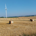
A long journey around Enquin-les-Mines that will take you across the northern and southern slopes of Laquette.
Nature around Amettes
 7.14 mi
+312 ft
-305 ft
3h 35
Moderate
Departure from Amettes (Pas-de-Calais)
7.14 mi
+312 ft
-305 ft
3h 35
Moderate
Departure from Amettes (Pas-de-Calais)
A lovely nature walk around the little village of Amettes, home to the birthplace of Saint Benoît-Joseph Labre.
The Fontinettes boat lift
 5.86 mi
+49 ft
-49 ft
2h 45
Easy
Departure from Arques (Pas-de-Calais) (Pas-de-Calais)
5.86 mi
+49 ft
-49 ft
2h 45
Easy
Departure from Arques (Pas-de-Calais) (Pas-de-Calais)
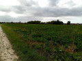
The Sentier des Fontinettes invites you to discover the sometimes unexpected natural treasures of Arques: from the Étang de Beauséjour to the Étang de Malhôve, via the Rihoult Forest and the canal towpath, not forgetting the water sports centre and the boat lift.
The source of the Peene at Sainte-Marie-Cappel
 6.32 mi
+75 ft
-75 ft
3h 00
Easy
Departure from Sainte-Marie-Cappel (Nord)
6.32 mi
+75 ft
-75 ft
3h 00
Easy
Departure from Sainte-Marie-Cappel (Nord)
A route through the fields following the course of the Peene’s sources, starting from Sainte-Marie-Cappel, with Mont Cassel and Mont des Récollets as a backdrop. Passing by one of the two documented sources of the Peene or Peene Becque.
Cassel and Oxelaëre from Sainte-Marie-Cappel
 7.62 mi
+604 ft
-594 ft
4h 00
Moderate
Departure from Sainte-Marie-Cappel (Nord)
7.62 mi
+604 ft
-594 ft
4h 00
Moderate
Departure from Sainte-Marie-Cappel (Nord)
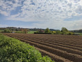
Circular starting from Sainte-Marie-Cappel, passing through Cassel and Oxelaëre.
The Lowlands between Vendin and Gonnehem
 7.21 mi
+30 ft
-33 ft
3h 20
Easy
Departure from Vendin-lès-Béthune (Pas-de-Calais)
7.21 mi
+30 ft
-33 ft
3h 20
Easy
Departure from Vendin-lès-Béthune (Pas-de-Calais)
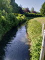
A short, unpretentious route with no significant elevation gain in the Béthune countryside. A mix of footpaths, farm tracks and small roads to keep you going for a good half-day.
Le Puits sans Fond stream
 7.28 mi
+361 ft
-354 ft
3h 40
Moderate
Departure from Fléchin (Pas-de-Calais)
7.28 mi
+361 ft
-354 ft
3h 40
Moderate
Departure from Fléchin (Pas-de-Calais)
A short walk that takes you up to the ridge before descending and going along the Puits sans Fond stream. More pleasant in dry weather, as some paths can be very wet.
Val de Clarence and Bois de Roquelaure
13.96 mi
+646 ft
-640 ft
7h 00
Difficult
Departure from Lapugnoy (Pas-de-Calais)
A patchwork of the various marked trails in the area for a long stroll, ending at the Bois de Roquelaure. It is a highly urbanised area, but you still feel as though you are in the countryside.
Woods, footpaths and mining heritage around Lapugnoy
 13.71 mi
+505 ft
-509 ft
6h 45
Difficult
Departure from Lapugnoy (Pas-de-Calais)
13.71 mi
+505 ft
-509 ft
6h 45
Difficult
Departure from Lapugnoy (Pas-de-Calais)
Long route through the Bois de Roquelaure, the Poulouches d'Allouagne and the Vallée Carreau d'Auchel. Return via Lozinghem and Mont Éventé before finishing at the Terril de Lapugnoy and a beautiful path on the edge of the Bois des Dames.Relatively little tarmac (but we are still in an urban area), but in wet weather, some paths can become difficult.
Two woods, a slag heap and a charterhouse to digest it all
14.94 mi
+738 ft
-735 ft
7h 30
Difficult
Departure from Labeuvrière (Pas-de-Calais)
Up to the entrance to the Bois des Dames, the route is much the same as this walk (there aren’t many options in the Bois de Roquelaure), but for the section through the Bois des Dames, I took different paths. The final stretch passes behind Emmaüs before reaching the Chartreuse des Dames and joining the Bois des Sablières.It’s a long, winding route, with hardly any tarmac and a significant elevation gain; whilst there are no major hills, there’s a succession of ascents and descents, which makes it more tiring . Very difficult in wet weather.Use ofthe Visorando app is strongly recommended.
From one woodland to another, starting from Labeuvrière and passing by slag heap no. 12
 11.18 mi
+640 ft
-614 ft
5h 40
Moderate
Departure from Labeuvrière (Pas-de-Calais)
11.18 mi
+640 ft
-614 ft
5h 40
Moderate
Departure from Labeuvrière (Pas-de-Calais)
The route takes you through the two woods of Lapugnoy: Roquelaure, with its easy paths, followed by the Bois des Dames, where the trails can be very wet. I’ve tried to stick to the lesser-known paths, particularly in the Bois des Dames, which makes for a route that’s quite difficult to follow. I recommend using the Visorando app. Note: on OpenStreetMap, the paths are clearly marked.
The slag heap is very beautiful in spring when it’s covered in flax.
From La Nave to Puits Sans Fond
14.13 mi
+873 ft
-853 ft
7h 15
Difficult
Departure from Fontaine-lès-Hermans (Pas-de-Calais)
Numerous trails for a walk that stretches between mountains and valleys.This hike is a great way to spend a day outdoors.
At the end of December 2019, after the rains, the paths became very difficult and particularly slippery (even on the flat sections!), both on the normal route and on the alternative route. Under these conditions, the walk can be classified as very difficult.
Bernard’s walk from Lapugnoy
 Association / Club / Walk leader
 6.86 mi
+407 ft
-427 ft
3h 30
Moderate
Departure from Lapugnoy (Pas-de-Calais)
6.86 mi
+407 ft
-427 ft
3h 30
Moderate
Departure from Lapugnoy (Pas-de-Calais)
A lovely walk that takes you through the Bois des Dames State Forest, with its rich biodiversity and a good climb, returning via Labeuvrière and passing over the slag heap. A bit of mining history: in 1920, many Polish workers arrived in Lapugnoy, where they were forced to build the barracks to house themselves.
Le Puits sans Fond depuis Febvin-Palfart
6.42 mi
+423 ft
-407 ft
3h 20
Moderate
Departure from Febvin-Palfart (Pas-de-Calais)
C’est un parcours en pleine nature. Sur les hauteurs, le randonneur apercevra l’Audomarois, les Monts des Flandres et le bassin minier. C'est un sentier balisé de la Communauté d'Agglomération du Pays de Saint-Omer.
Standaert Straete - Mont des Récollets from Cassel
 4.60 mi
+433 ft
-430 ft
2h 30
Moderate
Departure from Cassel (Nord)
4.60 mi
+433 ft
-430 ft
2h 30
Moderate
Departure from Cassel (Nord)
A walk that will allow you to enjoy the beautiful landscapes of Flanders as you descend north of Mont-Cassel.Admittedly, there are long stretches of tarmac, but these are not busy roads.
Around Bailleul-les-Pernes
7.17 mi
+443 ft
-453 ft
3h 40
Moderate
Departure from Aumerval (Pas-de-Calais)
A short route, on paths and minor roads, following theGR®127.
The two woods and the Coqueline
 12.29 mi
+679 ft
-692 ft
6h 15
Difficult
Departure from Aumerval (Pas-de-Calais)
12.29 mi
+679 ft
-692 ft
6h 15
Difficult
Departure from Aumerval (Pas-de-Calais)
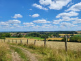
A very pleasant nature trail in dry weather, but becomes more challenging in wet weather: grassy sections (a good test for your shoes, deep ruts, muddy sections).
Warning: October 2024. While it's relatively easy to get through the ruts, the last part of the path out of the wood (before point 9) is in a terrible state. The path has been broken up by machinery and you can only pass along the sides, which are themselves very difficult. It's very slippery and sometimes you have to change sides, which is a real challenge. This used to be a signposted mountain bike trail, is it still?
Alternative route from Annezin
 5.07 mi
+33 ft
-33 ft
2h 20
Easy
Departure from Annezin (Pas-de-Calais)
5.07 mi
+33 ft
-33 ft
2h 20
Easy
Departure from Annezin (Pas-de-Calais)
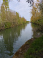
This walk starting from Annezin will let you discover the charms of an urban walk, sometimes on good paths, sometimes on tarmac. You’ll follow in the footsteps of the old canal, which no longer exists today.
Mont Cassel and Mont des Récollets starting from Terdeghem
 10.06 mi
+607 ft
-587 ft
5h 10
Moderate
Departure from Terdeghem (Nord)
10.06 mi
+607 ft
-587 ft
5h 10
Moderate
Departure from Terdeghem (Nord)
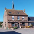
This route alternates between small roads and paths.
Explore Cassel via the Chemin des Remparts and enjoy a bite to eat as we’re two-thirds of the way through the walk.
After Cassel, we follow a series of paths to reach Terdeghem.
Circular route between Fouquereuil and Bruay
 13.31 mi
+495 ft
-499 ft
6h 35
Difficult
Departure from Fouquereuil (Pas-de-Calais)
13.31 mi
+495 ft
-499 ft
6h 35
Difficult
Departure from Fouquereuil (Pas-de-Calais)
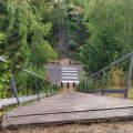
Long route through the urban area. Follow the Lawe and then the Brette to reach the Miner's Monument in Bruay. To return, head to Cité 4 in Bruay before reaching the Bois des Dames by following the PR® du Bois des Dames. Crossing the woods takes you to the slag heap before leading you to Emmaüs. From there, the return journey is via the Bois de la Sablière. There are many paths and "bus lanes" for a route that is passable even in wet weather.
La Cuvette from Clamarais
10.60 mi
+49 ft
-49 ft
4h 55
Moderate
Departure from Clairmarais (Pas-de-Calais)
This route is divided between marshland, bocage and forest. It crosses Flanders before returning to the Audomarois region. In the first part of this itinerary, walkers will see street names in Flemish. This is a signposted trail of the Communauté d'Agglomération du Pays de Saint-Omer.
The Two Rivers Trail in Fouquières-lès-Béthune
 5.18 mi
+135 ft
-135 ft
2h 30
Easy
Departure from Fouquières-lès-Béthune (Pas-de-Calais)
5.18 mi
+135 ft
-135 ft
2h 30
Easy
Departure from Fouquières-lès-Béthune (Pas-de-Calais)
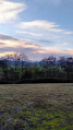
The two rivers trail from Fouquières-lès-Béthune to Fouquereuil takes you along the Blanche to the Annezin marsh, then along the Lawe before walking above the water under a railway line!
This route will take you to the Fouquereuil storage slag heap (the Terril de la Cuisse Maraune) where you can enjoy a superb 360° panorama from the top. The return journey is through the fields.
The two Chartreuses in Fouquières-lès-Béthune
 7.69 mi
+174 ft
-151 ft
3h 40
Moderate
Departure from Fouquières-lès-Béthune (Pas-de-Calais)
7.69 mi
+174 ft
-151 ft
3h 40
Moderate
Departure from Fouquières-lès-Béthune (Pas-de-Calais)
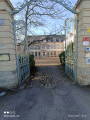
Belle randonnée sans difficulté. Elle vous fait découvrir des chartreuses dans la campagne et les bois environnants.
La catorive à Béthune
 7.21 mi
+36 ft
-36 ft
3h 20
Moderate
Departure from Béthune (Pas-de-Calais)
7.21 mi
+36 ft
-36 ft
3h 20
Moderate
Departure from Béthune (Pas-de-Calais)
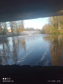
Venez découvrir Béthune avec ses anciens canaux, au départ, puis son port de plaisance, sans oublier le centre ville avec son beffroi.
Discovering the Audomarois marshlands
 4.26 mi
+7 ft
-10 ft
2h 00
Easy
Departure from Clairmarais (Pas-de-Calais)
4.26 mi
+7 ft
-10 ft
2h 00
Easy
Departure from Clairmarais (Pas-de-Calais)
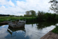
A walk that combines crossing the Clairmarais market garden marsh with the Romelaëre Nature Reserve.Lots of birdwatching: ash herons, coots, storks... And the star attraction of this walk: crossing the canals on the chain ferries, which will appeal to young and old alike!Please note: chain ferries and drawbridges only operate from March 15 to September 5.
The Pignolet trail in Fiefs
 7.24 mi
+381 ft
-381 ft
3h 40
Moderate
Departure from Fiefs (Pas-de-Calais)
7.24 mi
+381 ft
-381 ft
3h 40
Moderate
Departure from Fiefs (Pas-de-Calais)
A short walk alternating between roads, tracks and forest paths. You’ll be treated to some stunning views, especially in fine weather.
Let’s wander around the mountain
17.41 mi
+1,434 ft
-1,404 ft
7 hrs
 Very difficult
Departure from Godewaersvelde (Nord)
Very difficult
Departure from Godewaersvelde (Nord)
A very long route on and around Mont des Cats, allowing you to explore its southern section. I’ve tried to take as many paths as possible, resulting in a very winding route (hence the name of the walk). Take care on the small roads where visibility isn’t always very good.