


Refine your search for walks in Tête de Pibossan (1621m)
Tête de Pibossan (1621m) walks


 Tête de Pibossan at the start of the Croix-sur-Roudoule
 Visorando Member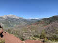
 11.79 mi
 +4,265 ft
 -4,265 ft
 9h 10
9h 10
 Difficult
 Departure from La Croix-sur-Roudoule (Alpes-Maritimes)
A beautiful and original hike on a little-used route offering a lovely view of the Mercantour (some peaks can be seen from unusual angles) from the summit of Pibossan.
Spring is the ideal time to walk this route, with the broom in bloom.
The route follows what is probably an ancient Roman road (paved path) through the red earth rising from the Daluis Gorges.
Walks near Tête de Pibossan (1621m)
Daluis Gorges
 2.33 mi
+482 ft
-676 ft
1h 30
2.33 mi
+482 ft
-676 ft
1h 30
 Moderate
Departure from Guillaumes (Alpes-Maritimes)
Moderate
Departure from Guillaumes (Alpes-Maritimes)
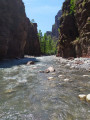
A route at the bottom of the superb Daluis Gorges! A water hike to be undertaken only in good weather, ideal in summer during hot weather. A hike accessible to children who can swim. Closed shoes are essential.
This hike crosses a protected natural site that is subject to regulations. See practical information.
From the Pont des Roberts to Valberg via the Baisse du Barrot
 13.13 mi
+4,921 ft
-1,949 ft
8 hrs
13.13 mi
+4,921 ft
-1,949 ft
8 hrs
 Very difficult
Departure from Guillaumes (Alpes-Maritimes)
Very difficult
Departure from Guillaumes (Alpes-Maritimes)
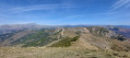
A beautiful, long, straight-line hike, with significant elevation gain but no technical difficulties. It requires at least two vehicles: one at the start and one at the finish.
Gueydan Bridge – Entrevaux via the summit of La Lette
 10.68 mi
+3,665 ft
-3,845 ft
8h 05
Difficult
Departure from Saint-Benoît (Alpes-de-Haute-Provence) (Alpes-de-Haute-Provence)
10.68 mi
+3,665 ft
-3,845 ft
8h 05
Difficult
Departure from Saint-Benoît (Alpes-de-Haute-Provence) (Alpes-de-Haute-Provence)
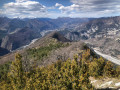
A beautiful, challenging route that keeps you on the ridgelines. The C-shaped configuration of the Var means that throughout this ascent you can admire the river’s banks on both the north and south sides. At the end of the hike, wander through the narrow streets lined with old walls in this magnificent village.
From the Aygue Blanche bridge to Montagne de l’Estrop
 3.69 mi
+3,209 ft
-0 ft
4h 30
Difficult
Departure from Péone (Alpes-Maritimes)
3.69 mi
+3,209 ft
-0 ft
4h 30
Difficult
Departure from Péone (Alpes-Maritimes)
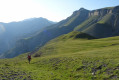
This hike is the first stage of a two-day circular route leading to the ascent of Mont Mounier.
Starting from the Pont d’Aygue Blanche near Péone, you’ll climb gradually towards the small plateau of the Montagne de l’Estrop, where you can camp in sheltered conditions. A stage through deciduous woodland and mountain pastures at the foot of the rocky ridge of the Montagne de l’Alp.
Amirat - Saint-Auban
 9.15 mi
+2,989 ft
-2,461 ft
6h 50
Difficult
Departure from Amirat (Alpes-Maritimes)
9.15 mi
+2,989 ft
-2,461 ft
6h 50
Difficult
Departure from Amirat (Alpes-Maritimes)
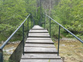
Second stage of the journey through the Haut-Estéron region. This stage takes you to Saint-Auban via the pretty villages of Gars and Briançonnet, then over the somewhat steep Col de l’Escoussier; a variety of landscapes and a trek through wild countryside await!
Mont Mounier as seen from the Montagne de l’Estrop
 10.63 mi
+2,703 ft
-5,919 ft
7 hrs
Very difficult
Departure from Péone (Alpes-Maritimes)
10.63 mi
+2,703 ft
-5,919 ft
7 hrs
Very difficult
Departure from Péone (Alpes-Maritimes)
This hike forms thesecond stage of the ascent of Mont Mounier.
Starting from the Montagne de l’Estrop, you’ll climb to the Col de Crousette for a beautiful view over the valley of the same name and the Haute-Tinée. You’ll then reach the Mont Mounier ridge, which you’ll follow to the summit.
The descent takes you through the hamlet of La Colle before climbing back up towards the Tête de Charnaye, then down again towards the altisurface, and finally the final descent to the Pont d’Aygue Blanche.
Le Mas - Amirat
 8.31 mi
+2,480 ft
-2,598 ft
6h 00
Moderate
Departure from Le Mas (Alpes-Maritimes)
8.31 mi
+2,480 ft
-2,598 ft
6h 00
Moderate
Departure from Le Mas (Alpes-Maritimes)
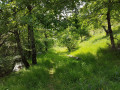
The first stage of the journey through the Haut Estéron region: the landscapes are magnificent and the area extremely wild; we didn’t come across a single other hiker. The trails are varied and well-marked. We’ll set off from the village of Le Mas to reach Amirat (lodge) via the Charamel mountain and the village of Les Mujouls.