The Passage de la Bourse from La Balme de Thuy

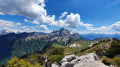
Discover a challenging route featuring the Passage de la Bourse, the partial ascent of the Vallon d’Ablon, then the Passage de la Gloire, and finally the return via Notre-Dame des Neiges and La Rosière.
Please note the comments regarding the Passage de la Bourse, which is equipped with a chain.

Details

n°14817100
Creation:
Last update:
Last review:
  • Walking
    Activity: Walking
  • ↔
    Distance: 11.01 mi
  • ◔
    Duration according to the author: 8 hrs 
  • ▲
    Difficulty: Very difficult

  • ⚐
    Back to start: Yes
  • ↗
    Ascent: + 4,111 ft
  • ↘
    Descent: - 4,098 ft

  • ▲
    Highest point: 5,453 ft
  • ▼
    Lowest point: 1,991 ft

Photos

Description of the walk

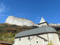
Car park access: head towards La Balme-de-Thuy; turn right before the church, at the hiking sign.

(S/E) Immediately after the car park, turn right onto the Route de Challes. Follow this road for about 700 metres before turning left at a signpost.
Then follow this path uphill to a junction called Les Durasses.

(1) Continue uphill and, at the next crossroads, ignore the path on the right which leads to Les Blonnières.

(2) Carry on to the left; the path climbs steeply, winds through the forest, then heads north-east, where it levels out somewhat.
It then veers west and emerges into an open area.
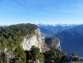
You can now see the rocky ridge, which you’ll need to follow along its base.

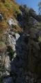
(3) At this point, the safety cable begins , securing this rocky ascent. A few metres after the end of the cable, the path returns to the forest and leads you easily to the top of the climb.

(4) Be careful not to reach the ridge; the path branches off to the left at a tree with a substantial trunk (no markings).
The path is barely visible for the first few metres, but soon becomes clearer. A few green and yellow markings help guide your way.
On the south side of the ridge, the path is initially level, then descends rapidly towards the valley.

(5) At the ‘Danger’ sign, turn sharply right and head down to the bottom of the valley. Continue on; there are cliffs used for rock climbing on your left, and shortly afterwards you’ll reach the Chalet d’Ablon.

(6) 30 metres past the chalet, you’ll see a signpost pointing towards the Passage de la Gloire.
You’ll need to climb up again, pass an easy rocky section, then continue along a pleasant path through the forest.
After about 30 minutes, you’ll reach the first track, which you’ll need to cross.
Further on, you’ll come out onto the Dran track, at a place called Passage de la Gloire.

(7) From the pass, turn right towards the Dran car park, then take the track above the car park (signposted arrow).
Then follow the signposts towards Notre-Dame des Neiges or La Rosière.

(8) At the crossroads, turn right, then at the place known as ‘Le Dran’, turn right again towards the chapel.

(9) From Notre-Dame des Neiges, continue straight on along theGR® 96 to La Rosière.

(10) From La Rosière, follow the track that forms part of theGR® 96 to reach Nant Debout Nord.

(11) Continue along the path on the right, which is level at first and then descends past the climbing area, until you reach the road leading to the Archaeological Site.

(12) At the site’s car park, head up the road on your right to return to the starting car park (S/E).

Waypoints

  1. S/E : mi 0 - alt. 2,037 ft - Balme de Thuy car park
  2. 1 : mi 0.53 - alt. 2,493 ft - Les Durasses
  3. 2 : mi 0.94 - alt. 2,881 ft - Junction with a track
  4. 3 : mi 1.9 - alt. 4,606 ft - Cable
  5. 4 : mi 2.29 - alt. 5,367 ft - Path on the left
  6. 5 : mi 2.56 - alt. 5,269 ft - ‘Danger’ sign
  7. 6 : mi 3.92 - alt. 4,577 ft - Chalet d’Ablon
  8. 7 : mi 5.29 - alt. 4,472 ft - Passage de la Gloire
  9. 8 : mi 6.08 - alt. 4,564 ft - Crossroads
  10. 9 : mi 6.82 - alt. 4,767 ft - Notre-Dame des Neiges
  11. 10 : mi 8.57 - alt. 3,940 ft - La Rosière
  12. 11 : mi 9.78 - alt. 2,582 ft - Nant Debout North
  13. 12 : mi 10.5 - alt. 2,024 ft - Archaeological Site Car Park
  14. S/E : mi 11.01 - alt. 2,037 ft - Balme de Thuy car park

Notes

Significant elevation gain and distance; good walking shoes are recommended.
Signposting is adequate except for the section near the summit leading to the ridge.
The Passage de la Bourse (3) is a rocky section equipped with a chain. It runs the entire length of this ascending section but remains tricky and exposed.
The start of the path leading down to the Vallon d’Ablon is not easy to spot.
It is better to take the Passage de la Gloire path, which is much more pleasant than the valley track.
The path shown on the map linking the stream Nant Debout to the castle is no longer passable; you will need to walk back up the road.

Worth a visit

Notre-Dame des Neiges.
The Archaeological Site.
The waterfall trail.
The Morette Military Cemetery.
Refreshments at the Morette inn.

Always be cautious and plan ahead when you're outdoors. Visorando and the author of this route cannot be held responsible for any accidents occurring on this route.

The GR® and PR® markings are the intellectual property of the Fédération Française de Randonnée Pédestre.

Reviews and comments

5 / 5
Based on 1 review

Reliability of the description
5 / 5
Ease of following the route
5 / 5
Route interest
5 / 5
Bouquetin740
Bouquetin740

Overall rating : 5 / 5

Date of your route : Jul 27, 2026
Reliability of the description : ★★★★★ Very good
Ease of following the route : ★★★★★ Very good
Route interest : ★★★★★ Very good
Very busy route : No

A very beautiful route, which is quite exposed in places at the Pas de la Bourse, but very well equipped with a thick, sturdy chain. Best avoided, however, if you’re afraid of heights and/or are with children.

Machine-translated

Other walks in the area

For more walks, use our search engine .

The GPS track and description are the property of this route's author. Please do not copy them without permission.