Sabatière slag heap

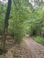
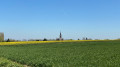
This short walk through the Scarpe Escaut Nature Reserve will take you through the woods, past marshes, where you can discover the remains of the old coal mines, reach the foot of the last headframe, climb to the top of the Térril de la Sabatière and enjoy the superb view.

Details

18604960
Creation:
Last update:
Last review:
  • Walking
    Activity: Walking
  • ↔
    Distance: 2.59 mi
  • ◔
    Average duration: 1h 25 
  • ▲
    Difficulty: Easy

  • ⚐
    Back to start: Yes
  • ↗
    Ascent: + 230 ft
  • ↘
    Descent: - 233 ft

  • ▲
    Highest point: 292 ft
  • ▼
    Lowest point: 59 ft

Photos

Description of the walk

The walk starts at the car park of the Maison de la Forêt in Raismes, at the junction of Avenue de la Font Bouillon and Avenue de l’Étoile de la Princesse on the Place d’Armes.

(S/E) Take the avenue running alongside the Maison de la Forêt for about 400 m.

(1) Take the second path on the right and follow the trail.

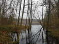
(2) When you reach the marshes, continue along the path to the right. At the junction with a second path, follow the path. You can take a detour by going straight ahead (a 10-metre cul-de-sac), then turn back. Return to Avenue de l’Étoile de la Princesse at Place d’Armes and walk along it.

(3) Cross via the path leading off to the right to reach the headframe, then turn back.

(3) Carry on straight ahead and, after crossing the avenue, turn right to climb up the Terril Sabatier.

(4) Head down to the left to continue the circular path and reach a cross-path.

(5) Turn left onto the path through the woods, join Avenue de la Princesse and return to the starting point (S/E).


Waypoints

  1. S/E : mi 0 - alt. 62 ft - Forest Centre in Raismes
  2. 1 : mi 0.26 - alt. 66 ft - Junction on the circular loop
  3. 2 : mi 0.63 - alt. 66 ft - Junction across the ponds
  4. 3 : mi 1.03 - alt. 75 ft - The headframe
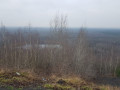
  5. 4 : mi 1.44 - alt. 292 ft - View from the slag heap - Téril Sabatier
  6. 5 : mi 1.79 - alt. 85 ft - Crossing path
  7. S/E : mi 2.59 - alt. 62 ft - Forest Centre in Raismes

Notes

A short walk, but be prepared for a climb up a spoil heap. Suitable footwear is recommended, particularly if it has rained recently.

Worth a visit

There are other routes to explore in the nature reserve, particularly around the Mare à Goriaux.

Reviews and comments

4.6 / 5
Based on 3 reviews

Reliability of the description
4.7 / 5
Ease of following the route
4.7 / 5
Route interest
4.3 / 5
BaudouinB
BaudouinB

Overall rating : 4.7 / 5

Date of your route : Apr 22, 2026
Reliability of the description : ★★★★☆ Good
Ease of following the route : ★★★★★ Very good
Route interest : ★★★★★ Very good
Very busy route : No

A short and pleasant walk through state-owned woodland, past ponds and slag heaps. The route is varied, featuring in particular the climb up the Sabatier slag heap via a fairly enjoyable single track. It is suitable for families, with the main challenge being the climb up the slag heap.

The route suggested here is actually a variation on the PR 7 – The Sabatier Slope Trail, proposed by the FFRandonnée. It includes a detour via the headframe of the former Sabatier No. 2 shaft. The slag heap and the pit are named after Maurice Sabatier, a director of the Compagnie des mines d’Anzin, whose presence on the site is still commemorated today by the nearby street.

For those wishing to find details of the original route:
https://nomdunrandonneur.com/2026/04/22-...

Machine-translated

Tipoune
Tipoune

Overall rating : 4.3 / 5

Date of your route : Jun 02, 2024
Reliability of the description : ★★★★★ Very good
Ease of following the route : ★★★★☆ Good
Route interest : ★★★★☆ Good
Very busy route : No

A lovely Sunday morning walk. A bit of mud and some mosquitoes… but given the weather, that’s hardly surprising.
Lovely view when you reach the top – a shame the information board isn’t very legible any more.
The route could be a bit longer to allow time to visit both slag heaps.

Machine-translated

Totdu
Totdu

Overall rating : 4.7 / 5

Date of your route : Jul 31, 2023
Reliability of the description : ★★★★★ Very good
Ease of following the route : ★★★★★ Very good
Route interest : ★★★★☆ Good
Very busy route : Yes

An interesting tour exploring 300 years of mining history

Machine-translated

Other walks in the area

For more walks, use our search engine .

The GPS track and description are the property of this route's author. Please do not copy them without permission.