Country:
 City:
City:


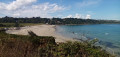
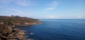
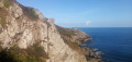
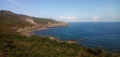
Start from the car park at Plougasnou-Saint-Jean-du-Doigt beach. If possible, park in the eastern part of the car park, at the junction of the D79 and the D79a.
No signposting
(S/E) Head up the D79 towards Saint-Jean-du-Doigt, taking a tarmac path running parallel to the right-hand side of the road. Ignore a road coming from the left. At Traon Véniec, turn left to cross the road at the pedestrian crossing and follow Rue de Ker François towards a holiday centre. Continue uphill and, at the next Fork in the road, turn left, leaving the holiday centre on your right.
(1) After the second ‘Exit Saint-Jean-du-Doigt’ sign, turn right onto Route du Goajou (no entry). Pass a detached house on the left, then a small road on the right, and continue uphill. At the ‘Stop’ sign, go straight on and pass through a housing estate.
(2) At a small roundabout (with a beautiful house opposite on the right), take the first left onto the Route de Kervennou. Follow this small road to the end, ignoring another road on the left.
Yellow signposts (sparse and weathered)
(3) At the junction, turn left and immediately ignore a turn-off on the left. Shortly afterwards, just before a large livestock farm, turn right onto a farm track. At the end, at a three-way junction, take the left-hand path, a shaded track through the ferns. You’ll come out onto a small road at a place called Pen ar Prat.
(4) Follow it to the right, ignoring a small road on the right and then, immediately afterwards, another on the left. You’ll pass a dead-end on the left; stay on the road, which winds round a few bends. Enter the hamlet of Prajou.
(5) Then turn immediately left into a cul-de-sac that climbs slightly (beautiful houses and an old well topped with a cross). At the top of the hill (view of the sea), head gently downhill along the road. Cross a small car park and continue along a track towards the coastal path. You’ll soon reach a junction with a signpost marking the junction with the GR®34.
Red and white markings (rare as the route is obvious)
The coastal path is dotted with signposts bearing the name of the commune and that of the locality in Breton, sometimes with its French translation.
(6) Follow the coastal path and the GR® to the left. Descend via a series of hairpin bends and a few steps carved into the rock. Pass the ‘Beg an Fry’ and ‘Pont Melven’ signposts in turn, alternating between short ascents and short descents.
(7) Begin a steep ascent to go round a rocky outcrop on the left. In places, the path is interspersed with wooden steps and boardwalks. At the top, head back down and pass the Krec’h Meur signpost. Climb again to reach Pointe Runglaz (not signposted).
(8) Continue along the coastal path, head down, then up again, and pass the Kanol ar Marc’h signpost. Further on, cross a stream, climb a flight of steps and immediately reach a junction (incorrectly marked on IGN and OSM maps).
(9) Turn right here (be careful, there are no markings here; there is a sign pointing towards Saint-Paul’s Chapel but it is no longer attached at the base, so depending on any pranks played by previous passers-by, it may be misleading). Continue up and down the coastal path. At the top of a steep hill, you’ll reach the Beg ar Senlioù signpost.
(10) Continue on roughly level ground. At a fork in the road (a large concrete post with an arrow), turn right. Cross a wet area using a footbridge and a boardwalk. Then climb up a series of hairpin bends and descend in the same way. You will arrive at the foot of the Aod at Lay signpost.
(11) Continue along the coastal path and head uphill to a T-junction (the D79a road is a short distance to the left).
(12) Turn right here and head downhill. Cross a footbridge over a stream and climb steeply uphill. Then head downhill again and climb back up along the path, which is interspersed in places with wooden steps. You’ll reach the Beg Gracia signpost.
(13) Continue along the coastal path. After a descent, cross a footbridge; immediately ignore a path branching off to the left and turn right. You’ll arrive at the foot of the Ar Roc’h blad signpost.
(14) Continue along the coastal path, keeping the bell tower of Saint-Jean-du-Doigt church in sight as it comes into view. Walk up to a car park, cross it and join the D79a.
(15) Follow the road to the right and head down to the car park at Plougasnou-Saint-Jean-du-Doigt beach (S/E).
 Visorando Member

 Easy
Easy