Circular walk starting from Saint-Jean-du-Doigt beach

This circular walk follows the coastal path (GR®34) to Pointe de Primel, then returns to the starting point via the inland route.

Details

29649684
Creation:
Last update:
Last review:
  • Walking
    Activity: Walking
  • ↔
    Distance: 6.51 mi
  • ◔
    Average duration: 3h 35 
  • ▲
    Difficulty: Moderate

  • ⚐
    Back to start: Yes
  • ↗
    Ascent: + 682 ft
  • ↘
    Descent: - 659 ft

  • ▲
    Highest point: 285 ft
  • ▼
    Lowest point: 10 ft

Photos

Description of the walk

Park at the Saint-Jean-du-Doigt beach car park.

(S/E) From the car park, walk along the beach towards the west. At the far end, as the Customs Officers’ Path does not continue along the coast, carry on along the pavement of the beach road which climbs towards Plougasnou.

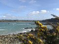
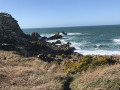
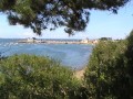
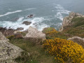
(1) Turn right onto Impasse de Kermaria and follow theGR®34to join the coastal path on the left. Follow the path as it winds along the coastline, passing Pointe de Roc’h Louët. Beautiful views of Pointe de Primel and the Trégor coast towards Lannion.
Join the developed promenade along Anse de Primel.

(2) Follow the edge of the beach at low tide. At the far end of the beach, leave the coastline temporarily (access prohibited due to rockfalls) by taking Rue du Grand Large for 50 metres.

(3) At the crossroads, turn right towards the Camping de la Mer and walk alongside it

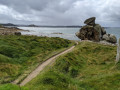
(4) Once past the campsite, turn right at the Fork in the road to reach the pebble beach (removing pebbles is prohibited). Walk round the Pointe de Primel, taking care near the fault line that separates the small island from the mainland at the tip of the headland.

(5) Continue along theGR® trail and you’ll come out onto the seafront at Trégastel beach. Carry on for about 50 metres along the road (Rue de Rhun Prédou).

(6) Cross the road with care and turn left onto Rue de Kereven.

(7) At the T-junction at the top of the street, leave theGR®34route and continue uphill to the left along Rue de Kerlongavel.

(8) On the hilltop at the Fork in the road, turn slightly left onto Rue de Kerhouin.

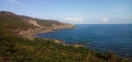
(9) At a right-hand bend, leave the road and take the path opposite, which crosses the Route de Sainte-Barbe further on to the right and left respectively. Beautiful views of the coast once again. At the end of the path, turn left onto the Route de Kermenhir.

(10) 300 m further down, at a place called Kerguelen, turn left onto Promenade de la Méloine.

(11) 300 m further on, turn right and follow the cycle route signs. After a short stretch of dirt track, you’ll rejoin the tarmac on the Chemin de Ruffelic, then the Chemin de Lézouzard. Return to the beach road

Follow the route in reverse to complete the circular loop at the beach car park (S/E).

Waypoints

  1. S/E : mi 0 - alt. 26 ft - Saint-Jean-du-Doigt beach car park
  2. 1 : mi 0.64 - alt. 217 ft - Junction of the circular loop
  3. 2 : mi 2.35 - alt. 30 ft - A developed promenade along the Anse de Primel
  4. 3 : mi 2.75 - alt. 23 ft - Crossroads
  5. 4 : mi 2.98 - alt. 23 ft - Camping de la Plage
  6. 5 : mi 3.4 - alt. 39 ft - Pointe de Primel
  7. 6 : mi 4.01 - alt. 23 ft - Trégastel Beach
  8. 7 : mi 4.09 - alt. 52 ft - Top of Rue de Kereven
  9. 8 : mi 4.29 - alt. 187 ft - Kerlongavel Fork
  10. 9 : mi 4.59 - alt. 285 ft - Kerhouin country lane
  11. 10 : mi 5.17 - alt. 230 ft - Kerguélen
  12. 11 : mi 5.31 - alt. 213 ft - Cycle sign
  13. S/E : mi 6.51 - alt. 26 ft - Saint-Jean-du-Doigt beach car park

Notes

((S/E)) Car park at Saint-Jean-du-Doigt beach.

Red and white markings forthe GR®34from (S) to (7).

Walking poles are recommended in wet weather (some very muddy sections from to in early January 2023).

This circular route can also start at (6) (car park), which avoids the return journey along Plougasnou-Saint-Jean-du-Doigt beach between (S) and (about 1 km shorter).

There are a few shops in Primel-Trégastel, though not all are open out of season.

Worth a visit

Primel-Trégastel headland.
Port du Diben.
Parish churchyard of Saint-Jean-du-Doigt.

Always be cautious and plan ahead when you're outdoors. Visorando and the author of this route cannot be held responsible for any accidents occurring on this route.

The GR® and PR® markings are the intellectual property of the Fédération Française de Randonnée Pédestre.

Reviews and comments

4.4 / 5
Based on 3 reviews

Reliability of the description
4.3 / 5
Ease of following the route
4.3 / 5
Route interest
4.7 / 5
Nine 68
Nine 68
• Edited:

Overall rating : 5 / 5

Date of your route : Jul 04, 2023
Reliability of the description : ★★★★★ Very good
Ease of following the route : ★★★★★ Very good
Route interest : ★★★★★ Very good
Very busy route : No

You do indeed need to start off on the GR trail; it had rained the day before, so the path was slippery – good footwear and walking poles are recommended. The route ends with quite a long stretch along a road, though fortunately it isn’t very busy.

Machine-translated

jean treboulzac
jean treboulzac
• Edited:

Overall rating : 4 / 5

Date of your route : Jun 20, 2023
Reliability of the description : ★★★★☆ Good
Ease of following the route : ★★★★☆ Good
Route interest : ★★★★☆ Good
Very busy route : No

Don’t go as far as point 1: you’ll end up on private property with a brand-new gate on the coastal path side. Take the GR a little before that. Taking Rue de Kerlongavel to head back up isn’t a very good idea: it’s tarmac and very steep. The Plougasnou trail follows a path that leads to the car park a little further down (see the map)

Machine-translated

Les pommiers
Les pommiers
• Edited:

Overall rating : 4.3 / 5

Date of your route : Mar 16, 2023
Reliability of the description : ★★★★☆ Good
Ease of following the route : ★★★★☆ Good
Route interest : ★★★★★ Very good
Very busy route : No

A lovely walk

Machine-translated

Other walks in the area

For more walks, use our search engine .

The GPS track and description are the property of this route's author. Please do not copy them without permission.