In the footsteps of the three bishops in Roquepine

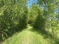
A lovely walk between two charming little villages, Roquepine and Saint-Orens, through lovely rolling countryside.

Details

16388494
Creation:
Last update:
Last review:
  • Walking
    Activity: Walking
  • ↔
    Distance: 6.99 mi
  • ◔
    Average duration: 3h 55 
  • ▲
    Difficulty: Moderate

  • ⚐
    Back to start: Yes
  • ↗
    Ascent: + 771 ft
  • ↘
    Descent: - 794 ft

  • ▲
    Highest point: 748 ft
  • ▼
    Lowest point: 423 ft
  • ⚐ Country: France
  • ⚐ City: Roquepine (32100)
  • ⚑
    Start/End: N 43.911559° / E 0.467226°
  • ❏
    IGN map(s): Ref. 1841SB, 1842SB
  • Hour-by-hour weather

Photos

Description of the walk

Park in the small car park not far from the town hall.

(S/E) Take the path between the houses towards the cemetery. Follow the dirt track that runs alongside the cemetery downhill to reach the tarmac road known as the Chemin de la Riberette. Turn right and continue until you reach the right-angled bend.

(1) Take the dirt track opposite. Cross the Route de l’Auvignon, pass the Ruisseau de l’Auran and take the dirt track on the right, heading uphill through the fields and then through the woods. Then follow a path that winds its way uphill through the trees, ending on a tarmac road in the hamlet of Pourrio.

(2) Turn right, cross the hamlet and take the dirt track downhill to reach the Route de Saint-Puy. Turn left, cross the bridge over the Ruisseau de l’Auran and continue to the locality known as Gélat.

(3) Turn right and continue along a dirt track: take care as the entrance to the track is not very visible. Turn right at the three-way junction and carry on to the D 204 road near the hamlet of Les Trois Évêques.

(4) Turn left, then take the next right. Continue to the four-way crossroads, turn right and carry on to the hamlet of Labatcerque.

(5) Take the dirt track on the right and stay on this track until you reach the D 232 road. Turn left and continue to the centre of the village of Saint-Orens.

(6) Retrace your steps, pass through the fortified gate and continue along the road on your left. Pass through the hamlet of La Bourdette and continue along a dirt track until you reach the D 232 road.

(7) Turn right, then take the next left, and carry on until you reach the D 204 road at a T-junction.

(8) Cross the road to take the dirt track opposite, which leads onto the Chemin de la Tuilerie. Turn left, pass the hamlet of Le Baque and, 200 metres further on, reach the end of the tarmac road.

(9) Follow the dirt track to the left, which will take you to the hamlet of Le Cluzet.

(10) Take the Chemin du Cluzet uphill to Roquepine, pass the town hall and return to the car park (S/E).

Waypoints

  1. S/E : mi 0 - alt. 676 ft - Car park
  2. 1 : mi 0.51 - alt. 535 ft - Chemin de la Riberette, on the right. Near the - Auvignon (rivière) - Affluent de la Garonne
  3. 2 : mi 1.28 - alt. 630 ft - The hamlet of Le Pourrio
  4. 3 : mi 2.06 - alt. 548 ft - Gélat
  5. 4 : mi 2.77 - alt. 738 ft - D 204
  6. 5 : mi 3.35 - alt. 597 ft - Labatcerque hamlet
  7. 6 : mi 4.59 - alt. 581 ft - Centre of Saint-Orens
  8. 7 : mi 5.3 - alt. 646 ft - Junction with the D 232
  9. 8 : mi 5.95 - alt. 745 ft - Junction with the D 204
  10. 9 : mi 6.44 - alt. 630 ft - Turn left at the junction, towards the hamlet of Garé
  11. 10 : mi 6.73 - alt. 564 ft - Le Cluzet
  12. S/E : mi 6.99 - alt. 676 ft - Car park

Notes

Picnic break possible in Saint-Orens.

Worth a visit

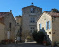
Visit the village of Saint-Orens.
Explore the village of Roquepine.

Reviews and comments

4.3 / 5
Based on 2 reviews

Reliability of the description
4 / 5
Ease of following the route
4.5 / 5
Route interest
4.5 / 5
francata
francata

Overall rating : 3.7 / 5

Date of your route : Nov 04, 2024
Reliability of the description : ★★★☆☆ Average
Ease of following the route : ★★★★☆ Good
Route interest : ★★★★☆ Good
Very busy route : No

a lovely, undulating walk in the Gers

Machine-translated

ChristianQ
ChristianQ

Overall rating : 5 / 5

Date of your route : Nov 07, 2021
Reliability of the description : ★★★★★ Very good
Ease of following the route : ★★★★★ Very good
Route interest : ★★★★★ Very good
Very busy route : No

A peaceful and enjoyable walk, even on a overcast day, and a bit of a challenge...

Machine-translated

Other walks in the area

For more walks, use our search engine .

The GPS track and description are the property of this route's author. Please do not copy them without permission.