Country:
 City:


Park on Avenue René Lassus, in the multi-purpose hall car park.
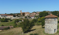
(S/E) Cross Avenue René Lassus, leaving the motorhome site on your left, and go straight on down the steps. Continue to the right along Boulevard des Remparts to join Avenue d’Armagnac (D654). Cross the departmental road, go down the slope opposite, between two stone posts, and follow the dirt track to the mill.
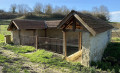
(1) Carry on straight ahead, then turn right onto Chemin du Chrestian, then turn left onto Chemin de l’Aumette de Haut. Turn right at the sewage treatment plant and head towards the wash house.
Turn right to return to the departmental road, cross it and continue to the right
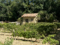
(2) Follow the path to the left and go round the back of the vineyard hut. Join Boulevard du Couchant.
(3) Turn left, then left again onto Rue de la Tombe. Then take the path on the right towards Parc de la Tombe; walk alongside the multi-sports ground, then turn right onto Boulevard du Nord de la Tombe. You’ll come to a junction.
(4) Follow the street to the left towards the cemetery, turn right and carry on straight ahead past Château Monluc. At the junction, turn right to complete the loop, then right again onto Rue du Château.
(4) Turn left and walk for a few dozen metres, then turn right onto Rue Orbe until you reach the junction with Avenue René Lassus. Turn right and head towards the church square. Head left towards the church, walk past the forecourt, then turn right into the Jardin des Cinq Sens.
(5) Turn right onto Rue de l’Église, turn right, then left in front of the town hall to return to Avenue René Lassus. All that remains is to turn right to return to the car park at the community hall (S/E).
 Visorando Member
 Moderate