Passing through Saint-Puy

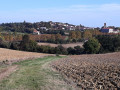
Starting from the charming village of Saint-Puy, where it’s lovely to wander, this hike over hill and dale offers beautiful views of the surrounding countryside.

Details

n°16104535
Creation:
Last update:
Last review:
  • Walking
    Activity: Walking
  • ↔
    Distance: 5.86 mi
  • ◔
    Average duration: 3h 15 
  • ▲
    Difficulty: Moderate

  • ⚐
    Back to start: Yes
  • ↗
    Ascent: + 620 ft
  • ↘
    Descent: - 623 ft

  • ▲
    Highest point: 640 ft
  • ▼
    Lowest point: 381 ft
  • ⚐ Country: France
  • ⚐ City: Saint-Puy (32310)
  • ⚑
    Start/End: N 43.876752° / E 0.464398°
  • ❏
    IGN map(s): Ref. 1842SB
  • Hour-by-hour weather

Photos

Description of the walk

Park at the side of Rue Féard, not far from the access road to Château Monluc.

(S/E) Set off along Rue Féard, keeping the château on your right, and continue straight on down the path.

(1) After a right-angle bend, take the first road on the right and then immediately turn right again. Continue along this road until you reach the hamlet of Bidet.

(2) Turn right onto the dirt track and carry on to Terre Blanche. Continue straight ahead on the tarmac road, then take the first path on the left and follow it to the road.

(3) Turn left, then turn right. Pass the hamlet of Coutard and carry on along a country lane. At the junction of the dirt tracks, turn right to reach the junction with a road near a wayside cross.

(4) Turn left, pass through Ordac and then Petit Ordac. Cross the road to Condom with care, head straight on and pass the hamlet of Lalanne. Continue a little further along this track before coming to a dirt track branching off to the left.

(5) Turn left and stay on this track until you reach a junction with another track on the ridge. Then turn right and carry on until you reach a junction with a tarmac road at the hamlet of Lièbe.

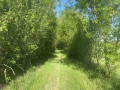
(6) Turn left. At the bend, take the dirt track opposite, carry on straight ahead for a good distance, then pass the wash house and come out onto a gravel track.

(7) Turn left, then at the junction, turn left again and you’ll come out onto the D654 (Avenue d’Armagnac).

(8) Cross with care (no pedestrian crossing) and head straight on until you reach the junction with Rue de la Tombe. Turn right, then take the fourth street on the left. At the top of the hill, turn right along the ramparts of Château Monluc and return to the starting point (S/E).


Waypoints

  1. S/E : mi 0 - alt. 633 ft - Parking near the - Château Monluc
  2. 1 : mi 0.3 - alt. 564 ft - Turn right twice
  3. 2 : mi 0.92 - alt. 469 ft - Bidet
  4. 3 : mi 1.76 - alt. 472 ft - Road on the left
  5. 4 : mi 2.4 - alt. 636 ft - Calvary crossroads
  6. 5 : mi 3.59 - alt. 430 ft - Crossroads on a country lane
  7. 6 : mi 4.27 - alt. 430 ft - Junction at the hamlet of Lièbe
  8. 7 : mi 5.33 - alt. 456 ft - Crossroads by the wash house
  9. 8 : mi 5.48 - alt. 522 ft - Avenue d’Armagnac
  10. S/E : mi 5.86 - alt. 633 ft - Parking near the - Château Monluc

Notes

Avoid doing this circular motion in hot weather.

Worth a visit

Village of Saint-Puy.

Reviews and comments

4.2 / 5
Based on 2 reviews

Reliability of the description
4.5 / 5
Ease of following the route
4.5 / 5
Route interest
3.5 / 5
diego270315
diego270315

Overall rating : 3.7 / 5

Date of your route : Dec 01, 2025
Reliability of the description : ★★★★☆ Good
Ease of following the route : ★★★★☆ Good
Route interest : ★★★☆☆ Average
Very busy route : No

The advantage of this route is that it passes in front of Terre Blanche, where our group had a gastronomic rendezvous with the hoteliers.

Machine-translated

nicodaime
nicodaime

Overall rating : 4.7 / 5

Date of your route : May 25, 2022
Reliability of the description : ★★★★★ Very good
Ease of following the route : ★★★★★ Very good
Route interest : ★★★★☆ Good
Very busy route : No

Although there are some small tarmac roads at the start, this walk is very pleasant, especially towards the end. We had a picnic at the wash house.

Machine-translated

Other walks in the area

For more walks, use our search engine .

The GPS track and description are the property of this route's author. Please do not copy them without permission.