Remontée à la source de l'Auvignon

C'est le cheminement imaginé par des membres du café associatif le "Bla-Blaziert'Café" pour rejoindre au plus court, leurs amis du plus vieux café associatif du territoire, à Mas- d'Auvignon (40 années d’existence), en longeant la rivière qui les relie.

Details

28500537
Creation:
Last update:
Last review:
  • Walking
    Activity: Walking
  • ↔
    Distance: 8.85 mi
  • ◔
    Average duration: 4h 50 
  • ▲
    Difficulty: Moderate

  • ⚐
    Back to start: Yes
  • ↗
    Ascent: + 873 ft
  • ↘
    Descent: - 889 ft

  • ▲
    Highest point: 748 ft
  • ▼
    Lowest point: 400 ft
  • ⚐ Country: France
  • ⚐ City: Blaziert (32100)
  • ⚑
    Start/End: N 43.934606° / E 0.476168°
  • ❏
    IGN map(s): Ref. 1841SB, 1842SB
  • Hour-by-hour weather

Photos

Description of the walk

When arriving in Blaziert from the D7, follow the sign for “Parc Autos”, where you can park just below the community café, the “Bla-Blaziert Café”. Volunteers will be delighted to welcome you there!

(S/E) Below the car park, follow the Chemin des Écoliers towards the hamlet of Pébéraut.

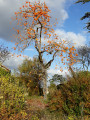
(1) Just before you enter the area, on your left, admire a rare, hundred-year-old Siberian elm. Continue straight on, skirting the farm along thePR®®11local footpath.

(2) Pass through two wooden gates in succession, taking care to close them properly to ensure the safety of a flock of sheep and some magnificent Mérens cattle. Follow thePR®®11markings towards the hamlet of Bauziet. After crossing the local road, carry on straight ahead on thePR®®11, heading down along the edge of the woodland towards the Auvignon ford.

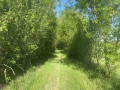
(3) Before the ford, on the left, you can cross dry-footed over the two fallen poles that serve as a footbridge. After this crossing, leave thePR®®11. Turn left, following the grassy path that runs alongside the River Auvignon. Passing a first reservoir on your right, cross the local road.

(4) Then follow the road to the right, then turn left onto the Route de Roquepine until the next junction.

(5) Take the Chemin de la Riberette. At the first junction, turn left and continue along this path until you rejoin the departmental road. Turn left again and walk for 150 m until you reach a grassy path running alongside the river.
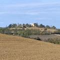
(6) Take this path and follow the River Auvignon. In the distance behind you, admire the fortress of Roquepine.

(7) At the junction leading up towards Le Tuco, turn right onto the path which climbs gently towards Mas-d’Auvignon.

(8) At the hamlet of La Bourdette, look out for a magnificent Lebanese cedar and two remarkable umbrella pines in a park on your left. Continue towards Mas-d’Auvignon.

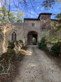
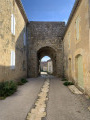
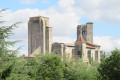
(9) Near the Château du Mas d’Auvignon, turn left to climb the narrow path that leads into the village, running alongside the ramparts. Walk through the village to the medieval gate via Rue de la Forge.

(10) Turn back towards the Tuco crossroads.

(7) Turn right and climb the hill leading to Le Tuco. Continue to the Cers farm.

(11) Go round it on the right and, as you head back down, take the well-marked local path on the left which winds through the valley and then climbs back up towards Piémont.

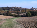
(12) On reaching the Piémont, follow the local track to the left as far as the village of Blaziert, which can be seen in the distance.

(13) Walk up to the village, passing the cemetery, then turn left onto the Chemin des Senteurs, which leads back to the municipal car park (S/E).

Waypoints

  1. S/E : mi 0 - alt. 571 ft - Bla-Blaziert’Café – Car park
  2. 1 : mi 0.17 - alt. 476 ft - Notable tree
  3. 2 : mi 0.29 - alt. 476 ft - Pébéraut
  4. 3 : mi 0.86 - alt. 400 ft - Ford over the River Auvignon
  5. 4 : mi 1.19 - alt. 413 ft - Route
  6. 5 : mi 1.6 - alt. 554 ft - Junction
  7. 6 : mi 2.31 - alt. 440 ft - Retention pond
  8. 7 : mi 3.19 - alt. 476 ft - Tuco crossroads – Access to Mas-d’Auvignon - Auvignon (rivière) - Affluent de la Garonne
  9. 8 : mi 3.9 - alt. 656 ft - La Bourdette
  10. 9 : mi 4.12 - alt. 738 ft - Château du Mas d'Auvigon
  11. 10 : mi 4.24 - alt. 745 ft - Medieval gate
  12. 11 : mi 5.93 - alt. 643 ft - The Cers
  13. 12 : mi 6.93 - alt. 636 ft - View of the village of Blaziert
  14. 13 : mi 8.63 - alt. 528 ft - Blaziert Cemetery
  15. S/E : mi 8.85 - alt. 571 ft - Bla-Blaziert’Café – Car park

Notes

Bring gaiters as the grass is tall along the river.

Community bar near (10), open at weekends.

Worth a visit

Notable trees (1) and (8).
The Château du Mas d’Auvignon (:7).

Always be cautious and plan ahead when you're outdoors. Visorando and the author of this route cannot be held responsible for any accidents occurring on this route.

The GR® and PR® markings are the intellectual property of the Fédération Française de Randonnée Pédestre.

Reviews and comments

3.9 / 5
Based on 3 reviews

Reliability of the description
3.7 / 5
Ease of following the route
3.7 / 5
Route interest
4.3 / 5
LaPierre
LaPierre

Overall rating : 3.3 / 5

Date of your route : May 26, 2024
Reliability of the description : ★★★☆☆ Average
Ease of following the route : ★★★☆☆ Average
Route interest : ★★★★☆ Good
Very busy route : No

Actually, the gaiters… which we hadn’t thought it worth bringing, would have come in very handy!
Especially with this Breton drizzle, which is quite unusual around here at this time of year.
As a result, we ended up soaked through, from head to toe.
The route description could do with being a bit more precise between points 3 and 5; we were unsure of the way several times.
A lovely route, with tiny, authentic villages

Machine-translated

TONYM
TONYM

The stretch between Mas d’Auvignon (a very pretty village) and Roquepine (a magnificent château currently undergoing restoration) is lovely – whether in winter or spring
As you’ve no doubt noticed, a detailed map is useful for following the route along the river properly, and for planning alternative routes. And don’t forget some good-quality string – it’ll come in handy for mending your shoes!

Machine-translated

pjd_64
pjd_64

Overall rating : 4.3 / 5

Date of your route : May 04, 2023
Reliability of the description : ★★★★☆ Good
Ease of following the route : ★★★★☆ Good
Route interest : ★★★★★ Very good
Very busy route : No

The advice about gaiters is spot on! At the very least, wear long trousers.
The route description would benefit from specifying the points at which you need to cross to the other bank of the Auvignon. The route marked on the map isn’t precise enough to allow you to plan ahead and make sense of it easily – at least not until you’ve realised you need to pay attention to it.

Machine-translated

TONYM
TONYM

Overall rating : 4 / 5

Date of your route : Dec 21, 2022
Reliability of the description : ★★★★☆ Good
Ease of following the route : ★★★★☆ Good
Route interest : ★★★★☆ Good
Very busy route : No

It has to be said that, due to physical problems, we were unable to complete the entire route, but as has been our custom on our Wednesday walks for the past three years, we left the path to head for Roquepine, where there is a lovely spot for a picnic, with shelter if needed – an important detail for us, which is often missing from the descriptions and which I think would be worth adding
It’s interesting to note that the route seems to have taken into account the fact that farmers are now obliged to leave a strip of land clear along the rivers, which should open up plenty of new walking routes in the future
Thank you for providing this route – we’ll no doubt be back to complete it!

Machine-translated

Other walks in the area

For more walks, use our search engine .

The GPS track and description are the property of this route's author. Please do not copy them without permission.