In the footsteps of the resistance fighters between Gedinne and Graide

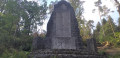
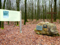
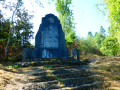
The walk starts in Gedinne and follows a route largely through the vast Ardennes forests of the province of Namur, passing through Haut-Fays. Along the way, you’ll have the chance to visit the Monument du Maquis (a memorial to 17 resistance fighters killed in 1944) and the walk ends at Graide-Station.

Details

n°3739538
Creation:
Last update:
Last review:
  • Walking
    Activity: Walking
  • ↔
    Distance: 11.80 mi
  • ◔
    Average duration: 6h 10 
  • ▲
    Difficulty: Moderate

  • ⚐
    Back to start: No
  • ↗
    Ascent: + 866 ft
  • ↘
    Descent: - 886 ft

  • ▲
    Highest point: 1,476 ft
  • ▼
    Lowest point: 1,119 ft

Photos

Description of the walk

(S) Gedinne station, Namur province. From the station building, head towards the N95. Turn left towards Bouillon, cross the level crossing and turn immediately left towards Rochefort. Follow the road for 370 m.

Blue Rectangle 27 signpost

(1) At the bend, where there is a wide open space on your left, cross carefully and take the grassy path on your right. Walk straight on until you reach a junction with a wide path.

No signposting

(2) At the junction, continue straight on along the wide, stony path.

(3) At the bend, continue straight on along the path. Head uphill, ignoring the adjacent paths, and once at the top, follow the path as it bends to the left. Continue until you reach the road. Cross with care and continue along the path opposite for 200 m.

Marking: Yellow Rectangle 3

(4) Take a sharp right-hand bend and follow the path. When you pass two fir woods, you’ll enter the province of Luxembourg and then emerge from the forest. At the road, go straight on and enter Haut-Fays. Walk past a telecoms mast and then past the water tower. Walk along the cemetery wall and, at the junction with another road, turn right.

Signposting: Yellow Rectangle 1 (occasional in the village)

At the junction with the N835, carry on straight ahead along the dead-end road. Walk down the road and past the farm. The road turns into a dirt track.

(5) At the Fork in the road, keep left and walk for 500 m.

(6) At the next Fork in the road, turn right and walk for 500 m.

(7) At the junction, carry on straight ahead for 1.3 km until you reach a large crossroads.

Cycle signpost 3: a Blue Triangle on two Blue Circles

(8) Turn right, cross over the La Rancenne stream and return to the province of Namur via an uphill stretch.

(9) At the crossroads with a picnic table, turn left. Go straight on at the crossroads and turn left onto the next path (not shown on the OSM map). Continue to the right and then ignore the path on your right. Carry on straight ahead. At the multi-way junction, go straight on.

Green Diamond signposting

(10) Turn left at the signpost and carry on straight ahead at the next junction. Then turn left just before the wide track and head onto a grassy path. This turns sharply to the right. Carry on straight ahead for 50 metres to reach the rear of the Maquisards’ memorial. Retrace your steps and turn left this time. Follow the path, which bends sharply to the right, and turn left at the crossroads. Leave the woods and walk along the meadows to the farm. Turn right at the wide car park near the farm.

(11) At the crossroads in the hamlet of Agrainchenêt, take the concrete track on the left. Walk downhill for 430 m until you reach a crossroads.

(12) Turn right onto the grassy path. Further on, ignore the path on your right, then the next one. A sign points to the Maquis camp (not shown on the OSM map). There is nothing to see there; it is just a sign indicating the hamlet – you will not find a reconstruction of the camp.

No signposting

Carry on straight ahead. The path veers sharply to the right. Head uphill; the path veers to the left. A track joins from your right.

(13) At the next track, turn left. The track curves sharply to the right and, at the crossroads, carry on straight ahead.

(14) At the small jetty on your left, turn off, cross the stream and head up the path. At the top, there’s a bench on your right and, further on, a crossroads; go straight on. Follow the path as it turns sharply left.

(15) At the junction, turn right; you’ll see the back of a wind turbine. The path bends sharply to the left as it passes below the wind turbine. Walk past a house; the path branches off to the right. Continue uphill until you reach the road. Turn left and follow the quiet road for just over 1.2 km, crossing over the Rives stream.

(16) Take a sharp right onto the farm track (but if you’d like to visit the Jardin des Hiboux, see the practical information) and walk for 450 m until you reach the end of a fir wood on your left, set back slightly from the track.

(17) Turn left at the vegetable patch. Continue along the main path until you reach the road. Cross with care and follow the farm track straight on until you reach the old local tram line, now a RAVeL path. Turn right.

(18) At the next junction, carry on straight ahead (not shown on the OSM map). At the railway line, turn left and head downhill to the road and Graide-station railway station (E).

Waypoints

  1. S : mi 0 - alt. 1,309 ft - Gedinne station
  2. 1 : mi 0.23 - alt. 1,322 ft - At the right-hand bend on the grassy track
  3. 2 : mi 0.7 - alt. 1,339 ft - At the junction, go straight on
  4. 3 : mi 0.84 - alt. 1,381 ft - At the bend, carry on straight ahead
  5. 4 : mi 1.6 - alt. 1,447 ft - Right-hand hairpin bend
  6. 5 : mi 2.9 - alt. 1,355 ft - At the fork in the road, take the left-hand path
  7. 6 : mi 3.19 - alt. 1,237 ft - At the fork in the road, turn right
  8. 7 : mi 3.52 - alt. 1,224 ft - At the junction, go straight on
  9. 8 : mi 4.31 - alt. 1,122 ft - At the large junction on the right
  10. 9 : mi 4.43 - alt. 1,171 ft - At the crossroads with a picnic table on the left
  11. 10 : mi 5.52 - alt. 1,204 ft - Turn left at the signpost
  12. 11 : mi 6.54 - alt. 1,234 ft - At the Agrainchenêt junction, turn left
  13. 12 : mi 6.8 - alt. 1,132 ft - Grassy path on the right
  14. 13 : mi 7.64 - alt. 1,194 ft - On the path to the left
  15. 14 : mi 8.01 - alt. 1,191 ft - Cross the small jetty
  16. 15 : mi 8.68 - alt. 1,207 ft - At the junction, turn right
  17. 16 : mi 10.06 - alt. 1,207 ft - Right-hand hairpin bend
  18. 17 : mi 10.34 - alt. 1,227 ft - Turn left at the pine forest
  19. 18 : mi 11.28 - alt. 1,289 ft - At the junction, go straight on
  20. E : mi 11.8 - alt. 1,283 ft - Graide-station railway station

Notes

No water available along the route.

May be muddy in places.

Picnic tables at (9) and (11).

At (16), to get to the Jardin des Hiboux, take the path on the left. At the end of the fence, turn right. At the T-junction, turn left. When you reach the road, turn right.

For the return journey:
Graide and Gedinne stations are served hourly (every two hours at weekends and on public holidays) by the L train from Libramont to Bertrix to Dinant. There are also a few buses, but they run very infrequently and few operate at weekends, during school holidays or on public holidays. So please be careful and plan your journey well in advance!

Worth a visit

Nearby
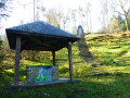
Maquis Monument: a memorial stone honouring 17 resistance fighters killed in 1944.

RAVeL: Réseau Autonome de Voies Lentes (Autonomous Network of Low-Speed Routes) is an initiative of the Walloon Region in Belgium, which aims to create a network of routes reserved for pedestrians, cyclists, people with reduced mobility and horse riders, where conditions allow. This network of greenways follows towpaths and disused railway lines leased by the Region under a 99-year lease.

Nearby
Jardin des Hiboux: a falconry centre housing over 75 birds, with demonstrations of birds in flight.

Reviews and comments

4.5 / 5
Based on 2 reviews

Reliability of the description
4 / 5
Ease of following the route
4.5 / 5
Route interest
5 / 5
lazzerini
lazzerini

Hello hindimurphy,

and thank you for the information about the concrete path.
I’ve tweaked the description a little at (16) and (17), hoping that this makes it clearer. (Awaiting approval from a moderator)
It’s a shame about the monument. I seem to recall there were also directional signs… but as it’s been August, I wouldn’t swear to it.

All the best

Machine-translated

hindimurphy
hindimurphy

Overall rating : 4.7 / 5

Date of your route : Feb 21, 2021
Reliability of the description : ★★★★★ Very good
Ease of following the route : ★★★★☆ Good
Route interest : ★★★★★ Very good
Very busy route : No

All in all, a lovely route. Highly recommended
The directions without signposts are vague, which meant I missed the monument to the Maquisards.
At a place called Agrainchenêt, the concrete path is perfectly accessible.
Points 16 and 17 are a bit unclear, but you always manage to find your way back onto the path eventually.
Thank you for suggesting these lovely routes.

Machine-translated

grandin
grandin ★
colinette56
colinette56

Yes, that’s right, the review is about the idyllic Ardennes walk starting from Graide

Machine-translated

lazzerini
lazzerini

Hello colinette56,

I think you’ve got the wrong walk.
I didn’t quite understand your explanation… particularly the bit about the chapel, which we don’t see on this walk – and for good reason…
After giving it some thought, your comments should actually be on the ‘Idyllic Ardennes from Graide’ walk, shouldn’t they?
It’s part of the same route and I’m the author of that one too, and on that route we do indeed pass the chapel at Oizy.
Please could you move your rating and comment to the correct walk. As for me, I’ll see what I can do to improve it.

Thanks
Kind regards

Machine-translated

colinette56
colinette56

Overall rating : 4.3 / 5

Date of your route : Sep 29, 2020
Reliability of the description : ★★★☆☆ Average
Ease of following the route : ★★★★★ Very good
Route interest : ★★★★★ Very good
Very busy route : No

Some of the descriptions contained information that was difficult to understand. For example, to reach point 3, the road ends in a path that is flooded. Do not follow this path after heavy rain; at point 4, (ignore the path on the left marked with a Red Triangle and carry on) – following this path is misleading; it would be more accurate to state that you should turn directly right
At point 13, simply follow the signs for the Chapel of Our Lady of Good Help and walk past the chapel.
Rue de la Chapelle goes all the way round the block and continues to the chapel; you can take it on the right or on the left and reach the chestnut tree with a bench.
Otherwise, a lovely walk – many thanks to whoever suggested it.

Machine-translated

Other walks in the area

For more walks, use our search engine .

The GPS track and description are the property of this route's author. Please do not copy them without permission.