


 Country:

 City:


The starting point is at the car park on Place Jean Goutte Toquet in Ouanne.
(S/E) With your back to the river, head up towards the cross street. Turn right onto it. Take Rue Principale by turning right and you’ll come to a flat bridge spanning a branch of the river.
(1) Immediately after crossing the bridge, turn left onto Rue des Vignes. At the 90° bend, take the path on the left. Cross the footbridge and continue along this track, keeping the stream on your right. Just before the last few properties, take a wide grassy track on the right, crossing the stream at the end of it.
(2) Turn left and you’ll soon come to a courtyard with sheds on the right. Leave the road leading to the craft workshops on your left and carry straight on along a path. After two consecutive bends, you’ll reach a track that’s half tarmac, half grass, leading onto a cross-road. After a quick left and right, rejoin the track upstream of the wash house. Carry on, ignoring the turn-off to the right, and you’ll come to another stretch of road leading onto the D950 at Usselot.
(3) Take the D950 to the right for about 250 m, then leave it to take a track on the right which climbs steadily at first and then more steeply as you approach the edge of the woods. You’ll come out onto a stabilised cross-country track.
(4) Turn left onto the flat path. At the next junction, facing two wind turbines, head to the right. You’ll soon see four masts; ignore the various paths leading to the technical platforms and head towards the huts.
(5) Pass them by keeping to the right, then turn right again at the next Fork in the road to begin the descent towards the Montputois wash house. Watch out for farm machinery manoeuvring around the farm buildings.
(6) Take a slight left/right turn whilst leaving the track that leads to the farm’s technical methane production facilities, and join the track running close to the buildings and sheds. On the gentle descent, turn left twice and follow a slight incline to reach a wide cross-track.
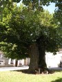
(7) Pass by the foot of a solitary tree (December 2021) and, keeping to the right, head down towards Pierrefitte-le-Haut. When you reach the road, follow it until you come to the junction with the D950.
(8) Cross the road carefully and continue straight ahead. Pass by the foot of the wash house at Pierrefitte-le-Bas (resurgence of the Ouanne). At the end of the road, head straight on along the path, leaving it on the right at the first Fork in the road. Continue down a gentle slope, passing between fields of arable crops. Pass a small overgrown area on the right and, just before a hedge on the right, leave this path by turning left.
(9) Start climbing again and reach the summit. At the junction, carry on straight ahead and head back down towards Duenne. In the hamlet, continue to the crossroads marked by a grassy central island.
(10) Turn right, then left immediately afterwards. Follow the stony path which climbs up to the junction with the Voie Romaine. Ignore this and turn right onto a short stretch of road, then a short stretch of path, until you reach the D85.
(11) Cross the road carefully, then carry on straight ahead until you reach a side road.
(12) Turn right onto it and follow it until you reach the large bend, about 500 m further on.
(13) Head downhill along a rather technical track running along the edge of the woods, where you may encounter branches across the path and ruts. When you reach the road, carry on straight ahead for about 200 m.
(14) Before the wooded areas, turn right onto the tarmac road. Follow it to the junction with the D85. Cross the junction and turn left to rejoin the route you have already taken.
(1) Carry on straight ahead, then turn left in front of the clearing towards Toucy (S/E).

 Visorando Member

 Tourism professional
 Association / Club / Walk leader
 Tourist office
 Easy

