Through the Couloutre Wood

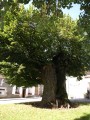
This route takes you into the Couloutre Woods, where the great chestnut tree stands, offering shelter within its trunk in the event of heavy rain. In the village of Couloutre, you can enjoy a refreshing drink on the inn’s terrace. Head towards Ménestreau to explore its 19th-century wash house in the centre of the village. During your walk, you’ll catch sight of the castles of the Lords of La Rivière in Couloutre and of Villiers in Ménestreau.

Details

n°309283
Creation:
Last update:
Last review:
  • Mountain biking
    Activity: Mountain biking
  • ↔
    Distance: 13.38 mi
  • ◔
    Duration according to the author: 2 hrs 
  • ▲
    Difficulty: Easy

  • ⚐
    Back to start: Yes
  • ↗
    Ascent: + 600 ft
  • ↘
    Descent: - 604 ft

  • ▲
    Highest point: 955 ft
  • ▼
    Lowest point: 669 ft
  • ⚐ Country: France
  • ⚐ City: Couloutre (58220)
  • ⚑
    Start/End: N 47.409245° / E 3.226895°
  • ❏
    IGN map(s): Ref. 2522SB, 2622SB

  • ◶
    Type of surface:
  •  
     
     
    ■ 33% Road ■ 34% Byway ■ 33% Path
  • ⇧
    Bike carrying: Not specified
  • ▲
    Difficulty: Not specified
  • Hour-by-hour weather

Photos

Description of the route

Starting point: Place de l’Église. Blue signposts (route no. 6).

(S/E) Follow Rue du Bourg south-west.
(1) Turn left onto Route de Menou, then ignore the road on the left.

(2) At the fork in the road (cross), turn left and continue up the path.
(3) At the top of the hill, turn right. Turn left onto the road. Then turn left twice.

(4) At the junction, turn right. At the Fork in the road, take the right-hand fork. Carry on straight ahead (south-west) until you reach the next road.
(5) Cross the road. Take the first right, then the first left.

(6) At the road, turn right, then take the second right.
(7) Turn left onto the road. At the next junction, turn right.

(8) Pass the tannery and its retting pond on your right. At the next junction, turn left.
(9) At a place called La Maison Bleue, cross the road and continue straight ahead along a path.

(10) At Pilles, turn right towards Les Moutiots.
(11) Walk through Les Moutiots and, at the Fork in the road, head slightly to the left.

(12) Pass through Montaubry, then continue along a path heading north-north-east.
(13) At the three-way junction, turn right and go through Nérondes.

(14) Cross the D1 and continue along the path on the right. Keep heading east.
(15) Turn right and pass through the hamlet of Le Pelé. At the next Fork in the road, turn left.

(16) Turn right onto the road.
(17) Take the second right, pass through Menestreau and continue along the road.

(18) At the fork in the road, take the right-hand track.
(19) In Villiers, turn right, then take the first right. Pass through the Bois de la Rivière.

(20) As you come out of the woods, turn left towards the village of Couloutre (S/E).

Waypoints

  1. S/E : mi 0 - alt. 699 ft - Place de l’Eglise
  2. 1 : mi 0.15 - alt. 715 ft - Route de Menou
  3. 2 : mi 0.33 - alt. 735 ft - Fork in the road
  4. 3 : mi 0.95 - alt. 823 ft - Top of the hill
  5. 4 : mi 1.67 - alt. 889 ft - Fitness and botanical trail
  6. 5 : mi 3.12 - alt. 932 ft - Cross the road
  7. 6 : mi 4.21 - alt. 801 ft - Turn right
  8. 7 : mi 5.07 - alt. 856 ft - Junction
  9. 8 : mi 5.82 - alt. 738 ft - Egeoir and tanning pond
  10. 9 : mi 6.41 - alt. 715 ft - La Maison Bleue
  11. 10 : mi 6.87 - alt. 696 ft - Pilles, after the - Nohain (rivière)
  12. 11 : mi 7.39 - alt. 715 ft - Les Moutiots
  13. 12 : mi 7.75 - alt. 738 ft - Montaubry
  14. 13 : mi 8.9 - alt. 709 ft - Three-way junction
  15. 14 : mi 9.28 - alt. 692 ft - Cross the D1
  16. 15 : mi 10.01 - alt. 738 ft - T-junction
  17. 16 : mi 10.53 - alt. 781 ft - Mineray Wood
  18. 17 : mi 11.17 - alt. 758 ft - Ménestreau
  19. 18 : mi 11.63 - alt. 761 ft - Fork in the road
  20. 19 : mi 11.96 - alt. 758 ft - Villiers Castle
  21. 20 : mi 12.87 - alt. 758 ft - Head towards the village
  22. S/E : mi 13.38 - alt. 699 ft - Place de l’Eglise

Notes

Please note: the route is closed during the hunting season from 15 September to 28 February.

Restaurant in Couloutre.

Worth a visit

Built and historical heritage:
(1) The 19th-century Saint-Germain Church in Couloutre,
(8) L’Égeoir and its retting pond, a reminder of a time when hemp was grown in the region,
(17) The 19th-century washhouse in the village of Ménestreau, and the Church of Saint-Pierre (19th century),
(19) Villiers Castle in Ménestreau (not open to visitors).
(20) The Château des Seigneurs de la Rivière (not open to the public),

Natural heritage:
The Couloutre fitness and botanical trail.

Reviews and comments

4.7 / 5
Based on 1 review

Reliability of the description
5 / 5
Ease of following the route
5 / 5
Route interest
4 / 5
dada14740
dada14740

Overall rating : 4.7 / 5

Date of your route : Aug 11, 2020
Reliability of the description : ★★★★★ Very good
Ease of following the route : ★★★★★ Very good
Route interest : ★★★★☆ Good
Very busy route : No

A lovely ride, alternating between woodland and open countryside, on a mountain bike and an electric city tandem.

Machine-translated

Other walks in the area

For more walks, use our search engine .

The GPS track and description are the property of this route's author. Please do not copy them without permission.