On the hills above Windsbourg

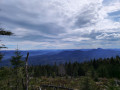
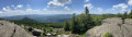
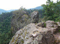
From the Hengst car park, head towards the Col de Hoellenwasen. Then make your way to the Rocher de Urstein viewpoint to admire the view over the Alsace valley. You’ll then pass by the Eichkopf before joining the Route Forestière des Russes and returning to your starting point.
A very easy walk with no particular difficulties. The only slightly tricky bit is climbing up to the Rocher de Urstein. In wet weather, the seven or eight steps leading up to the top of the rock can be dangerous.

Details

n°47224891
Creation:
Last update:
Last review:
  • Walking
    Activity: Walking
  • ↔
    Distance: 4.02 mi
  • ◔
    Average duration: 2h 10 
  • ▲
    Difficulty: Easy

  • ⚐
    Back to start: Yes
  • ↗
    Ascent: + 354 ft
  • ↘
    Descent: - 364 ft

  • ▲
    Highest point: 3,110 ft
  • ▼
    Lowest point: 2,700 ft

Photos

Description of the walk

To reach the Hengst car park, you need to drive through Windsbourg and continue for 4 km along the road through the forest. 1.5 km after Windsbourg, keep left at the Fork in the road: the barrier on the right-hand road is usually closed.

(S/E) Head slightly uphill to the right and you’ll find signs pointing towards the Hoellenwasen Pass. The path is marked with the Blue Cross. There are no particular difficulties in reaching the pass.

(1) From the pass, turn right onto the Red Cross-marked path towards the Rocher d’Urstein. There’s a slight climb at the start, but nothing too strenuous; the ascent won’t exceed 200 m. You’ll come to a junction.

(2) At this point, continue to the right to reach the rock, which is about 200 m away.

(3) Once you’ve finished admiring the view from the top, retrace your steps back to the previous junction.

(2) Take the sharp right-hand bend onto the path marked with a Red Rectangle crossed by a white line, heading towards the Elsassblick. Cross the Kohlweg.

(4) Carry on straight ahead to join the Route Forestière des Russes.

(5) Turn right and continue along the forest road, marked with the Blue Saltire. Go straight on until you reach the starting car park (S/E).

Waypoints

  1. S/E : mi 0 - alt. 2,874 ft - Hengst car park - auberge du Windsbourg
  2. 1 : mi 0.75 - alt. 3,005 ft - Hoellenwasen Pass - Urstein
  3. 2 : mi 1.1 - alt. 3,091 ft - Urstein Rock junction. Return
  4. 3 : mi 1.26 - alt. 3,097 ft - Urstein Rock
  5. 4 : mi 2.46 - alt. 2,776 ft - Kohlweg. At the foot of the - Eichkopf
  6. 5 : mi 2.69 - alt. 2,707 ft - Route Forestière des Russes
  7. S/E : mi 4.02 - alt. 2,874 ft - Hengst car park

Notes

A pleasant walk with little change in altitude and no particular difficulties.
Perfect for a family outing with young children.
The walk can be completed in 1 hour 30 minutes if you keep up a steady pace; we did it with plenty of stops, at a leisurely pace...

Reviews and comments

4.7 / 5
Based on 1 review

Reliability of the description
4 / 5
Ease of following the route
5 / 5
Route interest
5 / 5
Nanou67
Nanou67

Overall rating : 4.7 / 5

Date of your route : Jul 22, 2024
Reliability of the description : ★★★★☆ Good
Ease of following the route : ★★★★★ Very good
Route interest : ★★★★★ Very good
Very busy route : No

You’ll need to amend the description to find the start of the walk:
Walk through Windsbourg and take the forest track (ignore the old sign prohibiting access to all vehicles) – the forest track has just been tarmacked. Walk up to the small car park at Hengst.
Start of the walk. Turn right onto the new forest track – follow the sign with the Blue Crosses towards the Wiestal Pass (not sure of the name).

Machine-translated

Other walks in the area

For more walks, use our search engine .

The GPS track and description are the property of this route's author. Please do not copy them without permission.