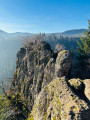
The Waterfall, Nideck Castle and Hirschfels Rock

There are numerous routes leading to the waterfall and the ruins of Nideck Castle. Here is a fairly short and easy alternative. Furthermore, it is a circular route, with the return journey passing by Hirschfels Rock.

Details

103652873
Creation:
Last update:
Last review:
  • Walking
    Activity: Walking
  • ↔
    Distance: 2.95 mi
  • ◔
    Average duration: 2h 10 
  • ▲
    Difficulty: Easy

  • ⚐
    Back to start: Yes
  • ↗
    Ascent: + 883 ft
  • ↘
    Descent: - 856 ft

  • ▲
    Highest point: 1,827 ft
  • ▼
    Lowest point: 1,112 ft

Photos

Description of the walk

Park near the Auberge du Nideck on the D218 between Oberhaslach and Wangenbourg.

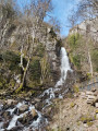
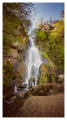
(S/E) Take the path leading uphill to the right of the inn. A sign points the way: ‘Vers la cascade’ (Towards the waterfall). This is the GR®53, marked with Red Rectangles, which runs alongside the Nideckbach. This leads directly to the waterfall.

(1) Take the path leading uphill to the right, which zigzags. There are steps at the end of this climb.

(2) Turn left towards the viewpoint.

(3) Continue along the path to the bridge over the Nideckbaechel.

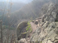
(4) Cross it and climb up to the left towards the ruined castle. This is signposted. Head for the tower first. You can climb higher via a very steep sandstone staircase, which is thankfully secured by a metal handrail.

(5) Turn back to the junction after the viewpoint.

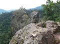
(2) Continue straight on uphill to the Hirschfels Rock, which takes about ten minutes to reach. The path is marked with Red Triangles.

(6) Continue down the path and, at an altitude of around 420 m, turn right onto the track to reach the car park and the inn on the D218 (S/E).

Waypoints

  1. S/E : mi 0 - alt. 1,112 ft - Inn on the D218
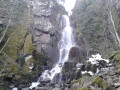
  2. 1 : mi 0.77 - alt. 1,480 ft - Cascade du Nideck (Nideck Waterfall)
  3. 2 : mi 0.9 - alt. 1,621 ft - Junction of the circular loop
  4. 3 : mi 0.95 - alt. 1,591 ft - Viewpoint
  5. 4 : mi 1 - alt. 1,604 ft - Bridge over the Nideckbaechel
  6. 5 : mi 1.3 - alt. 1,824 ft - Château du Nideck (ruine)
  7. 6 : mi 2.02 - alt. 1,749 ft - Rock - Hirschfels
  8. S/E : mi 2.95 - alt. 1,112 ft - Inn on the D218

Always be cautious and plan ahead when you're outdoors. Visorando and the author of this route cannot be held responsible for any accidents occurring on this route.

The GR® and PR® markings are the intellectual property of the Fédération Française de Randonnée Pédestre.

Other walks in the area

For more walks, use our search engine .

The GPS track and description are the property of this route's author. Please do not copy them without permission.