Elsassblick circular route via the Narion, the Noll and the Grossmann mountain pass

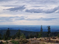
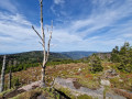
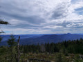
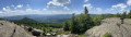
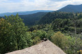
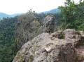
A beautiful hike through varied landscapes, with several peaks reaching around 1,000 metres in altitude, offering magnificent views over the Bruche Valley, the Vosges and the Lorraine plain.

The Visorando app or a hiking GPS is strongly recommended; see Practical Information.

Details

n°73233740
Creation:
Last update:
Last review:
  • Walking
    Activity: Walking
  • ↔
    Distance: 6.59 mi
  • ◔
    Average duration: 3h 55 
  • ▲
    Difficulty: Moderate

  • ⚐
    Back to start: Yes
  • ↗
    Ascent: + 984 ft
  • ↘
    Descent: - 978 ft

  • ▲
    Highest point: 3,268 ft
  • ▼
    Lowest point: 2,520 ft

Photos

Description of the walk

Access via Windsbourg to the “Elsassblick” car park: take the forest track, which is accessible by car but closed in winter and at night between 7 pm and 7 am; the route is not cleared of snow.

Red-white-red Red Rectangle markings.

(S/E) Take the path leading down into the woods. After the long descent, you’ll reach a junction.

(1) Turn right onto the path that crosses the Bois d’Oberhaslach, initially uphill, then on level ground. When the slope begins again, join a forest track.

(2) Take a sharp right-hand bend and follow the forest road uphill to the crossroads in the hamlet of Altmatt.

(3) Ignore the return path ahead and turn left onto the forest road. At the end, keep to the right to reach the Col du Narion, before the bend in the road and the Baraque aux Juifs.

Unmarked

(4) Just after the sign for the forest road, cut right across the forest, heading west towards the summit. Please note: there is a path, but it is very difficult to follow.

(5) At the summit, follow the cleared track straight on towards the Noll; blue arrows and paint marks provide a rough guide along the route. Keep heading in the same direction for about 300 m to reach the point with an altitude of 976 on the IGN map.

(6) You can cut straight across, without following the track, to continue along the cleared strip; otherwise, take the small descent to the left and, about 100 m further on, head up to the right towards the Noll.

(7) At the summit, follow the path to the right, heading north-east, to reach the Altmatt Refuge. Continue to the right to return to the junction you passed on the way there.

Blue Cross markings

(3) Ignore the paths on the right; turn left, following the Blue Cross markings, downhill to the forest track, then turn right towards the Grossman Refuge.

(8) Continue along the forest road for about a hundred metres.

Blue Saltire Markings

(9) Turn right onto the path towards Elsassblick. The path climbs in a wide right-hand bend, then heads north-east, downhill, to join a wider forest road.

(10) Turn right to return to the Elsassblick car park (S/E).

Waypoints

  1. S/E : mi 0 - alt. 2,661 ft - Elsassblick car park – Red Rectangle with a white cross
  2. 1 : mi 0.13 - alt. 2,520 ft - Crossroads
  3. 2 : mi 1.62 - alt. 2,831 ft - Junction – Forest road. Source of the - Hasel (rivière)
  4. 3 : mi 2.06 - alt. 3,068 ft - Crossroads - Refuge Altmatt
  5. 4 : mi 2.79 - alt. 3,038 ft - Col du Narion (922 m) - Barraque des Juifs
  6. 5 : mi 3.02 - alt. 3,258 ft - Le Narion (998 m)
  7. 6 : mi 3.23 - alt. 3,189 ft - Junction at elevation 973 – Two options
  8. 7 : mi 3.56 - alt. 3,241 ft - Crossroads (altitude 991) – Path heading north-east - Le Noll (991m)
  9. 8 : mi 4.74 - alt. 2,779 ft - Forest track - Refuge du Grossmann
  10. 9 : mi 4.82 - alt. 2,762 ft - Blue Saltire junction
  11. 10 : mi 6.06 - alt. 2,733 ft - Junction – Forest road
  12. S/E : mi 6.59 - alt. 2,661 ft - Elsassblick car park

Notes

Caution: steep descent after point (1); the path is virtually non-existent between points (4) and (5); try to follow the GPS track or the route on the map as best you can.

Club Vosgien signposting markers

Worth a visit

Source of the Zorn, Mutzig Rock, source of the Hasel.

Reviews and comments

3.8 / 5
Based on 2 reviews

Reliability of the description
3.5 / 5
Ease of following the route
3.5 / 5
Route interest
4.5 / 5
roland_becker
roland_becker

Overall rating : 3.3 / 5

Date of your route : May 02, 2026
Reliability of the description : ★★★☆☆ Average
Ease of following the route : ★★★☆☆ Average
Route interest : ★★★★☆ Good
Very busy route : No

You must follow the marker carefully between point 4 and point 7...

Machine-translated

DorothéeV
DorothéeV

Overall rating : 4.3 / 5

Date of your route : Aug 07, 2025
Reliability of the description : ★★★★☆ Good
Ease of following the route : ★★★★☆ Good
Route interest : ★★★★★ Very good
Very busy route : No

A beautiful hike with a superb view from Narion, perfect for a picnic! We enjoyed passing through areas with very different types of vegetation! It was also very peaceful.
One small downside: we had trouble finding the "path" on the right at point 7 of the route...

Machine-translated

Other walks in the area

For more walks, use our search engine .

The GPS track and description are the property of this route's author. Please do not copy them without permission.