Country:
 City:
City:


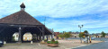
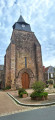
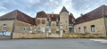
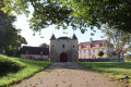
(S/E) Start at Place du Champ de Foire, at the foot of the market halls. Follow the green markings for route no. 1, ‘Sur les hauteurs de Cluis’. Take Rue des Jardiniers, then turn right onto Rue Grande (D990) to reach Saint-Paxent Church. Walk alongside it on the right, along Rue de l’Église, and turn right to reach the town hall (the former manor house of Cluis-dessus). Turn left onto Rue du Château (D54).
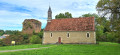
(1) Turn left onto Rue de la Croix de la Mission (signposted) and head towards the Notre-Dame de la Trinité Chapel.
(2) Leave the road by heading down a grassy path to reach the entrance to the castle ruins. Walk alongside the ruins below, staying on the grassy path, until you reach a narrow lane that climbs back up to the Route de Mouhers (D38).
(3) Follow this road, crossing a bridge over the Bouzanne, then turn right towards Les Bégeaudes and immediately turn left onto an uphill street (no entry for vehicles over 3.5 tonnes).
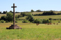
(4) At the next junction (small white cross on the right-hand side), turn right (follow the signposts). Then turn left towards La Brande.
(5) Continue straight on towards La Pierre Pleine along a gravel road, running alongside the Bois du Couvent. At a left-hand bend, leave the road and take a farm track on the right to reach the D54.
(6) Follow it carefully to the left until you reach the junction with the Route des Lhomais (pond on your left). Then turn right to reach the hamlet. Continue along a farm track flanked by hedges (known as ‘hedges’ in the Berry region).
(7) At the left-hand bend, turn right onto a grassy, tree-lined track which curves to the left, running alongside a field. After 300 m, follow the grassy track to the right as it crosses the fields and reaches Les Chavenauds.
(8) Follow the small road to the right for 150 m, then turn left to reach Les Grassets (or Graçais on the map). Continue along the small road, passing a track suitable for vehicles on your left.
(9) At the next junction, take the gravel track on the right, which leads onto the D124.
(10) Turn sharply right onto a grassy farm track that cuts across the fields and leads back down to the D124. Follow it to the right to cross a bridge and head back up to the junction with the Route des Boireaux.
(11) Turn right onto a track suitable for vehicles, pass a grassy track on your right, then continue straight on at the next junction to reach a small road.
(12) Follow the road to the left, pass a track on the left then another on the right, and 500 m further on, turn left onto a farm track which joins the D124.
(13) Cross carefully and continue towards Les Boisnauds. Pass house no. 4, then a shed, and take the track on the right, which is tarmac-surfaced at first but becomes a footpath after the left-hand bend. It joins a farm track; follow this to the right, skirting a pond on your left.
(14) Once you reach the D54, follow it carefully to the left until you reach a junction. In the bend, leave the D54 by heading straight down and then turning right towards Moulin Jallerat.
(15) Leave the road and take a footbridge on the left over the Bouzanne, then head up the wide grassy path. Back on the D54, follow it to the left, then head up Rue de la Cité to the left; this turns right to join the D990 (Stop sign). Follow it to the right to enter the village of Cluis. Do not take Rue Grande on the right, but carry on straight ahead along Rue Saint-Michel. Pass the cul-de-sac on the right and Rue de la Sablonnière on the left. Turn right into Rue du Champ de Foire, then follow the D38 to the left to reach the market halls and Place du Champ de Foire (S/E).
 Visorando Member

 Easy
Easy