Country:
 City:
City:


Park at Place du Champ de Foire. The start point is near Les Halles, at the foot of the signpost for walking trails.
(Out and back) Follow the yellow markings for the “Au cœur de la Vallée de l’Auzon” route. With your back to Les Halles, take Rue des Jardiniers then follow the D990 to the right as far as Saint-Paxent Church.
(1) Turn left to walk alongside the church on the right-hand side. Turn right to arrive opposite the town hall. Follow the D54 to the left, passing Rue des Fosses, and continue to the junction with Rue de la Croix de la Mission.
(2) Follow the yellow signposting opposite (please note: there are several routes at this junction; the others head off to the left). Continue along the D54 until you reach the outskirts of Cluis.
(3) At the start of the left-hand bend, leave the road and head down a grassy path on the right, continuing until you reach a footbridge over the Bouzanne, which you cross.
(4) At Moulin Jallerat, follow the road to the right and carry on straight ahead at the next junction. Take another small road to the right to cross a bridge over the Bouzanne.
(5) Turn left towards the Grand Moulin and continue along a farm track. After the climb, turn right to join the D990.
(6) Carefully follow the road down to the right for 60 m, then turn left onto a grassy track leading to the hamlet of Série.
(7) Carry on straight ahead along a small road. Continue straight on at the next junction towards Le Colombier. The road becomes a farm track: follow it until you reach a track.
(8) Turn right onto it to cross the Auzon and head up the track. Carry on straight ahead towards the south-west, then follow the edge of a woodland until you reach a small road.
(9) Turn right into the woodland and follow the track until you reach a small road, which you’ll take on the right.
(10) Leave the road at a slight bend and turn right onto a track suitable for vehicles, running alongside the houses at Maison Dieu. Pass some access points on the left and follow the farm track for 200 m. Turn left onto a grassy track, then turn right to rejoin the small road.
(11) Follow it to the right for 250 m, then turn left onto a gravel track that runs behind La Couture. Continue straight on until you reach the Pissany farm and the D75.
(12) Cross it carefully and carry on straight ahead. The track climbs up to the D38; follow it to the right until you reach a road on the left.
(13) Turn left onto this road, head towards Neuville, and pass under the bridge of the old railway line.
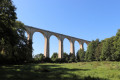
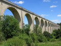
(14) Turn right immediately and head down to the foot of the viaduct. Follow the path as it enters a wood and cross the ford.
(15) Start a steep climb, leaving a path on your right. You’ll come to a fork in the path.
(16) Follow the yellow markings to the left, which will take you to a car park. Turn right onto the stone bridge that crosses over the old railway line and join the access road to the viaduct: follow it to the left until you reach the entrance to Cluis.
(17) Pass Rue des Véveilles on your left and continue along Rue Berton to the end. Turn left twice to return to Les Halles and the Champ de Foire car park (S/E).

 Visorando Member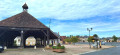

 Easy
Easy