Gournay route

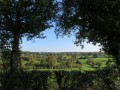
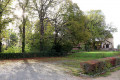
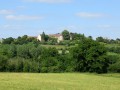
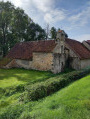
A pleasant walk following the FFRP-marked trails around the village of Gournay (Indre), offering the chance to explore the surrounding meadows and enjoy some lovely views.

Details

165699
Creation:
Last update:
Last review:
  • Walking
    Activity: Walking
  • ↔
    Distance: 7.50 mi
  • ◔
    Average duration: 3h 45 
  • ▲
    Difficulty: Moderate

  • ⚐
    Back to start: Yes
  • ↗
    Ascent: + 348 ft
  • ↘
    Descent: - 328 ft

  • ▲
    Highest point: 771 ft
  • ▼
    Lowest point: 591 ft
  • ⚐ Country: France
  • ⚐ City: Gournay (36230)
  • ⚑
    Start/End: N 46.584545° / E 1.732152°
  • ❏
    IGN map(s): Ref. 2126SB
  • Hour-by-hour weather

Photos

Description of the walk

The start is at the car park near the village hall in Gournay, on the D42.

(S) On leaving the car park, turn right onto the D42, heading north. 200 m after the ‘Les Vignaux’ sign, turn right onto the D42b (towards Neuvy-Saint-Sépulchre). Cross the bridge and immediately turn right onto the path running alongside the cemetery (blue, yellow and green markings).

(1) After about 800 m, at a place called Les Gabauds, follow the blue markings by taking the path on the left. It rejoins the D42b amongst the houses; take this road to the right. At the next junction, ignore the blue and yellow markings on the left and continue straight on towards the hamlet of Petit Chaumont.

(2) 200 m after the last house in the hamlet, turn onto the small tarmac road on the left (green markings).

(3) After about 800 m, at the end of the tarmac section and at the junction of several paths, follow the green signposting by continuing straight ahead along a path heading north-east. Then pass a path on your right to reach the D927, which you must cross with care. Continue along the grassy track opposite. After 900 m, the track widens to join a small tarmac road. Turn left here and continue straight on, leaving the green signpost on your right.

(4) After 500 m, turn left onto a small tarmac road which initially descends southwards before turning south-west. It becomes a gravel track and then a grassy path, flanked by hedges.

(5) This leads onto a small tarmac road; follow it for 50 metres to the right before turning onto another road on the left. Then head back down to rejoin the previous road and continue to the right.

(6) Turn right again onto a gravel track (yellow markings). Continue to the D42, which you must cross carefully to carry on opposite and pass through a tunnel under the D927.

(7) Cut across the small tarmac road to follow the yellow markings along a fairly wide grassy track. At the next junction, turn right and then immediately left onto a grassy path.

(8) Join a wide track on the left (continue to follow the yellow markings).

(9) Once you’re back on the D42, take it to the right and head downhill towards a small private pond (blue and yellow markings by a Yellow Cross).

(10) Take a grassy path on the right at the pond.

(11) When you reach the back of the village hall, turn right and take the small tarmac road on the left to head back up towards Gournay.

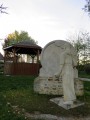
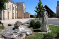
(12) On a bend, at the first houses, turn right onto a path (marked in blue and yellow) towards the Chapel of Saint-Abdon, then turn left to enter the village. Behind the church, veer slightly to the left to walk along its western side, then cross the village via a small, well-maintained path passing under a bandstand. Return to the D42 to reach the car park.


Waypoints

  1. S/E : mi 0 - alt. 650 ft - Car park near the village hall in Gournay
  2. 1 : mi 0.64 - alt. 620 ft - Les Gabauds – Blue signposts
  3. 2 : mi 1.66 - alt. 771 ft - Follow the green [x] markings
  4. 3 : mi 2.1 - alt. 738 ft - Follow the green [x] markings
  5. 4 : mi 3.55 - alt. 719 ft - Turn left
  6. 5 : mi 4.42 - alt. 689 ft - Turn right, then left
  7. 6 : mi 4.79 - alt. 604 ft - Follow the yellow markings to the right. Cross the - Auzon (rivière) - Affluent de la Bouzanne
  8. 7 : mi 5.54 - alt. 676 ft - Follow the yellow markings straight ahead
  9. 8 : mi 5.81 - alt. 689 ft - Follow the yellow markings to the left
  10. 9 : mi 6.39 - alt. 669 ft - Turn right, then follow the blue and yellow markings
  11. 10 : mi 6.64 - alt. 620 ft - Turn right after the pond
  12. 11 : mi 6.87 - alt. 659 ft - Turn right behind the village hall
  13. 12 : mi 7.17 - alt. 673 ft - Turn right (blue and yellow markings)
  14. S/E : mi 7.5 - alt. 650 ft - Car park near the village hall in Gournay

Notes

No water points apart from in Gournay.
Take care when crossing the D927 local road after point (3) as it is very busy.

Worth a visit

Reviews and comments

4.2 / 5
Based on 3 reviews

Reliability of the description
4 / 5
Ease of following the route
4.7 / 5
Route interest
4 / 5
lolo36
lolo36

Thank you for your comment. I’m not surprised that this little path is no longer accessible, as it was already rather neglected when I went for that walk. I’ll update the information accordingly. I hope you continue to enjoy the trails in the Indre.

Machine-translated

Nicolas Pinot
Nicolas Pinot

Overall rating : 4 / 5

Date of your route : Jul 02, 2017
Reliability of the description : ★★★★☆ Good
Ease of following the route : ★★★★☆ Good
Route interest : ★★★★☆ Good

The “little grassy path” at the end of point 7 is blocked, but you can take a short detour via the village further up.
It’s a lovely walk that’s typical of the southern Boischaut region of Berry.
Some of the signposts are missing or obscured, but you can manage without them.
Thanks to the authors

Machine-translated

gazok54
gazok54 ★

Thank you

Machine-translated

roxburystyle
roxburystyle

I can confirm that the description is entirely accurate.

Machine-translated

gazok54
gazok54 ★

Thank you, roxburystyle and lolo36.
The waymarking is indeed not Visorando’s responsibility, so we cannot guarantee it. However, the description is intended to be reliable and can be adjusted based on your comments.

Machine-translated

lolo36
lolo36

Thank you for your comment, and I’m glad you enjoyed this walk.

Machine-translated

roxburystyle
roxburystyle

Overall rating : 4.5 / 5

Date of your route : Sep 26, 2016
Reliability of the description : Not used / Not applicable
Ease of following the route : ★★★★★ Very good
Route interest : ★★★★☆ Good

A pleasant route.

No issues with the markings on the map, particularly at point 7, which is right opposite the path you’re on. That said, it’s true that the physical signposting leaves a bit to be desired, but this isn’t a problem at all as long as you use the detailed route guide.

Machine-translated

lolo36
lolo36

Thank you for your reply.
As far as I can remember, the path is just on the other side of the small road, almost directly opposite, but the vegetation may have been obscuring the signposts.
I’d advise you to download the Visorando app onto your smartphone if you have one, then follow the route – which you can save beforehand – so you can see if you’re straying off the path.
I also found it a bit tricky at first, and some paths aren’t marked properly any more due to a lack of maintenance by the local council – whether because of a lack of time or staff…
In any case, welcome to the world of hiking, and I hope you’ll continue to enjoy it.
Kind regards, Lolo.

Machine-translated

Terence6
Terence6

Hello

It was at point 7 (see below) that we couldn’t find the yellow markings and ended up in the hamlet of Les Rollins, all the way to the D927. We’re new to hiking, so perhaps the markings are there but we just missed them (we did look carefully)
So we headed back via the D42 – we still really enjoyed the walk, though

See you soon
Terry

(7) Cross the small tarmac road and follow the yellow markings along a fairly wide grassy path. At the next junction, turn right and then immediately left onto a grassy track.

Machine-translated

lolo36
lolo36

Thank you, Terence6, for your post.
Regarding the problems encountered with the marked paths:
- regarding point 4, I’m not surprised, as this path is often obscured by vegetation due to a lack of maintenance, as it isn’t part of an official route. I assume you carried on along the road and then turned left at the first junction. I’ll amend the description accordingly in any case.
- As for point 7, I’m a bit more surprised, as it’s on the official yellow route, unless there’s been a change since then… Could you be a bit more specific about the exact spot where there’s a problem? Thanks in advance.
Enjoy the rest of your Visorando walks!

Machine-translated

Terence6
Terence6

Overall rating : 4.3 / 5

Date of your route : Aug 07, 2016
Reliability of the description : ★★★★☆ Good
Ease of following the route : ★★★★★ Very good
Route interest : ★★★★☆ Good

We went on this walk on the day of the sheepdog trials in Gournay

It was very pleasant, but we had to ‘cheat’ twice as the paths described in points 4 and 7 were impossible to find
However, the map helps you find your way back on a bit further on (make sure you bring a compass)

Machine-translated

Other walks in the area

For more walks, use our search engine .

The GPS track and description are the property of this route's author. Please do not copy them without permission.