Country:
 City:
City:


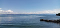

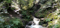
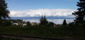
Start at the Amphion landing stage, on the D1005, between Évian-les-Bains and Thonon-les-Bains. Park in the small car park at the landing stage (around ten spaces) or in the car park along the D1005 before the landing stage when approaching from Évian.
The signposts mentioned in the description are one-way, indicating the direction of travel.
Green + Blue + Red signposts
(S/E) Cross the D1005 at the pedestrian crossing located at the exit of the landing stage car park (take care, as the road is very busy). Pass a bar-tobacconist’s on your right and turn into Impasse de la Rive. At the end, continue along a narrow path between walls and property fences. At the end, take thesecond right, Rue de la Source, which is closed to vehicles over 19 tonnes.
At a fork in the road (not shown on the map), ignore the right-hand track leading to the harbour village and carry on straight ahead (narrow passage; an old derelict farmhouse on the right-hand side). At the three-way junction that follows, turn left and head uphill. After about 40 metres, turn left onto Rue de la Tour. Pass No. 56 on your left and turn right at No. 54.
(1) You’ll come out onto a main road; immediately turn left onto a concrete footpath that winds steeply uphill towards the main town.
Green + Blue + Red signposting and yellow markings
At the top, turn left onto the Voute de l’Abbé Étienne Chipier, which climbs via a flight of steps whilst passing under the railway line. As you emerge from the tunnel, turn left and climb another flight of steps. Continue along a concrete path to quickly reach a junction alongside the railway line.
(2) Take the signposted path leading uphill to the right. Follow this shaded, gravelly path. It ends with a short, steep climb leading onto a road (Rue du Belvédère). Cross the road with care (no pedestrian crossing) and follow it to the right, downhill along its clearly marked left-hand verge. When the road takes a hairpin bend to the right, turn left. When you reach a wooden gate, turn right and walk alongside an orchard on your left. You’ll reach a crossroads at the foot of a small waterworks building decorated with trompe-l’œil paintings.
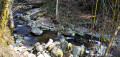
(3) Turn right onto a concrete path leading down towards the Amphion plain. At the bottom (waterfall on the left, railway bridge on the right), go straight on and head back up a track. Ignore a path branching off to the left (not shown on the map) and follow the railway line on your right. Further on, pass under a railway bridge and you will immediately reach a junction.
Blue + Red signposting and yellow markings
Carry on straight ahead (ignore the green signposting heading left – this is a shortcut). As you approach the D1005 bridge, turn left and head uphill through the trees (steep section). Ignore a path coming from the right and continue uphill until you soon reach a crossroads.
Blue + Red signposting
(4) Then turn sharply left (ignore the red and yellow arrows pointing to the right) and follow a grassy path bordering woodland on the left and a meadow on the right. Pass some greenhouses on the right and enter the woodland. Descend steadily.
Green + Blue + Red signposting and yellow markings
At a junction (with lovely walnut trees on the left), go straight on and head uphill. At a three-way junction below some houses, turn left and head back downhill (steep at the start). Cross a stream and return to a junction you passed earlier.
(3) Go straight on and follow the orchard on your right-hand side. Then veer left, then right, and head up Rue du Belvédère on its right-hand verge (there is no verge on the left). When you reach a dead-end on the right-hand side, turn left to cross the road (take care – there’s no pedestrian crossing). Head straight ahead onto the gravel path that leads downhill (steep at the start).
Mountain bike signpost 17
(2) At the junction by the railway line, cross the tarmac path and follow the path opposite which runs alongside the railway line below on the left. Alternate between short climbs and descents.
Green signposting
At a junction (not shown on the map), carry on straight ahead along the railway line (ignore the MTB route heading off to the right). Shortly afterwards, turn right with the path, head downhill and cross a stream via a wooden bridge.
Green + Blue + Red signposting and yellow markings
At the junction just past the bridge, turn sharply left and climb gently. Turn right along the path and descend again to a road.
(5) Then turn left, cross the railway line at the level crossing and pass the old Amphion station on your right. Shortly afterwards, leave the road and head down to the right onto a path that enters a woodland. The path soon gives way to a wide track that descends steeply alongside a small stream on the right-hand side. At the bottom, go round a private property on the right.
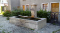
Cross a stream, cross a small road and climb the steps opposite which lead to Parc Maxima. At the top, follow a tarmac path to the left. At the next junction, turn right and head down to Source Maxima (kiosk, drinking fountains).
(6) Then turn left and continue along a gravel path. This curves to the right and passes at the foot of three remarkable trees: a lime tree, a cedar and a sequoia. At the T-junction, go left then turn right to come out onto the D1005 road.
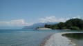
Cross the road at the pedestrian crossing (take care, as it is a very busy road). On the other side, turn left and walk along the lake on your right. This will take you to the Amphion landing stage (S/E).

 Visorando Member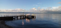
 Easy
Easy