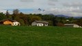
Along the Dranse from Vongy to Branlecul

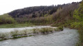
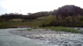
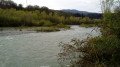
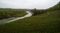
A short walk through shrubby vegetation, with some lovely stretches along the banks of the Dranse, just before it flows into Lake Geneva.

Details

1992355
Creation:
Last update:
Last review:
  • Walking
    Activity: Walking
  • ↔
    Distance: 2.32 mi
  • ◔
    Average duration: 1h 05 
  • ▲
    Difficulty: Easy

  • ⚐
    Back to start: Yes
  • ↗
    Ascent: + 43 ft
  • ↘
    Descent: - 43 ft

  • ▲
    Highest point: 1,348 ft
  • ▼
    Lowest point: 1,302 ft

Photos

Description of the walk

Start from the large car park near the Centre d’Aide par le Travail (bus stop), along the Route du Ranch, a road that begins at the foot of the Vongy Chapel.

(S/E) Follow the road southwards and turn left with it at the corner of a sports ground. Pass through a metal gate and go through the tunnel under the D1005.

(1) After a sharp right-hand bend and at the start of a gentle left-hand bend, leave the tarmac, climb the embankment on the left and follow a path through the woodland.

At a three-way junction, take the left-hand path, which quickly leads to the banks of the Dranse for a lovely view. Retrace your steps. Continue along the main path until you come out onto a stony track.

(2) Follow the path to the left, ignoring the faint tracks on either side. Cross a small open area and continue straight ahead along a path. Further on, you’ll reach the bank of the Dranse (which may or may not be visible at this point, depending on the season).

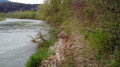
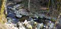
(3) Continue along the narrow path beside the river (this short section requires care). The path soon veers away from the Dranse and continues through the woodland. Carry on southwards, below and some distance from the Thonon bypass (D1005). The path turns left then right and returns to the riverbank. Follow the river upstream for a short while until you reach a clear, level spot ideal for a break.

(4) The return journey follows the same route, in the opposite direction.

(2) At the start of a left-hand bend on the stony track, don’t miss the start of the path on the right.

(1) Follow the road to the right to reach the car park (S/E).

Waypoints

  1. S/E : mi 0 - alt. 1,306 ft - Route du Ranch – Car park
  2. 1 : mi 0.23 - alt. 1,302 ft - Start of the trail
  3. 2 : mi 0.37 - alt. 1,316 ft - Junction
  4. 3 : mi 0.65 - alt. 1,322 ft - Along the banks of the - Dranse (rivière)
  5. 4 : mi 1.18 - alt. 1,348 ft - Branlecul
  6. S/E : mi 2.32 - alt. 1,306 ft - Route du Ranch – Car park

Notes

In dry weather, good walking shoes are sufficient for this short walk.

Warnings:
- Do not undertake this walk if the Dranse is in flood.
- Do not venture into any wetlands that the path may run alongside.
- The area is a protected natural site: keep dogs on a lead.

A detailed map is useful (at the very least, the one accompanying this description).

Hike undertaken by the author on 21 April 2019.

Worth a visit

- Beautiful views along the banks of the Dranse.

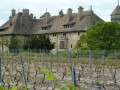
- At the end of the path (4), there is a viewpoint overlooking the opposite bank and, to the left, the Vignes de Pont vineyards (Marin wine, AOP Vins de Savoie).

Reviews and comments

4.2 / 5
Based on 3 reviews

Reliability of the description
4.7 / 5
Ease of following the route
5 / 5
Route interest
3 / 5
goldwings
goldwings

Overall rating : 4.7 / 5

Date of your route : Sep 13, 2021
Reliability of the description : ★★★★★ Very good
Ease of following the route : ★★★★★ Very good
Route interest : ★★★★☆ Good
Very busy route : No

The path is overgrown as it is rarely used and not well maintained. The proximity of the Thonon bypass (constant motorway-style noise) spoils the experience a little. Otherwise, it’s a very wild and secluded spot, with beautiful views of the Dranse waterfalls. You really feel at one with nature (visually).

Machine-translated

Hamzouille
Hamzouille

Overall rating : 4 / 5

Date of your route : May 01, 2019
Reliability of the description : ★★★★☆ Good
Ease of following the route : ★★★★★ Very good
Route interest : ★★★☆☆ Average

A nice, peaceful little walk – it’s a shame the A-road is so close by

Machine-translated

jml74
jml74

Overall rating : 4 / 5

Date of your route : May 06, 2019
Reliability of the description : ★★★★★ Very good
Ease of following the route : ★★★★★ Very good
Route interest : ★★☆☆☆ Disappointing

Hello,
The walk was too short for my liking and noisy, as it’s too close to the Thonon bypass – you can hear the cars far too clearly!

Machine-translated

Other walks in the area

For more walks, use our search engine .

The GPS track and description are the property of this route's author. Please do not copy them without permission.