Country:

 City:
City:


Start from the church in Champanges, Place Anselme Boujon. Park in the car park near the sports grounds, behind the church and opposite the town hall. Champanges is situated about ten kilometres from Thonon-les-Bains or Évian-les-Bains.
Signposts are provided at major junctions.
No signposting
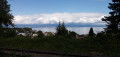
(S/E) Take Rue du Stade and walk past a playground and then some tennis courts on your right. Turn left with the road and, at the corner of a bar-restaurant-lodge, turn right onto Route des Hermones. At the junction, go straight on. At a fork in the road, turn right onto Chemin de la Fin d’Amont. After the last houses, the tarmac gives way to a gravel track (on the right, a view of the Châteaux d’Allinges and Lake Geneva). Turn right with the track and head downhill.
(1) You’ll come out onto the D11; follow it to the left (take care, as it’s a fairly busy road). Cross a stream and enter Thièze. Before the road bends to the left, it’s advisable to use the right-hand verge, which offers better visibility. Pass two chicanes for vehicles by taking a footpath to the right of the road.
Yellow markings
(2) At the corner by a bar-restaurant with green render, turn sharply right towards Les Thièzes. Head downhill through a residential area, staying on the tarmac road which is circular and turns to the left, and ignore the paths branching off to the right.
(3) At the ‘Thièze dessous’ signpost, take a sharp right-hand turn. The tarmac soon gives way to a stony track. Walk along the left-hand side of a horse pasture. At the corner of the pasture, take the stony path on the left which leads downhill.
Unmarked
(4) You’ll come out onto a small road; follow it to the right. After passing a riding centre on the left and a sewage treatment plant on the right, cross a stream.
Yellow + Red and Yellow markings
(5) At the foot of a sign marking the end of the 30 km/h speed limit, turn right onto a gravel track bordered by a hedge on the right. Wind your way for some time through the meadows, ignoring all the turnings on the left (lovely view of the Mémises-Borée-Oche massif). Once the gravel gives way to tarmac, ignore a path branching off to the right and you’ll come to a three-way junction.
(6) Then take the small road on the right, which is well shaded and climbs steadily through the meadows. At the top of the hill, rejoin the D11 (Rue de Savoie) and follow it to the left along the left-hand pavement. After a few dozen metres, cross the road at the pedestrian crossing and follow it in the same direction as before.
No signposting
Take thefirst right, Rue des Allobroges. At the junction, turn right and you’ll soon reach the car park by the town hall and the church (S/E).

 Visorando Member
 Moderate