On the ridges around the Recastron valley

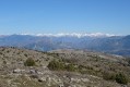
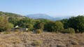
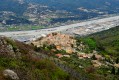
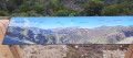
This walk takes you through the Condamines neighbourhood, along roads and shortcuts, to reach a DFCI track. At the top of this track, you’ll find yourself facing the pretty village of La Roquette-sur-Var and a viewpoint overlooking the Var valley and the villages of Bonson, Gilette, Le Broc, Carros and Gattières. Not to mention the surrounding peaks: Mont Vial, Mont Lion, Mont Arpasse, etc.

Details

n°110260766
Creation:
Last update:
Last review:
–
  • Walking
    Activity: Walking
  • ↔
    Distance: 4.40 mi
  • ◔
    Average duration: 2h 50 
  • ▲
    Difficulty: Easy

  • ⚐
    Back to start: Yes
  • ↗
    Ascent: + 896 ft
  • ↘
    Descent: - 873 ft

  • ▲
    Highest point: 1,168 ft
  • ▼
    Lowest point: 328 ft

Photos

Description of the walk

Park in the car park of the Complexe Sportif de la Bréa: there is an information board for this walk. The route is marked with an orange line.

(S/E) As you leave the sports centre car park, take Rue Pierre Grilli, which is almost directly opposite.

(1) At the three-way junction, keep to the right to follow the road called Ancien Chemin de Nice. Pass the bottom of the Récastron valley on your left and walk for about 200 m.

(2) Take the small stone staircase on the left. Cut across Route de Condamines, then follow Chemin Émile Girard straight ahead, which rejoins the same road further up.

(3) Walk about twenty metres to the left, then turn right to take the shortcut that cuts across two bends. Join the road one last time and follow it to the left until you reach the junction.

(4) Turn left and follow the Route des Maquisards to the start of the Raiet DFCI track, situated in a hairpin bend.

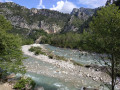
(5) Carry on straight ahead along this track, which overlooks the Récaston valley on its eastern slope, then on its western slope after taking a hairpin bend to the left. You’ll reach a junction marked ‘shortcut’.

(6) Turn right and head up the ridge to reach the highest point of this walk.

(7) Turn sharply left to follow the narrow path back to the end of the DFCI track.

(8) Continue downhill, come out onto the Chemin des Vignes, and head to the right. Join the Route du Puy, turn right, and continue to the dead end.

(9) Turn right onto the path, which winds several times before rejoining Rue Pierre Grilli. Continue to the right to return, very quickly, to the sports complex car park (S/E).

Waypoints

  1. S/E : mi 0 - alt. 374 ft - Sports complex car park
  2. 1 : mi 0.19 - alt. 374 ft - Three-way junction
  3. 2 : mi 0.69 - alt. 335 ft - Stone steps
  4. 3 : mi 0.81 - alt. 456 ft - Return via the Route des Condamines
  5. 4 : mi 1.03 - alt. 581 ft - Route des Maquisards
  6. 5 : mi 1.65 - alt. 810 ft - Start of the DFCI track
  7. 6 : mi 2.75 - alt. 922 ft - Junction – ‘shortcut’ sign
  8. 7 : mi 3.24 - alt. 1,168 ft - Ridge – highest point
  9. 8 : mi 3.71 - alt. 781 ft - End of the DFCI trail
  10. 9 : mi 4.13 - alt. 561 ft - Dead end – path on the right
  11. S/E : mi 4.4 - alt. 374 ft - Sports complex car park

Notes

(6) Alternative route: in bad weather, carry on straight ahead to reach (8) directly, thereby shortening the walk.

Worth a visit

Along the DFCI track, there are information boards describing the different plant species found there.

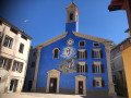
On the way back, visit the Church of Saint-Roch in Saint-Martin-du-Var.

Other walks in the area

For more walks, use our search engine .

The GPS track and description are the property of this route's author. Please do not copy them without permission.