
Visorando Visorando
Visorando Visorando
  •  Tools 
    • Walking route planner
    • Import a GPX file
  • Walks
  • Help ↗
  • Visorando Premium
  • Sign up
  • Log in
Loading…
  1. Visorando
  2. lionelnice

lionelnice

lionelnice
Visorando Member
Premium user
  • Gender: man

Sign up: 14 Oct 2012

Published routes 2

Published route(s)

  • List
  • Map

Walking On the ridges around the Recastron valley
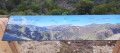
Sur les crêtes autour du vallon de Recastron
↔4.40 mi ↗+896 ft ↘-873 ft ◔2h 50 ▲Easy
⚑Departure from Saint-Martin-du-Var (Alpes-Maritimes)
This walk takes you through the Condamines neighbourhood, along roads and shortcuts, to reach a DFCI track. At the top of this track, you’ll find yourself facing the pretty village of La Roquette-sur-Var and a viewpoint overlooking the Var valley and the villages of Bonson, Gilette, Le Broc, Carros and Gattières. Not to mention the surrounding peaks: Mont Vial, Mont Lion, Mont Arpasse, etc.
Download PDF  PDF Download GPX  GPX

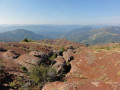
Walking Dôme de Barrot via Léouvé

Dôme de Barrot par Léouvé
↔11.48 mi ↗+3,999 ft ↘-3,999 ft ◔8h 45 ▲Difficult
⚑Departure from La Croix-sur-Roudoule (Alpes-Maritimes)
From Léouvé to the Dôme de Barrot, in the red rocks between Daluis and Cians.
Download PDF  PDF Download GPX  GPX
Back to top
  • Privacy policy
  • Contact
  • Manage my cookies
  • Visorando community

Download the app now and go on an adventure!

App storeApp Store
Google playGoogle Play

Checking services status…© 2026 Visorando
 Loading…