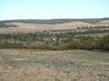
On the cross-country paths of the Gron region

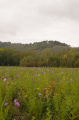
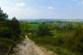
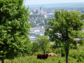
This lovely route takes you through the charming residential village of Gron, which was under the jurisdiction of Vauluisant Abbey in the 13th century before passing to Sainte-Colombe Abbey in the 16th century. After following the many narrow lanes and local paths, the route climbs up to the heights, offering beautiful views of the Yonne valley and Saint-Étienne Cathedral in Sens on one side, and the Gâtinais on the other. It also follows a short section ofthe GR®213.

Details

1563067
Creation:
Last update:
Last review:
  • Walking
    Activity: Walking
  • ↔
    Distance: 6.63 mi
  • ◔
    Average duration: 3h 20 
  • ▲
    Difficulty: Moderate

  • ⚐
    Back to start: Yes
  • ↗
    Ascent: + 361 ft
  • ↘
    Descent: - 377 ft

  • ▲
    Highest point: 571 ft
  • ▼
    Lowest point: 259 ft

Photos

Description of the walk

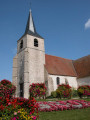
Town hall car park (opposite the church).

(S/E) On leaving the car park, turn right onto the village’s main street, Rue Haute, then turn left. After a few steps, turn immediately right into Ruelle du Puits de Vau. At the end of the lane, continue straight ahead, running alongside the sports grounds. At the end of the street, carry on straight ahead along Rue des Moulins, then immediately turn left past the nursery onto a small local footpath. Cross Rue de la Croix Jacquelin and continue along this path. Turn left at the junction. At the end of the path, turn left into Rue des Grands Barreaux.

(1) At the end of the street, take the tarmac road on the right (Voie communale de Gron aux Fours) for several hundred metres.

(2) Take the first path on the left to reach the hamlet of Les Épenards.

(3) Turn right in the middle of the hamlet and cross it via the Chemin des Épenards. On leaving the hamlet, continue straight on along the track that extends from the tarmac road. This track curves to the right. Follow it for several hundred metres.

(4) You’ll come to a small tarmac road leading to Chaumes. Without reaching the main road, turn right and then immediately left. Continue along this path for about 1 km until you reach the road linking Gron to Bel Air.

(5) Turn left onto this road. At the entrance to Bel Air, turn right to cross the hamlet and carry on without leaving the track, which continues along the tarmac road for about 1 km.

(6) Before the high-voltage power lines, turn right to join theGR®213after a few steps. Continue along this path, which runs alongside a woodland on your right.

(7) At the next junction, leave theGR®213, which heads off to the left, and turn right, still following the edge of the woodland. Enter the woodland and continue along this path, ignoring all the paths to the right and left. Pass under the high-voltage power line, then continue left onto the path that descends towards the village of Gron and turns into a road.

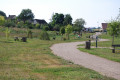
(8) Just before the entrance to the village, leave the road and cross diagonally to the right through the leisure area to reach Rue des Damiettes, where you turn right. After a few steps, turn left across the road into a narrow passageway between two houses. It zigzags a few times before emerging onto Rue du Bordiot. Head down to the right for a few dozen metres, then turn left onto a lovely tree-lined path. At the end of this path, walk along the right-hand side of a property, cross the Ruisseau des Moulins to reach the top of a park, the Parc de la Fosse aux Loups. Head down to the left towards the park entrance (campervan parking area).

(9) Turn right again into the park and follow the valley floor towards the village centre and the shops. Just before reaching the Grande Rue, turn left up the small winding path that leads to Rue Haute. Turn right to reach, after a few steps, the Place de la Mairie and the starting point of the route (S/E).


Waypoints

  1. S/E : mi 0 - alt. 292 ft - Town Hall car park
  2. 1 : mi 0.65 - alt. 272 ft - Junction with Rue des Fours
  3. 2 : mi 1.11 - alt. 295 ft - Turn-off towards the hamlet of Les Épenards
  4. 3 : mi 1.49 - alt. 302 ft - Junction at the hamlet of Les Épenards
  5. 4 : mi 2.35 - alt. 328 ft - Turn right at the fork before the road
  6. 5 : mi 3.02 - alt. 440 ft - Junction on the road from Gron to Bel Air
  7. 6 : mi 3.8 - alt. 568 ft - Junction with the GR213
  8. 7 : mi 4.23 - alt. 541 ft - Turn-off towards Bois des Haugames
  9. 8 : mi 5.69 - alt. 354 ft - T-junction at the Gron leisure area
  10. 9 : mi 6.23 - alt. 285 ft - Motorhome parking area
  11. S/E : mi 6.63 - alt. 292 ft - Town Hall car park

Notes

For your safety, please avoid using this route during the traditional hunting season from 1 October to 28 February.

Routes through woods and forests must follow rural tracks; entering any woodland (even communal woodland) is prohibited. Please take care.

Worth a visit

Fosse aux Loups Park with a fitness trail, a book box and shared allotments.
A pleasant service area for motorhomes at the entrance to Fosse aux Loups Park.
Numerous shops and services in the village of Gron (bakery, butcher’s and delicatessen, chemist’s)
Les Copains d’abord restaurant in Gron

Always be cautious and plan ahead when you're outdoors. Visorando and the author of this route cannot be held responsible for any accidents occurring on this route.

The GR® and PR® markings are the intellectual property of the Fédération Française de Randonnée Pédestre.

Reviews and comments

4.2 / 5
Based on 3 reviews

Reliability of the description
4.3 / 5
Ease of following the route
4.3 / 5
Route interest
4 / 5
jean-paul.vicente
jean-paul.vicente

Overall rating : 3.7 / 5

Date of your route : May 06, 2023
Reliability of the description : ★★★★☆ Good
Ease of following the route : ★★★★☆ Good
Route interest : ★★★☆☆ Average
Very busy route : No

Hello, regarding the walk ‘Along the back roads of the Grônois region’
– In my opinion, there’s a mistake in the description of the start/finish (S/F). It should read as follows: Leaving the car park, turn left onto Rue des Courois. After a few steps ....................................
- Furthermore, in the ‘Nearby’ section: the restaurant ‘Les Copains d’Abord’ is no longer in business.
In any case, thank you for all the work you’ve put into this website. Kind regards.

Machine-translated

OT Sens
OT Sens ★

Thank you, vincent.claude, for sharing your thoughts on this lovely walk – we’re delighted you enjoyed it!
See you soon on the trails of the Sénonais!
The team at the Sens and Sénonais Tourist Office

Machine-translated

vincent.claude
vincent.claude

Overall rating : 5 / 5

Date of your route : Feb 25, 2021
Reliability of the description : ★★★★★ Very good
Ease of following the route : ★★★★★ Very good
Route interest : ★★★★★ Very good
Very busy route : No

Nothing to report, very nice!
You can shorten the route using the map provided.

Machine-translated

OT Sens
OT Sens ★

Hello,
Thank you for leaving a review of this walk – we’re delighted you enjoyed it!
See you soon on the trails of the Sénonais!
The team at the tourist office

Machine-translated

poret
poret
• Edited:

Overall rating : 4 / 5

Date of your route : Nov 29, 2020
Reliability of the description : ★★★★☆ Good
Ease of following the route : ★★★★☆ Good
Route interest : ★★★★☆ Good
Very busy route : No

A pleasant 10-kilometre walk in the hills above Gron. It can be done in any season without any difficulty.

Machine-translated

Other walks in the area

For more walks, use our search engine .

The GPS track and description are the property of this route's author. Please do not copy them without permission.