Country:
 City:
City:


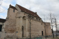
The route starts from Place Jean Jaurés (large car park).
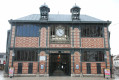
(S/E) With your back to the entrance to the bandstand of the former tourist office, cross the road and continue along the Promenades pedestrian walkway, running alongside Boulevard des Garibaldi. Walk past the Théâtre Municipal de Sens on your right and go past the fountain. Continue straight on, passing Sainte-Mathie Church on your right and the bandstand a little further on. Cross the Boulevard de Maupeou to reach the Quai Jean Moulin (protected crossings). Turn left and walk alongside the River Yonne for a few dozen metres, before heading back up to the Pont d’Yonne.
(1) Cross the bridge, then turn right to reach the Church of Saint-Maurice below. Turn right immediately, go down the cobbled steps and walk along the Quai de l’Yonne for about 400 metres. Turn left twice and continue along the Quai de la Fausse Rivière. Carry on along this route and return to the main street, Rue Lucien Cornet. Cross this street and turn left. Then turn right onto Rue Claude Bernard, before taking a narrow passageway on the right which leads back to the banks of the Yonne.
(2) Continue to the tip of the Île d’Yonne and the water sports centre, then turn left onto Quai Boffrand so as to return to the level of the Pont d’Yonne. Cross the bridge again, keeping to the right-hand pavement. At the end of the bridge, turn right onto Quai Ernest Landry. Walk downhill for about 100 metres and cross the road again to reach the Promenades. Follow the Promenades (Cours Tarbé) until you reach Square Jean Cousin. On leaving the square, cross the junction and carry on straight ahead. Pass the Poterne (a remnant of the ramparts) on your left, before continuing straight on to Place des Héros.
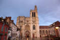
(3) Cross Boulevard du Mail to the right, walk a few steps, then turn immediately right onto Rue Gué Saint-Jean. Walk past the washhouse, then continue towards Rue Ambroise Paré. At the end, turn left onto Rue Alsace Lorraine. Cross at the junction and turn right onto the Promenades. Carry on to Place Jean Jaurès, then turn left onto the small Rue Drapès, then right and left again to reach Place Drapès. Cross over to Rue de Brennus opposite, to reach Place de la République and its famous Saint-Étienne Cathedral.
(4) Walk past the carousel and turn left onto Rue des Déportés de la Résistance. Walk on to the Jardins de l’Orangerie.
(5) After taking in the sights, retrace your steps for a few dozen metres and turn left onto Rue Abélard. At the end of this street, turn right onto Rue du Général Alix. Continue straight on and cross Rue de la République at the Maison d’Abraham.
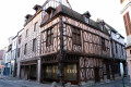
(6) Continue along Rue Jean Cousin, then turn left onto Rue Cugnières. Turn right onto Rue Jossey and walk past the Maison Jean Cousin, which regularly hosts temporary exhibitions. At the next junction, turn right into Rue de l’Écrivain, then left onto Rue de l’Épée. Walk past the Palais de Justice and return to the Grande Rue. Turn right and walk up this pedestrianised street until you reach the fourth street on the left. Take Rue du Plat d’Étain, then turn right into Rue Voltaire to continue walking alongside the covered market on your right.
(7) Back at Place de la République and facing the cathedral, turn left onto Rue de la République. Walk past the Town Hall and the statue of Brennus on top of it. Continue straight on until you reach Place Jean Jaurés again (S/E).


 Tourist office
 Moderate
 Association / Club / Walk leader
 Difficult