Circular walk in the State-owned Forest of the Sèdiéres estate

Between Clergoux, the Domaine de Sèdiéres and Eyrein, discover the flora and fauna of the Corrèze region amongst ponds, forests and white water.

Details

n°984188
Creation:
Last update:
Last review:
  • Walking
    Activity: Walking
  • ↔
    Distance: 12.20 mi
  • ◔
    Average duration: 6h 20 
  • ▲
    Difficulty: Difficult

  • ⚐
    Back to start: Yes
  • ↗
    Ascent: + 823 ft
  • ↘
    Descent: - 827 ft

  • ▲
    Highest point: 2,044 ft
  • ▼
    Lowest point: 1,804 ft

Photos

Description of the walk

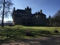
Park in the car park before the château, then follow the signs to the theatre.

(S/E) Continue to the right for 150 metres and turn right into the Domaine de Sédières State Forest.
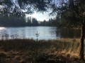
Join the road on the right at the Neuf pond.

(1) Turn left along the pond to reach its northern end.

(2) Carry on straight ahead and rejoin the previous road.

(3) Turn right, then carry on straight ahead at the junction and turn left, staying on the road (D135E3).

(4) Turn right onto a forest track, following the orange and white arrow-shaped signposts.
Carry on to the right until you reach Sévezergue.

(5) After the stone house, turn left, go through the village and turn left, following the road to the junction with the D60E.

(6) First turn right then left, passing the Maison de la Chasse (wooden chalets). Go through the wooden gate and go round the pond on the right.

(7) At the far end of the pond, look out for and take a path leading uphill through the woodland on the right. Carry on straight ahead at the three-way junction, then turn left to rejoin the track. Turn right and continue for about 800m, then turn left towards the Puy de Gumont. At the junction, keep left.

(8) Turn right onto a path through the woodland for about 800 metres, then continue straight on until you reach the D10.

(9) At the road, turn left at a 90° angle onto a descending track.

(10) Look for a grassy track on the right leading into a woodland and continue on to Treins.

(11) After the farm, turn left onto the road, then leave it on the left a little further on to take a wide track leading towards Pont Tort in the direction of Le Chambon. Pass Pont Tort and continue on to the Croix des Lépreux.

(12) Head towards Eyrein on the D135E3 and continue through the village. At the town hall, turn left.

(13) Turn left onto the Chemin de la Rissiére. Reach the rock of the same name (yellow markings). Continue to the road and turn left. Carry on for about 500 metres and take a path on the left.

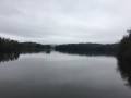
(14) Turn right at the Fork in the road, then carry on straight ahead, ignoring the paths to the right and left, until you reach the Étang de la Chèze.

(15) Walk alongside the Étang de la Chèze to the picnic tables and take the tarmac path leading uphill on the right. At the crossroads of tracks, turn right. You’ll reach another crossroads separating the hamlets of Puy des Deux Bouleaux and Puy de la Tour.

(16) Leave the track and take a path descending to the left which leads to the Étang des Agadis. Look for a narrow single track through the woodland and go round the pond on the right. Head for the point separating this pond from the Étang du Château.

(17) Head uphill to the right to reach a large, wide track. Take this track to the right. Turn left between the Étang du Château and the Étang de la Prade, heading towards the Château de Sédières and the car park in front of the château (S/E).


Waypoints

  1. S/E : mi 0 - alt. 1,824 ft - Car park in front of the castle
  2. 1 : mi 0.64 - alt. 1,837 ft - Keep to the left along the pond
  3. 2 : mi 0.96 - alt. 1,827 ft - Straight ahead
  4. 3 : mi 1.38 - alt. 1,906 ft - Turn right onto the road
  5. 4 : mi 2.08 - alt. 1,834 ft - On the right, a forest track
  6. 5 : mi 2.66 - alt. 1,834 ft - Sévezergue
  7. 6 : mi 3.03 - alt. 1,900 ft - The Hunting Lodge
  8. 7 : mi 3.45 - alt. 1,847 ft - Turn right at the end of the pond
  9. 8 : mi 4.78 - alt. 2,011 ft - Path on the right
  10. 9 : mi 5.67 - alt. 2,037 ft - Turn left at a 90° angle off the road
  11. 10 : mi 5.87 - alt. 1,985 ft - Grassy path on the right.
  12. 11 : mi 6.3 - alt. 1,991 ft - Treins Farm
  13. 12 : mi 7.5 - alt. 1,913 ft - Croix des Lépreux
  14. 13 : mi 8.01 - alt. 1,873 ft - The Rissiére Path
  15. 14 : mi 9.37 - alt. 1,936 ft - Turn right at the fork in the road
  16. 15 : mi 9.87 - alt. 1,867 ft - The Chèze Pond
  17. 16 : mi 10.67 - alt. 1,998 ft - Path on the left
  18. 17 : mi 11.54 - alt. 1,837 ft - The end of the pond on the right
  19. S/E : mi 12.2 - alt. 1,824 ft - Car park in front of the castle

Notes

Make sure you take plenty of water.
Wear sturdy shoes.
There are numerous ponds along this route, so it’s best to choose a relatively sunny time of year, as some sections may be damp.

Worth a visit

Reviews and comments

3.4 / 5
Based on 3 reviews

Reliability of the description
3.7 / 5
Ease of following the route
3.3 / 5
Route interest
3.3 / 5
Marcel de l'Indre
Marcel de l'Indre
• Edited:

I’m doing this route at the weekend! I’ll post a review

Machine-translated

MarJeaLou
MarJeaLou

Overall rating : 2.7 / 5

Date of your route : Jan 20, 2024
Reliability of the description : ★★★★☆ Good
Ease of following the route : ★★☆☆☆ Disappointing
Route interest : ★★☆☆☆ Disappointing
Very busy route : No

A route that’s worth doing for its length. The signposting is virtually non-existent and can sometimes be misleading. Thank goodness for the Visorando app – without it, I’d have gone completely astray! Completed very early this morning. Points of interest: the lakes, the wildlife (roe deer, chaffinches, goldfinches), magnificent beech and oak woodlands, a few beautiful restored Corrèze-style buildings and the lepers’ cross. The finish through the castle grounds is lovely. The walk took 5 hours. No particular difficulties. Remember to wear a high-visibility vest – this is a hunting area. Best done in March/April when nature is coming to life, and no doubt with the chance to spot and hear woodcocks.

Machine-translated

ASPTTrando_ML
ASPTTrando_ML

Overall rating : 3.7 / 5

Date of your route : Jun 28, 2020
Reliability of the description : ★★★☆☆ Average
Ease of following the route : ★★★★☆ Good
Route interest : ★★★★☆ Good
Very busy route : No

A lovely walk, with varied scenery and paths through the woodland – very pleasant in the heat. The route description isn’t always easy to follow; a map is essential, and indeed a GPS is needed to pinpoint your location at named junctions, but there are no signs on the ground… the guide should refer to the existing markings and indicate when to leave the marked path for an unmarked section… nevertheless, it’s a lovely way to discover the region, which deserves to be better promoted.

Machine-translated

randorenaud
randorenaud

Overall rating : 4 / 5

Date of your route : Oct 16, 2018
Reliability of the description : ★★★★☆ Good
Ease of following the route : ★★★★☆ Good
Route interest : ★★★★☆ Good

A walk in the woods with lots of ponds
Didn’t go all the way to Eyrin as it was a bit of a long way; turned off towards the Puy de l’Echavon to reach the Puy de Mont Pierre
Visited Sediere Castle, which was hosting an original exhibition

Machine-translated

Other walks in the area

For more walks, use our search engine .

The GPS track and description are the property of this route's author. Please do not copy them without permission.