Country:
 City:
City:


Departure from Mézières-sur-Seine – Épône station, coming from Paris, Gare Saint-Lazare, Train J, towards Mante-la-Jolie.
(S/E) On leaving the station, turn right (Avenue de la Gare), carry on straight ahead, and continue onto the D130 after carefully crossing the boulevard. Enter Mézières-sur-Seine, and carry on until you reach Rue Henri Bretonnet on the right.
(1) Take this street, follow it to the end, then turn left and walk for about twenty metres.
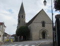
(2) Carry on to the right along Rue Nationale until you reach Saint-Nicolas Church.
(3) Just before you reach it, turn left onto Chemin Saint-Nicolas, then continue to the right along a path at the edge of the woods . Enjoy the views over the Seine. At the junction, keep left and continue to the end of Rue de la Fontaine Lubin.
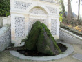
(4) Turn left, then immediately left again onto Grande Rue. Head up through the woods and, at the three-way junction, keep to the right. Walk past a wash house and reach the top of the hill. Turn left at the foot of the fire hydrant and head up the path alongside the wall on your left. Continue through fields and woodland, pass under a high-voltage power line, and arrive at a crossroads, just before the next set of high-voltage power lines.
(5) Turn left, then right, and pass under the high-voltage power lines. Follow the path along the edge of the woodland on your right until you reach another set of power lines.
(6) Turn right, following the edge of the woodland, cross the high-voltage power lines again on the left, then turn right at the corner of the woodland and join a cross-path.
(7) Ignore the road on your left and continue to the right. At the entrance to the golf course, head straight on and reach the edge of the woodland, passing under the high-voltage power lines.
(8) Turn left and, at the road, continue to the right. Enter La Plagne and carry on along the Grande Rue until you reach the junction with the wash house on your left.
(9) Turn left onto Rue des Saules and, at the 90° left-hand bend, take the path on the right. Follow the edge of the woodland, then turn right at the corner of the field and carry on until you reach the corner of the forest on your right.
(10) Take the path on the left, pass the Chapelle Saint-Germain de Secqueval on your right, and continue downhill to the D158. Turn left and head towards the sign marking the end of the built-up area of the hamlet of Les Castors.
(11) Turn sharply right onto the track and follow the PR® sign. Pass under the high-voltage power lines, turn left, then right and left in succession. Reach a woodland, follow the edge of the woodland on your right, and reach the corner of the field.
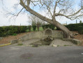
(12) Turn right, heading south, and continue along this path for about 500 metres. Enter Guerville and carry on straight ahead to the Lavoir de la Guitelle.
(13) Turn left onto Rue de la Libération, then right, and walk past the church on your right.
(14) At the corner by the Town Hall, turn right onto Rue de Lombardie, heading towards Senneville. At the next three-way junction, keep left onto Rue Saint-Martin, pass a washhouse and continue up this street to the end. At the multi-way junction, head straight on along Rue des Rubeilles, passing the Guerville nursery school, then a roundabout, and continue along a track until the fork in the road, at the corner of several fields.
(15) Turn left, across the fields, cross the D158, and carry on straight ahead until you reach the next road. First turn left then right, and head straight ahead along a track. Go past the house on your left, then head down the path opposite. Continue to the end of Impasse des Costières, with the wash house on your right.
(16) Turn right (Rue des Fillancourts) and head towards the 90° left-hand bend at No. 32. Turn onto the track on the right and follow the valley to the fork between the two sets of high-voltage power lines.
(17) Carry on to the left, head into the woods and climb up through them until you reach the fork a few metres after passing under the fourth power line (elevation 133).
(18) Carry on straight ahead through the woods until you reach a field. Keep to the right and head towards the village of Villeneuve.
(19) Walk straight through the village along Rue de la Villeneuve, then Chemin de Fort à Faire. At No. 17, continue straight on until you reach the first houses in Épône.
(20) Turn left, following a wall on your right. At the 90° left-hand bend, carry on straight ahead along the path and continue straight on until you reach a street opposite No. 20.
(21) Turn right; at the end of Rue des Ligneux, turn right (Rue Nationale) and head for No. 20.
(22) Turn left onto Avenue de la Gare and carry on straight ahead until you reach Mézières-sur-Seine – Épône station (S/E).

 Visorando Member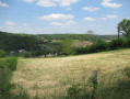
 Moderate
 Easy
Easy