On the ridge of the Grande Étoile at Le Luminier

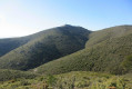
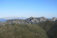
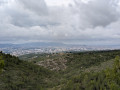
DFCI tracks, steep paths and the ridge path of the Massif de l’Étoile make up this circular route starting from Palama, offering a magnificent 360° panorama. There are a few technical sections to navigate, but they are not particularly difficult.

Details

18628132
Creation:
Last update:
Last review:
  • Walking
    Activity: Walking
  • ↔
    Distance: 7.15 mi
  • ◔
    Average duration: 4h 25 
  • ▲
    Difficulty: Moderate

  • ⚐
    Back to start: Yes
  • ↗
    Ascent: + 1,266 ft
  • ↘
    Descent: - 1,266 ft

  • ▲
    Highest point: 2,136 ft
  • ▼
    Lowest point: 1,076 ft
  • ⚐ Country: France
  • ⚐ City: Marseille (13000)
  • ⚑
    Start/End: N 43.374385° / E 5.438616°
  • ❏
    IGN map(s): Ref. 3145ET
  • Hour-by-hour weather

Photos

Description of the walk

From Château-Gombert, take the Chemin de Palama. Pass two riding centres, then park at the end of the road in thesecond car park on the left, located after the Chemin Martin.

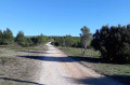
(S/E) Set off along the Chemin de l’Étoile, heading north-west. Go through the barrier blocking vehicle access, then stay on the DFCI track, heading towards La Grande Étoile. Pass under a power line several times and arrive at fire tank no. 402 (elevation 448).

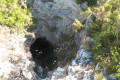
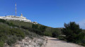
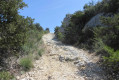
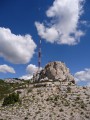
(1) Turn right onto the steep, stony track. Pass by an electricity pylon and arrive at the foot of the Grande Étoile viewpoint. Turn right and follow the cliff-edge path which passes beneath Les Barres. Pass by the climbing site and, further on, a cave. You’ll reach the tarmac road, Route de la Télévision.

(2) Leave it immediately to the right to follow a path along the cliff edge. Join the road and follow it for about 250 m.

(3) Turn right and follow the path that runs along the cliffs. The markings are blue. Pass a few boulders where you may need to use your hands at times, then arrive at the Étoile facilities (elevation 652). Head back down, heading north-west along the cliff. Pass a large cairn and continue to the end of the path (blue markings)

(4) Turn right and carefully descend the small rocky outcrop (alternatively, at the cairn, a small path takes a detour to the left to return beneath the rocks). Head into the forest and reach the Col des Ouides.

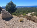
(5) Carry on straight ahead and climb the lovely round hillock. Take in the magnificent scenery, then continue along the ridge, keeping to the right, passing by the Grotte des Maquisards before reaching a Fork in the road.

(6) Turn right, following the purple markings. Follow the path as it descends steadily alongside the Vallon des Ouides. You’ll reach a junction of DFCI tracks and fire tank no. 600.

(7) Turn right onto the DFCI track. Just after a hairpin bend, you’ll reach a Y-junction.

(8) Take the track on the right and then keep to the right. Pass by fire tank no. 406 and a ruin further down the slope.

(9) A few metres past the valley floor, leave the track and take a path on the left, heading down into the valley. Please note: there are no signposts or cairns. At the bottom, turn right, then keep to the right as you gradually climb back up to join a wider path (signposted ‘Sentier de découverte’). Follow this path; after a few bends, it passes by the ruins of the Grande Bergerie before reaching the barrier at the start of the route and the car park (S/E).

Waypoints

  1. S/E : mi 0 - alt. 1,076 ft - Car park on Chemin de l’Étoile
  2. 1 : mi 1.33 - alt. 1,476 ft - Cistern no. 402
  3. 2 : mi 1.95 - alt. 1,864 ft - Junction towards the cliff
  4. 3 : mi 2.19 - alt. 1,893 ft - Junction towards L’Étoile
  5. 4 : mi 2.73 - alt. 2,070 ft - Rock face
  6. 5 : mi 2.85 - alt. 1,913 ft - Col des Ouides
  7. 6 : mi 3.64 - alt. 1,890 ft - Fork
  8. 7 : mi 4.26 - alt. 1,706 ft - Cistern no. 600
  9. 8 : mi 4.86 - alt. 1,325 ft - Y-junction
  10. 9 : mi 6.33 - alt. 1,280 ft - Junction towards the valley
  11. S/E : mi 7.15 - alt. 1,076 ft - Car park on Chemin de l’Étoile

Notes

For reference: the author’s time for this route was 3 hours 15 minutes (excluding a lunch break).

Worth a visit

- Les Barres de la Grande Étoile, with its climbing area and cave.
- The Grotte des Maquisards, which served as a base for the Compagnons de la Liberté from 1943 to 1944.
- The Pilon du Roi, an additional 3 km round trip from the (6). Please note: this is a steep and difficult path.
- The Source des Ouides, 150 m from (8) on the track to the left.
- The nature trail and the ruins of the Grande Bergerie.

Reviews and comments

4.7 / 5
Based on 2 reviews

Reliability of the description
4.5 / 5
Ease of following the route
4.5 / 5
Route interest
5 / 5
Kerfred
Kerfred

Overall rating : 5 / 5

Date of your route : May 16, 2022
Reliability of the description : ★★★★★ Very good
Ease of following the route : ★★★★★ Very good
Route interest : ★★★★★ Very good
Very busy route : No

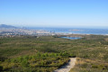
Beautiful views of Marseille, L’Estaque, Gardanne and Allauch.
Two small caves to visit along the way.
A fairly easy walk, with no difficulties.
Be careful not to miss the paths that branch off from the main tracks. If you do, it’s no big deal – there’s always another path to get back onto the original route.

Machine-translated

Randonneur du dimanche

Overall rating : 4.3 / 5

Date of your route : Mar 12, 2022
Reliability of the description : ★★★★☆ Good
Ease of following the route : ★★★★☆ Good
Route interest : ★★★★★ Very good
Very busy route : No

A lovely walk, with magnificent views over the city of Marseille,
best avoided on days when the mistral is blowing, as it’s very windy on the ridge!

Machine-translated

Other walks in the area

For more walks, use our search engine .

The GPS track and description are the property of this route's author. Please do not copy them without permission.