La Grande Étoile starting from Baume Loubières

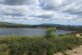
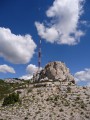
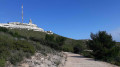
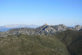
A lovely walk starting from Château Gombert and the Loubières Caves, with a climb up to the Grande Étoile and a magnificent view of Marseille and the surrounding mountains. A walk with no major difficulties, on easy-going paths; just take care on the descent between points (6) and (7), as it is a steep descent. Enjoy the walk!

Details

106090403
Creation:
Last update:
Last review:
  • Walking
    Activity: Walking
  • ↔
    Distance: 4.79 mi
  • ◔
    Average duration: 3h 15 
  • ▲
    Difficulty: Moderate

  • ⚐
    Back to start: Yes
  • ↗
    Ascent: + 1,198 ft
  • ↘
    Descent: - 1,204 ft

  • ▲
    Highest point: 1,791 ft
  • ▼
    Lowest point: 587 ft
  • ⚐ Country: France
  • ⚐ City: Marseille (13000)
  • ⚑
    Start/End: N 43.357536° / E 5.422987°
  • ❏
    IGN map(s): Ref. 3145ET
  • Hour-by-hour weather

Photos

Description of the walk

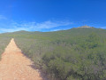
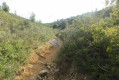
(S/E) Head uphill to the left from the DFCI track at Grottes Loubières and continue to a three-way junction.

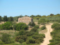
(1) Turn left and you’ll reach cistern no. 405.

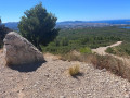
(2) Turn onto the path leading uphill to the right. You’ll spot a small cave just after this, on the left, as well as your first view of Marseille a little further up.

(3) Turn left onto a slightly narrower path. As you walk along this path, look back from time to time to gradually take in a beautiful view of Marseille. Continue on to cistern no. 402. You’re at the foot of the Grande Étoile!

(4) To climb up, take the fairly steep path directly opposite. At the top, be careful: ignore the path that goes straight on behind the Étoile and stay on the Marseille side.

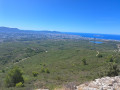
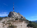
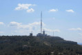
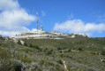
(5) You’ve reached the Grande Étoile. You can admire Marseille, Notre-Dame de la Garde, the Stade Vélodrome, L’Estaque, the Calanques… Continue along the path to the right, along the cliff face.

(6) Turn right down a fairly steep slope until you reach a crossroads with four paths.

(7) Ignore the path on the left and take the track that descends to the left.

(8) At a hairpin bend on the track, turn sharply right onto a slightly narrower path and continue to cistern no. 404.

(9) Take the track on the right.

(10) Further on, take a path on the right which bypasses the track and leads to another water tank – unnumbered and largely covered in graffiti.

(11) Turn left, then right, and follow the track down to the car park (S/E).

Waypoints

  1. S/E : mi 0 - alt. 594 ft - DFCI at Grottes Loubières
  2. 1 : mi 0.41 - alt. 705 ft - Three-way junction
  3. 2 : mi 0.69 - alt. 804 ft - Water tank 405 - Grottes Loubière
  4. 3 : mi 0.88 - alt. 906 ft - Heading towards l’Étoile - Grottes Loubière
  5. 4 : mi 1.96 - alt. 1,457 ft - Water tank 402
  6. 5 : mi 2.21 - alt. 1,755 ft - La Grande Étoile
  7. 6 : mi 2.43 - alt. 1,785 ft - Quite a steep descent
  8. 7 : mi 2.66 - alt. 1,375 ft - Crossroads
  9. 8 : mi 2.91 - alt. 1,240 ft - Short single track to the right
  10. 9 : mi 3.47 - alt. 971 ft - Water tank 404
  11. 10 : mi 3.83 - alt. 965 ft - Path on the right
  12. 11 : mi 4.27 - alt. 846 ft - Water tank covered in graffiti
  13. S/E : mi 4.79 - alt. 591 ft - DFCI at Grottes Loubières

Worth a visit

A magnificent view of Marseille and the surrounding area.

Other walks in the area

For more walks, use our search engine .

The GPS track and description are the property of this route's author. Please do not copy them without permission.