Bramefan summit via Coste Longue

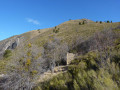
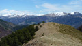
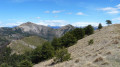
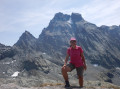
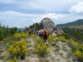
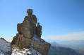
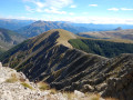
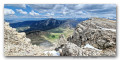
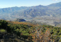
Shortly after setting off, we cross the magnificent little aqueduct and, further on, take a stunningly beautiful path that climbs very gently and is not marked on IGN maps for two-thirds of the ascent. At every clearing in the forest, we enjoy beautiful views over the Vallon des Graves and the Vallon de Vermeil, and at the summit we are treated to a panoramic view stretching from Mont Ventoux on one side to the Écrins massif.

Details

n°1952775
Creation:
Last update:
Last review:
  • Walking
    Activity: Walking
  • ↔
    Distance: 6.92 mi
  • ◔
    Duration according to the author: 5 hrs 
  • ▲
    Difficulty: Very difficult

  • ⚐
    Back to start: Yes
  • ↗
    Ascent: + 2,917 ft
  • ↘
    Descent: - 2,894 ft

  • ▲
    Highest point: 5,420 ft
  • ▼
    Lowest point: 2,539 ft

Photos

Description of the walk

Park at Basses Graves in a small space by the roadside, just past the recycling bins.
Warning! This walk includes some very technical sections. Please refer to the hikers’ comments below.

(S/E) Set off westwards towards the Sagnières aqueduct and the Vermeil torrent. After skirting the meadow, follow the path into the forest (you’ll need to pass through two horse fences).

(1) Turn right at the end of this fence (do not turn left towards the mountain bike markings) and you will soon reach the Sagnières aqueduct and stream, which you’ll approach on a descent, followed by the Combe Chabrières stream. The path runs along the right bank; follow it for about 150 metres to reach a junction.

(2) Leave the main path and turn right onto a path that climbs in switchbacks; the gradient remains gentle until around the 900-metre mark. Continue northwards to reach the ridge line towards the 1,016-metre altitude. Further on, the path is overgrown with tall broom, through which you’ll have to force your way, followed by fallen fir trees that you’ll need to climb over. You can also take the ridge line before reaching these obstructions and rejoin the path further on. Shortly afterwards, ignore a path branching off to the right which descends directly to Les Hautes Graves.

(3) Continue north-east. The path then veers west to tackle the slopes of Coste Longue via a very wide hairpin bend. You will then emerge onto the key section of the ascent.

(4) The path crosses the top of a ravine, which is a little exposed for 20 metres. Once past this section, the path narrows whilst still in the forest, then crosses a scree slope (1 cairn). From there, the path is less clearly defined, but you must maintain the diagonal ascent for 80 metres and climb straight up the slope to quickly rejoin the well-marked, level path.

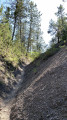
(5) This path veers off to the far left (west), running almost level and clearly visible once more. Gradually, the terrain changes. Above the forest, the path becomes stony and easy to follow, winding through two large hairpin bends, always with a gentle gradient.

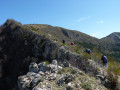
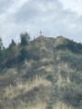
(6) At around 1,300 metres, it continues north-east: either try to follow it or climb up via the numerous animal tracks to reach the vicinity of the ridge line, which you then follow to the summit of Bramefan (this option is shown on the map).

(7) For the descent, continue along the ridge line to the secondary summit to the east.

(8) Head south-east along the gully to the Col de la Basse.

(9) Head south, passing close to a ruin which you leave on your right. The path veers slightly to the left to go round a hillock and reach the 1379m point. From there, the path heads west-north-west, then curves widely through the forest before turning south. It gradually becomes steeper, eventually joining a forest track.

(10) Follow this track downhill to reach Les Hautes Graves. From there, take the road back to the starting point (S/E).

Waypoints

  1. S/E : mi 0 - alt. 2,772 ft - Car park at Les Bases Graves
  2. 1 : mi 0.41 - alt. 2,631 ft - End of fence
  3. 2 : mi 0.68 - alt. 2,539 ft - Path leading uphill to the right
  4. 3 : mi 2.2 - alt. 3,474 ft - Straight ahead, north-east
  5. 4 : mi 2.58 - alt. 3,648 ft - Crossing the ravine
  6. 5 : mi 2.67 - alt. 3,714 ft - Turn left towards two fir trees at the edge of the path
  7. 6 : mi 3.26 - alt. 4,134 ft - Area where you leave the faint path
  8. 7 : mi 4.12 - alt. 5,420 ft - Bramefan summit
  9. 8 : mi 4.31 - alt. 5,381 ft - Secondary summit
  10. 9 : mi 4.57 - alt. 4,859 ft - Col de la Basse
  11. 10 : mi 5.68 - alt. 3,461 ft - Junction with forest track
  12. S/E : mi 6.92 - alt. 2,766 ft - Car park at Les Bases Graves

Notes

Parking is available just past the recycling bins.

The only water source is at the car park (recycling bins): a tap on the north wall at the outlet of the spring catchment that feeds the fishponds.

From this point (3), you can quickly reach Les Hautes Graves (descending the eastern slope) in the event of bad weather or simply to shorten the walk.
The route shown on the map is approximate as regards the positions of the hairpin bends but is a good representation of the actual terrain.

(8) Alternative route: you can descend from the secondary summit along the north-eastern ridge to the Col des Quatre Bornes and take the faint path starting on the right to reach the Col de la Basse.

Worth a visit

There are lovely views on either side of the path through the gaps in the forest.
Try to identify as many peaks as possible from the summit.
It is possible to extend the route from the Col de la Basse by crossing the Parustre ridge to the ruins of the Bane sheepfold. The path starts to the north-west of the ruins.

Reviews and comments

3.6 / 5
Based on 3 reviews

Reliability of the description
4 / 5
Ease of following the route
3 / 5
Route interest
3.7 / 5
chris05
chris05
• Edited:

Hello Olli
Thank you for your positive feedback!
Yes, as you describe, there’s an old path that climbs up to the ridge line, which avoids a large section of the vast broom thickets and shortens the circular route – something that might be a bonus for some people.

All the best
Christian

Machine-translated

olli
olli

In fact, the path above Sagnière is somewhat obscured by the vegetation, and the ridge between Miro and Coste Longue no longer offers much of a view
An interesting alternative is to park a little before Les Hautes Graves, near a track that heads north-east through horse pastures towards a fairly visible and obvious swathe of vegetation; after crossing Combe Chabriere, this allows you to climb up the rocky ridges quite easily (there are a few old red markings and a nice route that’s still fairly easy to follow)
You then rejoin the route described in the standard itinerary
Towards the top of the route, it’s safer and easier to cut straight across towards the ridge to avoid sections with loose scree and hazards. You eventually reach a well-marked path with a stone embankment just below the ridge; following it to the left takes you easily onto the ridge, and the rest is straightforward
This alternative route makes for a really lovely and enjoyable walk, provided you enjoy walking along abandoned paths / there are probably only hunters who pass this way these days
About 7 km with 700 m of elevation gain / A GPS is useful, with a bit of reference to aerial photos
Plenty of chamois on the ridge / ticks too...

Machine-translated

JPC07
JPC07
• Edited:

In response to MAGICAP, I’d like to clarify (RASPOUTINE) that we had a map, an altimeter and a printed copy of the VISORANDO route, and that we know the region where we spend four months of the year inside out. So, contrary to what you’ve written, the hike was thoroughly prepared. I really don’t appreciate your use of the term ‘inexperienced’. We don’t know each other, but having hiked in AFRICA and PERU, amongst other places, I think – without any boastfulness whatsoever – that I have a fair bit of experience. We’ve done much more difficult and technical hikes. I therefore stand by my view and maintain that this route is of absolutely no interest. There’s so much beauty to admire in this lovely region that it’s a real shame to waste time on a route that isn’t worth it. That said, everyone’s entitled to their own opinion: you don’t have to agree with us. If some people enjoy it, so much the better.

Machine-translated

chris05
chris05

Good evening, RASPOUTINE07
I’ve only just seen your message
What can I say? If this isn’t your sort of walk, that’s up to you. Personally, I love walking through the woods and discovering the scenery beyond the woodland. In the description, I point out that it’s a path not shown on IGN maps, so it’s not well-trodden, which means the vegetation has been left to grow freely.

Machine-translated

vanupied
vanupied

Overall rating : 4.3 / 5

Date of your route : Aug 04, 2019
Reliability of the description : ★★★★★ Very good
Ease of following the route : ★★★★☆ Good
Route interest : ★★★★☆ Good

A wild hike – as mentioned in the guidebook, the path is almost completely overgrown on the first few hairpin bends. I found my way thanks to the extremely accurate GPS track.
After the tricky, crumbly section, I ended up on a straight stretch – or almost straight, anyway. You can’t get lost; you just need to head for the ridge.
Best suited to those who like to head straight ahead!!

The only downside was that I was literally attacked by ticks at the summit – I counted five in one go.
So be careful – make sure you wear trousers to protect yourself.

Machine-translated

mapigap
mapigap
• Edited:

Mr Rasputin, if I may say so, a seasoned and, above all, experienced hiker would not set off without a map, a compass or an altimeter in an area they are unfamiliar with. It will also not have escaped your notice, if you studied the route (using an IGN map) before setting off, that it follows virtually no marked trails and runs largely through dense vegetation! A hike ‘off the beaten track’ requires preparation; being physically fit is not enough.

Machine-translated

grandin
grandin ★

Thank you for your review, RASPOUTINE07

I’ve added a warning to the description about the potential danger of certain sections.

Machine-translated

JPC07
JPC07
• Edited:

Overall rating : 2.3 / 5

Date of your route : Jun 13, 2019
Reliability of the description : ★★★☆☆ Average
Ease of following the route : ★★☆☆☆ Disappointing
Route interest : ★★☆☆☆ Disappointing

No mobile signal: without a map, compass or altimeter, give this a miss. How interesting is this walk? Absolutely not at all. It’s all through woodland from point 1 to point 6, with vegetation up to 1.50 metres high; the path is barely visible, and there are no views apart from a few spots, given the broom and invasive plants. Even at the top, the view to the north is blocked by trees. You have to wait until you reach the summit to get a view worth seeing. The start of the descent at the Col de la Basse is impossible to find. Here too, it’s almost entirely through woodland. The icing on the cake, so to speak. At point 4, instead of the described ‘slightly exposed top of a ravine for 20 metres’, you find yourself facing an extremely dangerous section, with a 50° slope, no handholds, completely sloping and with nowhere to put your feet, and a steep ravine several hundred metres deep on the right. Even for seasoned walkers – which I believe we are – it’s best to know this before setting off. So, in conclusion, not only is it completely uninteresting (no path, no views, overgrown vegetation), but it’s also very dangerous at this particular spot. There are plenty of other stunning walks nearby. Our advice: head elsewhere straight away.

Machine-translated

henri57
henri57 ★

Hello,

@mapigap

Could you please send it to me?

1. You can download it here from Framadrop
2. Please send me the link via private message.

Thanks in advance

See you soon

Machine-translated

mapigap
mapigap

Yes, I’ve recorded my route.

Machine-translated

henri57
henri57 ★

Hello,

Thank you for taking the time to share your thoughts.

After point 2, don’t rely on the GPS track, which is only approximate (practical tip – I can confirm this!), but simply follow the path!

So, the rating:

Reliability of the route on the map: Average

Fully justified.

Between points 5 and 6 we struggled a bit as we lost the trail. To avoid walking on a slope for too long, it’s best to try to reach the ridge as quickly as possible.

Question:

For comparison’s sake, did you record a track on your GPS?

See you soon

Machine-translated

mapigap
mapigap

Overall rating : 4 / 5

Date of your route : May 27, 2019
Reliability of the description : ★★★★☆ Good
Ease of following the route : ★★★☆☆ Average
Route interest : ★★★★★ Very good

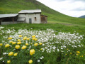
A very lovely route, partly along paths which, unfortunately, are no longer maintained. After point 2, don’t rely on the GPS track, which is rather approximate (practical information – I can confirm this!), but simply follow the path! Between points 5 and 6, we struggled a bit as we’d lost the track. To avoid walking on a slope for too long, it’s best to try to reach the ridge as quickly as possible. At the Col de la Basse (9), a poorly positioned wooden sign marks the start of the path to take for the descent; unfortunately, the start isn’t easy to find and the path winds far less than shown on the IGN map! Fortunately, with a bit of guidance, we eventually found our way back onto it. A little further down, near point 1379, three impressive wild boars ran past us! A lovely adventure amidst the flowers and wildlife. Thank you, Christian.
As the weather looked set to take a turn for the worse in the late afternoon, we’ve postponed the Parustre ridge and Bane sheepfold section until next time!

Machine-translated

Other walks in the area

For more walks, use our search engine .

The GPS track and description are the property of this route's author. Please do not copy them without permission.