Country:

 City:
City:


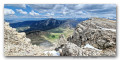
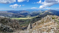
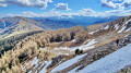
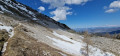
From Bayons, head towards Esparron-la-Bâtie; 200 m before the village, turn left, then, at the sewage treatment plant, turn right onto the track which climbs for 3 km to Lac d’Esparron. Please note: after 1.5 km, at the first junction on the track, turn right and cross the ford over the stream. Do not cross if there is heavy rain or the water level is too high. Continue along the track to the gate, which is open from1 May. When we were there, it was closed on 29 April 2025.
(S/E) Continue along the track heading due south towards the lake.
(1) At the junction of the track and the path, take the path that branches off to the right and rejoins the track further on.
(2) Follow it to the left for a few metres and then carry on to the right, heading due south (ignore the track that branches off to the left). You’ll reach Lac d’Esparron or Lac des Monges.
(3) Walk round it on the left (GR®6 access).
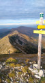
(4) At the sign for Le Pardon 1590, leave the GR® and turn right, following the sign for Sommet des Monges.
(5) It is possible to cut across the circular path to rejoin the path, but the route is not signposted.
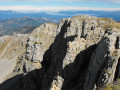
(6) Viewpoint over the Clapouse pastures and the Barres de Chine. Continue to the right along the ridge.
(7) Leave the ridge and continue to the right on the path, which gradually turns westwards.
(8) Turn left towards the south-east and continue to Les Monges ( elevation 2115).
(9) Then head left, due east, across the large alpine meadow and rejoin the ridge. From the 2071-metre point, gradually move away from the ridge, which becomes difficult to traverse.
(10) Caution: tricky section. Cross over to the northern flank of the ridge and follow a steep slope to reach the Croix de Veyre (elevation 1,886).
(11) Turn left, heading due north, onto the GR®6 (marked in white and red) until you reach the multi-way junction at the Col de Clapouse (elevation 1,692).
(12) Continue left, heading north-west, along the GR®accès (marked in white and red) towards Lac d’Esparron.
(13) Do not take the track branching off to the right; instead, follow the GR®accès.
(4) Once back at the Pardon signpost, turn back towards the lake, then on to the car park (S/E).
 Association / Club / Walk leader

 Visorando Member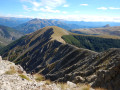
 Moderate
 Very difficult