Country:

 City:


From Turriers, head to Gierre via the D1 and continue along the well-maintained track (1.5 km) to the large car park at Piaure.
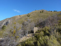
(S/E) At the signpost for Piaure (1,240 m), head towards Picouse. The well-marked path climbs steeply through a beautiful beech forest to the Picouse ridge.
(1) Follow the track branching off to the right across a wide open area to reach the Crête de la Grande Gautière.
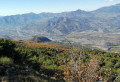
(2) Continue along the ridge through the scrub to the Col de la Baisse.
(3) Begin the very steep ascent to reach the summit of the Pointe d’Eyrolle.
(4) Continue to the left along the ridge and join the winding track. Follow this Piste de Tavanon and, via numerous hairpin bends, reach the Fontaine de Tavanon.
(5) Turn left onto the logging track for a few metres until you reach a junction directly beneath a power line.
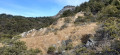
(6) Take care here: make sure you follow the yellow markings and not the red ones, which lead to the edge of the cliff. Walk downhill along this poorly maintained and faintly marked yellow path until you reach the Ravin de Chamioure.
(7) Take care here too: it is no longer possible to cross this ravine following the collapse of the track, which was swept away by the torrent’s floodwaters. You must therefore go round it on the right through thick scrub; although this is not straightforward, it is nevertheless possible. Descend into the torrent bed, then follow it back up to the usual crossing point before reaching the Gautière sheepfold.
(8) Go round the sheepfold to the west and continue slightly uphill to the left to reach the Col de Peyrouret.
(9) Follow the arrow pointing towards Piaure, 25 minutes ahead. The track descends steeply until you reach a crossroads of tracks.
(10) Turn left and follow the track which climbs steeply for about a hundred metres, then you’ll reach the Piaure car park (S/E).

 Visorando Member
 Moderate