The Tour des Monges

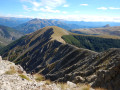
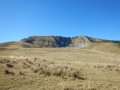
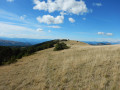
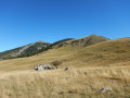
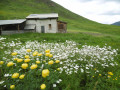
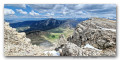
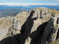
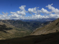
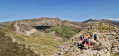
Lac des Monges, with its forest, mountain pastures and a magnificent ridge line offering exceptional views over the massifs of the Southern Alps (Dévoluy, Ecrins, Préalpes de Digne…). Please note that, despite the modest altitude, snow can linger well into the season.

Details

72948146
Creation:
Last update:
Last review:
  • Walking
    Activity: Walking
  • ↔
    Distance: 9.49 mi
  • ◔
    Average duration: 7h 00 
  • ▲
    Difficulty: Difficult

  • ⚐
    Back to start: Yes
  • ↗
    Ascent: + 3,041 ft
  • ↘
    Descent: - 3,031 ft

  • ▲
    Highest point: 6,909 ft
  • ▼
    Lowest point: 4,446 ft

Photos

Description of the walk

To reach the starting point, follow signs for “Esparron-la-Bâtie”. Just before the hamlet, turn left towards “Le Pont”. After 500 m, take the track branching off to the right, towards Lac d’Esparron (or Lac des Monges). After 2 km, the track splits in two. Park before the ford to start the walk.

(S/E) Cross the ford and follow the track suitable for vehicles for about 1.5 km. 

(1) At the junction of the tracks, stay on the one heading left, which is open to traffic for about 200 m.

(2) The footpath (PR®) leaves the forest track and climbs through the woods. On emerging from the woods, the footpath joins the end of the track at the car park.

(3) Cross the car park and continue along the road to Lac des Monges.

(4) At the lakeside, the PR® joins the GR®6. Follow this GR® towards the Col de Clapouse.

(5) Shortly after crossing the Ravin de Clapouse and passing the boulders on the left as you climb, leave the path and head towards the point with an altitude of 1684, without going via the Col de Clapouse. (It is also possible to continue to the pass, then turn left, heading north-north-east.)

(6) Turn left and follow the grassy ridge line which climbs north-east to the summit of La Laupie.

(7) After enjoying the view, continue north-west towards the Sommet de Clot Ginoux, following a path that remains wide and pleasant.

(8) Heading due north, make for the final summit to climb: the Oratoire.

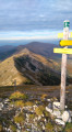
(9) At the Sommet de l’Oratoire, leave the GR® and head down to the left along the Crête de la Colle, a very wide ridge that presents no difficulty. Please note: the markings are not obvious. The trick is to spot the signpost (alt. 1,840 m) before heading down to the left. Keep slightly to the left and look out for a large, isolated pine tree. The signpost is a little further on to its left.

(10) The path descends to the left, zigzagging through the forest until it joins a forest track.

(11) Head down to the right, following the track that runs alongside the Ravin de la Garnaysse until you reach the car park (S/E).


Waypoints

  1. S/E : mi 0 - alt. 4,446 ft - Ford at the junction of the tracks
  2. 1 : mi 0.77 - alt. 4,606 ft - Crossroads of tracks
  3. 2 : mi 1.01 - alt. 4,718 ft - Exit from the track
  4. 3 : mi 1.43 - alt. 5,039 ft - Return along the track to the car park
  5. 4 : mi 1.68 - alt. 5,066 ft - Lac d'Esparon ou lac des Monges
  6. 5 : mi 3.34 - alt. 5,351 ft - Exit the GR to avoid the pass
  7. 6 : mi 3.62 - alt. 5,525 ft - Back to the GR6
  8. 7 : mi 4.7 - alt. 6,640 ft - Summit of La Laupie or Tourtoureau
  9. 8 : mi 5.52 - alt. 6,903 ft - Summit of Clot Ginoux or Les Cimettes
  10. 9 : mi 6.31 - alt. 6,778 ft - L’Oratoire. Altitude 2,072 m.
  11. 10 : mi 7.02 - alt. 6,040 ft - Crête de la Colle marker. Altitude 1,840 m.
  12. 11 : mi 7.87 - alt. 5,161 ft - Return via the forest track
  13. S/E : mi 9.49 - alt. 4,455 ft - Ford at the junction of the tracks

Notes

I recommend doing this route in autumn (late September/October) when the days are still long enough, the herds have moved on and the lake has regained its tranquillity. This is an area where you can spot mouflons, particularly in the ravines to the east of the ridge line from (6) to (9).

Worth a visit

The Bayons turnpikes – a route sometimes used by the Monte Carlo Rally!

Always be cautious and plan ahead when you're outdoors. Visorando and the author of this route cannot be held responsible for any accidents occurring on this route.

The GR® and PR® markings are the intellectual property of the Fédération Française de Randonnée Pédestre.

Reviews and comments

5 / 5
Based on 2 reviews

Reliability of the description
5 / 5
Ease of following the route
5 / 5
Route interest
5 / 5
User 26557241
• Edited:

Overall rating : 5 / 5

Date of your route : Aug 18, 2026
Reliability of the description : ★★★★★ Very good
Ease of following the route : ★★★★★ Very good
Route interest : ★★★★★ Very good
Very busy route : No

A superb walk – a real pleasure from start to finish!
The route is very well marked and easy to follow, with magnificent scenery and some lovely unobstructed views. The trail is also **very quiet**, which means you can really make the most of the surroundings and the peace and quiet.
I highly recommend this walk.
A big thank you to the author for this lovely route and for sharing such beautiful walks!

Machine-translated

mapigap
mapigap

Thank you for your feedback – it encourages me to write more guides!

Machine-translated

castaing.laurent
castaing.laurent

Overall rating : 5 / 5

Date of your route : Jun 23, 2026
Reliability of the description : ★★★★★ Very good
Ease of following the route : ★★★★★ Very good
Route interest : ★★★★★ Very good
Very busy route : No

A superb hike – admittedly a bit of a challenge – with absolutely magnificent scenery. Thanks to the author.

Machine-translated

Other walks in the area

For more walks, use our search engine .

The GPS track and description are the property of this route's author. Please do not copy them without permission.