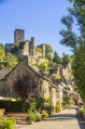
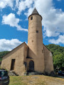
The Ponds Trail at Bournazel

Spurred on by a group of residents from the commune of Bournazel, the Tourist Information Office and Bournazel Town Hall have joined forces to carry out a major project to reopen and maintain rural paths, making them accessible for walking. Please respect their work.

Details

43260237
Creation:
Last update:
Last review:
  • Walking
    Activity: Walking
  • ↔
    Distance: 7.80 mi
  • ◔
    Average duration: 4h 00 
  • ▲
    Difficulty: Moderate

  • ⚐
    Back to start: Yes
  • ↗
    Ascent: + 440 ft
  • ↘
    Descent: - 420 ft

  • ▲
    Highest point: 1,788 ft
  • ▼
    Lowest point: 1,532 ft

Photos

Description of the walk

Starting point: Caussanel car park

(S/E) From the car park, head to Le Foirail and take the small tarmac road to the left of the Salle des Fêtes. At the crossroads (where all the trails start), follow the blue markings. Turn right and walk past the school. At the road, turn right then left, take the wide path that runs behind the housing estate and continue straight on. At the crossroads, turn right, then straight on, passing the remains of a lime kiln, and further on past the Fontaine du Cayrou until you reach the cross.

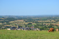
(1) Head to the right and walk through the hamlet of Cayrou. At the road, turn left, then right after the bend and before a house. Follow the road and take the second wide path, which climbs slightly to the left. Follow it to the road (viewpoint over the village, the castle and the Puech de Bournazel).

(2) At the D53 (Rignac road), head up to the right, keeping to the right-hand side (watch out for cars). At a place called La Bessière, turn left at the crossroads, staying on the tarmac road, until you reach the last houses.

(3) Head straight ahead onto a dirt track, through a meadow, then into a wood. Keep to the left at all times. At the road, turn right towards the Moulin du Roudillou, then right again towards the mill itself.

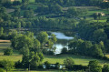
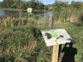
(4) Follow the path alongside the pond (muddy in wet weather). At the exit, on the tarmac road, turn left then right onto a farm track. Follow this to the hamlet of Crayssac.

(5) Walk through the hamlet and, at the D658 (Route de Roussennac), turn right then left towards the village of Le Garric.

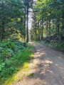
(6) Walk through the village and, on leaving it, pass the bread oven on your right and head left up a slight incline; then, after 80 metres (at the rubbish bins), turn right. Follow the pleasant path branching off to the left. It is shaded and winds between two stone walls. Further up, by the truffle oaks, head straight ahead, go down the path and rejoin the tarmac road leading to Bournazel.

(7) Turn right at the end of the road, then go straight on and turn left to reach the car park (S/E).


Waypoints

  1. S/E : mi 0 - alt. 1,673 ft - Caussannel car park – Le Foirail - Château de Bournazel
  2. 1 : mi 1.01 - alt. 1,660 ft - Cross
  3. 2 : mi 2.6 - alt. 1,673 ft - D53
  4. 3 : mi 3.14 - alt. 1,762 ft - La Bessière
  5. 4 : mi 4.45 - alt. 1,555 ft - Moulin Roudillou
  6. 5 : mi 5.64 - alt. 1,604 ft - Crayssac
  7. 6 : mi 6.38 - alt. 1,601 ft - Garric
  8. 7 : mi 7.63 - alt. 1,706 ft - Bournazel
  9. S/E : mi 7.8 - alt. 1,673 ft - Caussannel car park – Le Foirail - Château de Bournazel

Notes

- Wear suitable footwear.
- Take some food and drink with you.
- Hikers follow the route at their own risk. They remain responsible for any accidents they may suffer and for any damage they may cause to others (forest fires, damage to the environment, pollution, etc.).
- Stick to the marked trails and do not take shortcuts. If the route has been altered, follow the new signposting.
- Be considerate. We are not the only ones using the paths; be mindful of others.
- Take your rubbish away with you. Leave no trace of your visit; do not throw anything on the ground; carry a rubbish bag with you.
- Keep your dog on a lead, particularly near homes or livestock.
- Close gates and fences behind you, and walk around crops. Please respect the work of those who shape and preserve our environment.
- Observe the rules in certain areas.
- Do not light fires. Areas with dense vegetation (forests) or those that are too exposed (scrubland, dry heathland, etc.) can catch fire very quickly.
- Do not drink water from streams. Clear water does not necessarily mean it is safe to drink.
- Check hunting seasons; some routes may be dangerous.

Worth a visit

Viewpoint over the Puechs de Bournazel between the points (1) and (2).

Reviews and comments

4.8 / 5
Based on 2 reviews

Reliability of the description
5 / 5
Ease of following the route
5 / 5
Route interest
4.5 / 5
Office de tourisme du Pays Rignacois

We are delighted that you enjoyed this hike. Have a lovely day and happy walking!

Machine-translated

EMCI13
EMCI13

Overall rating : 4.7 / 5

Date of your route : Sep 19, 2025
Reliability of the description : ★★★★★ Very good
Ease of following the route : ★★★★★ Very good
Route interest : ★★★★☆ Good
Very busy route : No

Hike along small, shaded paths with minimal road travel. Pleasant, with little elevation gain. Peaceful countryside scenery.
Picnic by the pond where you will find a table. The hike starts at the foot of the castle, which you can visit on the way back.
A lovely hike to enjoy with the family

Machine-translated

Rigal
Rigal

Overall rating : 5 / 5

Date of your route : Jan 09, 2024
Reliability of the description : ★★★★★ Very good
Ease of following the route : ★★★★★ Very good
Route interest : ★★★★★ Very good
Very busy route : Yes

A lovely walk to go on
Partly on a footpath and partly on tarmac
However, there’s no elevation gain, but the scenery is lovely, with a beautiful, well-maintained lake called Le Roudillou
Marked in blue throughout the route
At the car park where the walk starts, there’s a map of the village showing all the possible walks and their corresponding colours – it’s really well detailed
Well worth a go

Machine-translated

Other walks in the area

For more walks, use our search engine .

The GPS track and description are the property of this route's author. Please do not copy them without permission.