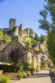
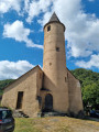
The Boriette path to Bournazel

Spurred on by a group of residents from the commune of Bournazel, the Tourist Information Office and Bournazel Town Hall have joined forces to carry out a major project to reopen and maintain rural paths, making them accessible for walking. Please respect their work.

Details

43260876
Creation:
Last update:
Last review:
  • Walking
    Activity: Walking
  • ↔
    Distance: 5.99 mi
  • ◔
    Average duration: 3h 50 
  • ▲
    Difficulty: Moderate

  • ⚐
    Back to start: Yes
  • ↗
    Ascent: + 1,243 ft
  • ↘
    Descent: - 1,240 ft

  • ▲
    Highest point: 2,175 ft
  • ▼
    Lowest point: 1,486 ft

Photos

Description of the walk

Starting point: Caussanel car park

(S/E) Take the road that starts to climb opposite the château. Follow the purple markings as you continue along the path. At the steeply ascending road, pass Caldecoste to reach a junction.

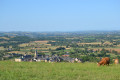
(1) Turn left onto the ascending path: there’s a viewpoint to the north over the Chaîne des Puys. At the edge of the forest, take the path leading down to the right and continue to the road.

(2) At the Route de la Fage, turn left then keep to the right onto the forest track climbing through the Bessade pine forest until you reach a multi-way junction.

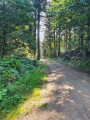
(3) Turn right onto a ridge path (viewpoint), then continue along the path to the left, leaving all other paths to your right. Walk past a meadow before beginning the descent towards La Boriette.

(4) Cross the hamlet and join the tarmac road. At the stone cross, turn left and head down to the stream.

(5) At the hairpin bend after the stream, take the path on the right which, after 100 m, begins to climb. Cross the stream (sign: no motorbikes). Continue to follow the ascending path. Below Carabols (which you cannot see), head down to the left and pass through the metal gate , taking care to close it behind you.

(6) Further on, head uphill and turn right onto a wide forest track, then left. Head up to the mobile phone mast by turning right (665 m – viewpoint).

(7) Pass the mast and head down to the right, following the main path, to reach a large car park. Cross it and head to the left. Take the tarmac road on the left.

(1) Carry on straight ahead, retracing your steps along the route you took on the way there, to return to Bournazel (S/E).


Waypoints

  1. S/E : mi 0 - alt. 1,673 ft - Caussanel car park – Le Foirail - Château de Bournazel
  2. 1 : mi 0.61 - alt. 1,969 ft - Junction of the circular loop
  3. 2 : mi 1.49 - alt. 1,834 ft - Route
  4. 3 : mi 1.86 - alt. 2,001 ft - Crossroads
  5. 4 : mi 3.11 - alt. 1,598 ft - La Boriette
  6. 5 : mi 3.52 - alt. 1,490 ft - Stream - Vayssade (ruisseau) - Affluent du Riou Viou
  7. 6 : mi 4.43 - alt. 1,854 ft - Fork in the path
  8. 7 : mi 4.85 - alt. 2,175 ft - Branch
  9. S/E : mi 5.99 - alt. 1,677 ft - Le Foirail – Caussanel car park - Château de Bournazel

Notes

- Wear suitable footwear.
- Take some food and drink with you.
- Hikers follow the route at their own risk. They remain responsible for any accidents they may suffer and for any damage they may cause to others (forest fires, damage to the environment, pollution, etc.).
- Stick to the marked paths and do not take shortcuts. If the route has been altered, follow the new signposting.
- Be considerate. We are not the only ones using the paths; be mindful of others.
- Take your rubbish away with you. Leave no trace of your visit; do not throw anything on the ground; carry a rubbish bag with you.
- Keep your dog on a lead, particularly near homes or livestock.
- Close gates and fences behind you, and walk around crops. We should respect the work of those who shape and preserve our environment.
- Follow the rules in certain areas.
- Do not light fires. Areas with dense vegetation (forests) or those that are too exposed (scrubland, dry heathland, etc.) can catch fire very quickly.
- Do not drink water from streams. Clear water does not necessarily mean it is safe to drink.
- Check hunting seasons; some routes may be dangerous.

Worth a visit

‘La Boriette’ is a name derived from the Occitan word ‘borieta’, a diminutive of ‘boria’, meaning ‘cattle shed’. It was therefore in a very practical spirit that the elders named this place, which, judging by the buildings of the old farm, was of very modest size. Despite this, the farmhouse at La Boriette had 15 inhabitants in 1868.
The difficulty of feeding so many mouths, combined with the predominant role of religion in nineteenth-century rural society, led many families to send at least one of their children into religious life. Thus, at La Boriette, the family saw one of their sons enter the priesthood.
He received an education and training that led him to serve under Monsignor Marty, himself a native of Aveyron, who, after serving notably as parish priest at Bournazel from 1940 to 1943, was Archbishop of Paris from 1968 to 1981.
This son, mindful of the journey he had undertaken and grateful for the love of his parents who had guided him towards the priesthood, commissioned the carving of the cross which you will find at the edge of the hamlet; a distinctive feature of this cross is that the facial features carved into the stone are those of his own parents.

Reviews and comments

4.6 / 5
Based on 3 reviews

Reliability of the description
4.7 / 5
Ease of following the route
4.3 / 5
Route interest
4.7 / 5
Office de tourisme du Pays Rignacois

Thank you for your feedback – it helps us to improve!

Machine-translated

Sylv13
Sylv13

Overall rating : 4.3 / 5

Date of your route : May 30, 2025
Reliability of the description : ★★★★☆ Good
Ease of following the route : ★★★★☆ Good
Route interest : ★★★★★ Very good
Very busy route : Yes

A lovely walk with some beautiful views and a large section through the forest.
The final stretch of the climb up to the pylon and the descent differ slightly between the marked route and the purple signposts, which we followed without any difficulty.

Machine-translated

Office de tourisme du Pays Rignacois

Thank you for this positive review! Have a lovely day – the sunshine is perfect for a walk!

Machine-translated

Lielle
Lielle

Overall rating : 4.3 / 5

Date of your route : Nov 03, 2024
Reliability of the description : ★★★★★ Very good
Ease of following the route : ★★★★☆ Good
Route interest : ★★★★☆ Good
Very busy route : Yes

A lovely walk.
No particular difficulties.
Well-maintained paths.

Machine-translated

Rigal
Rigal

Overall rating : 5 / 5

Date of your route : Feb 21, 2024
Reliability of the description : ★★★★★ Very good
Ease of following the route : ★★★★★ Very good
Route interest : ★★★★★ Very good
Very busy route : Yes

A lovely walk
A good portion of the route is through the forest with a fair amount of elevation gain
All the paths are well maintained
The route is marked in purple
At Bournazel Castle there is a car park with a map of the village and details of the various walks available, displayed on a board with very useful signposting

Machine-translated

labo
labo

I didn’t do the Boriette walk, but I did another route around Bournazel, which was also nice

Machine-translated

Other walks in the area

For more walks, use our search engine .

The GPS track and description are the property of this route's author. Please do not copy them without permission.