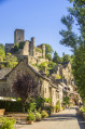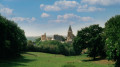
Lo birado

Spurred on by a group of residents from the commune of Bournazel, the Tourist Information Office and Bournazel Town Hall have joined forces to carry out a major project to reopen and maintain rural paths, making them accessible for walking. Please respect their work.

Details

n°43261371
Creation:
Last update:
Last review:
  • Walking
    Activity: Walking
  • ↔
    Distance: 14.76 mi
  • ◔
    Average duration: 8h 30 
  • ▲
    Difficulty: Difficult

  • ⚐
    Back to start: Yes
  • ↗
    Ascent: + 1,975 ft
  • ↘
    Descent: - 1,975 ft

  • ▲
    Highest point: 2,178 ft
  • ▼
    Lowest point: 1,227 ft

Photos

Description of the walk

Set off from the Caussanel car park.

(S/E) From the car park, head to the fairground and take the small tarmac road to the left of the Salle des Fêtes.

(1) At the crossroads (where all the paths start), follow the brown signposts with white trim, turning right. Walk past the school and, when you reach the road, turn right then left to take the wide path that runs behind the housing estate and carry on.

(2) At the three-way junction, veer to the right then head straight on, passing the remains of a lime kiln and, further on, the Fontaine du Cayrou. Carry on to the cross.

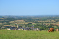
(3) Head to the right and walk through the hamlet of Cayrou. When you reach the road, turn left then right before a house. Follow the road and then take a wide, gently ascending path to the left. Follow it until you reach the D53 (Route de Rignac): a viewpoint overlooking the village, the castle and the Puech de Bournazel.

(4) Head uphill to the right, keeping to the right-hand side (watch out for cars). At a place called La Bessière, turn left at the crossroads and follow the tarmac road as far as the last houses.

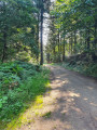
(5) Head straight ahead onto a dirt track, first through meadows, then skirting the edge of a woodland.

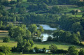
(6) At the road, turn right and cross the stream. Then take the first path on the right towards the Moulin du Roudillou and continue along the pond (muddy in wet weather) until you reach the tarmac road.

(7) Head left, then turn right onto a farm track. Follow it straight on to the hamlet of Crayssac. Pass through the hamlet to reach the D658 (Route de Roussennac).

(8) Turn right onto it, then turn left at the junction to reach the hamlet of Le Garric.

(9) Pass the bread oven on your right, head left up a gentle slope, then after 80 m (at the bins) continue right along the pleasant, shaded path between two stone walls. Further up, by the truffle oaks, turn left, then turn right onto the track and left again onto a long straight stretch with a view of the Chaîne des Puys. You’ll come out onto a road.

(10) Head down the road to the right (ruins of a lime kiln). After about 400 m, leave the road and head down to the left along a wide path through the woodland to Bouysses, keeping to the right at all times.

(11) At the exit (water reservoir), head uphill to the right. Keep to the left at all times to join the Rulhe-Cransac road, head left for 30 m and take the path leading uphill to the right. Further up, turn left, still through the woodland, and you’ll soon reach a junction of three paths (clearing).

(12) Head downhill opposite, rejoin a road and follow it to the right. Walk through Antagnagues until you reach the end of the tarmac.

(13) Turn right onto a wide path and continue straight on, ignoring the first path on the left. At the bottom, head right, follow the stream through the woods and cross it four times – it may be muddy in wet weather. Then ignore the junction with the Boriette. At the road, head down to the left and cross the stream.

(14) At the hairpin bend after the stream, take the path on the right which, after 100 m, begins to climb. Cross the stream (sign: ‘No motorbikes’). Continue to follow the ascending path.

(15) Below Carabols (which you cannot see), head down to the left and go through the metal gate, taking care to close it behind you. Further on, head up to the right then turn right again onto a wide forest track. Keep left twice and head up to the relay mast (alt. 665 m – viewpoint).

(16) Pass the mast and head down to the right, following the main path. Reach the edge of the forest and keep to the left to arrive at a large car park.

(17) Cross the car park and head left. Take the tarmac road opposite and head down towards Bournazel, continuing straight on at the right-hand bend onto a small path.

(1) Carry on straight ahead to return to the starting point (S/E).

Waypoints

  1. S/E : mi 0 - alt. 1,673 ft - Caussanel car park – Le Foirail - Château de Bournazel
  2. 1 : mi 0.09 - alt. 1,709 ft - Junction of the circular loop
  3. 2 : mi 0.53 - alt. 1,703 ft - Three-way junction, on the right
  4. 3 : mi 1.07 - alt. 1,660 ft - Cross
  5. 4 : mi 2.66 - alt. 1,677 ft - D53
  6. 5 : mi 3.19 - alt. 1,762 ft - La Bessière
  7. 6 : mi 4.13 - alt. 1,535 ft - Road junction
  8. 7 : mi 4.97 - alt. 1,562 ft - Route
  9. 8 : mi 5.85 - alt. 1,611 ft - D658
  10. 9 : mi 6.44 - alt. 1,601 ft - Le Garric
  11. 10 : mi 7.3 - alt. 1,749 ft - Route
  12. 11 : mi 8.44 - alt. 1,345 ft - Bouisses walk
  13. 12 : mi 9.04 - alt. 1,867 ft - Road junction
  14. 13 : mi 9.9 - alt. 1,404 ft - Antagnagues
  15. 14 : mi 11.61 - alt. 1,493 ft - Stream - Vayssade (ruisseau) - Affluent du Riou Viou
  16. 15 : mi 12.19 - alt. 1,814 ft - Junction below Cabarols
  17. 16 : mi 13.13 - alt. 2,178 ft - Branch
  18. 17 : mi 14.01 - alt. 2,005 ft - Car park
  19. S/E : mi 14.76 - alt. 1,673 ft - Le Foirail – Caussanel car park - Château de Bournazel

Notes

- Wear suitable footwear.
- Take some food and drink with you.
- Hikers follow the route at their own risk. They remain responsible for any accidents they may suffer and for any damage they may cause to others (forest fires, damage to the environment, pollution, etc.).
- Stick to the marked trails and do not take shortcuts. If the route has been altered, follow the new signposting.
- Keep a low profile. We are not the only ones using the paths; be considerate of others.
- Take your rubbish away with you. Leave no trace of your visit; do not throw anything on the ground; carry a rubbish bag with you.
- Keep your dog on a lead, particularly near homes or livestock.
- Close gates and fences behind you, and walk around crops. We should respect the work of those who shape and preserve our environment.
- Observe the rules in certain areas.
- Do not light fires. Areas with dense vegetation (forests) or those that are too exposed (scrubland, dry heathland, etc.) can catch fire very quickly.
- Do not drink water from streams. Clear water does not necessarily mean it is safe to drink.
- Check hunting seasons; some routes may be dangerous.

Worth a visit

Lime kilns

At the start of the 20th century, around ten kilns were built in the commune. To make lime, you need limestone, coal to burn it and land in the Ségala region to use it.
As Bournazel is situated at the tip of the Causse du Quercy, bordering acidic soils and very close to the Cransac mining basin, all the conditions were in place for setting up the lime kilns. The last one ceased operation in 1962.
The kiln chamber was loaded from the top of the kiln, known as the ‘gueulard’; coal and limestone were laid in alternating layers until the kiln was full. To prevent the chamber from cooling during calcination, this process was repeated continuously.

Reviews and comments

5 / 5
Based on 1 review

Reliability of the description
5 / 5
Ease of following the route
5 / 5
Route interest
5 / 5
Office de tourisme du Pays Rignacois

Hello, thank you for this positive review. Enjoy your walks!

Machine-translated

User 1924645

Overall rating : 5 / 5

Date of your route : Jan 19, 2026
Reliability of the description : ★★★★★ Very good
Ease of following the route : ★★★★★ Very good
Route interest : ★★★★★ Very good
Very busy route : No

Well-marked route

Machine-translated

Other walks in the area

For more walks, use our search engine .

The GPS track and description are the property of this route's author. Please do not copy them without permission.