A walk through the heart of the Grande Vallée woodland

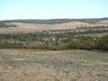
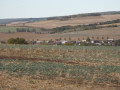
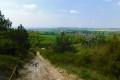
This lovely route, which runs largely through woodland, presents no major difficulties, despite a fairly steep climb at the start and end of the walk. It offers fine views over the Vanne valley and the Eaux de Paris aqueduct, as well as the Yonne valley, where, against the backdrop of the Côte de Paron and the distinctive silhouette of Sens Cathedral (Saint-Étienne), stands the first Gothic cathedral ever built.

Details

1562967
Creation:
Last update:
Last review:
  • Walking
    Activity: Walking
  • ↔
    Distance: 6.39 mi
  • ◔
    Average duration: 3h 25 
  • ▲
    Difficulty: Moderate

  • ⚐
    Back to start: Yes
  • ↗
    Ascent: + 528 ft
  • ↘
    Descent: - 505 ft

  • ▲
    Highest point: 696 ft
  • ▼
    Lowest point: 269 ft

Photos

Description of the walk

Car park at the Gaston Moitrier village hall.

(S/E) Go round the village hall via the D146 departmental road, then turn right onto the Route des Fleuris. Walk past the tennis courts, then turn left onto the unpaved track – the rural track from Malay-le-Grand to La Houssaye. Stay on this track for several hundred metres. It soon enters the forest.

(1) At a three-way junction in the forest, continue along the path on the right for a further 2 km. Keep heading south-south-east.

(2) At the junction of several paths, take the one on the right. As you leave the woods, keep close to the edge on the left.

(3) When you reach the tarmac road (known as the “Route des Fleuris”), turn right and follow it for a few hundred metres.

(4) Take the first path on the left and follow it along the edge of the woods. Continue straight on along this path, which then enters the woods. As you emerge from the woods, carry on straight ahead to stay along the edge (hunting posts). The path branches off to the right before entering the forest once more.

(5) Continue along this main track through the woods for a good distance of about 2 km. Join the tarmac-surfaced local road leading to Maillot and follow it straight on.

(6) Shortly after leaving the woods, leave the Maillot road and take the first path on the right, continuing for several hundred metres. At the next junction, turn right, then carry on straight ahead, staying on the main path.

(7) At the junction between two wooded areas, when you can no longer go straight on, head down to the left towards the sports grounds and the village hall car park (S/E).


Waypoints

  1. S/E : mi 0 - alt. 269 ft - Village hall car park
  2. 1 : mi 1.04 - alt. 574 ft - Fork in the road deep in the forest
  3. 2 : mi 2.09 - alt. 643 ft - Crossroads in the heart of the forest
  4. 3 : mi 2.48 - alt. 696 ft - Junction on a tarmac road
  5. 4 : mi 2.73 - alt. 679 ft - Junction on a path at the edge of the forest
  6. 5 : mi 3.72 - alt. 558 ft - Entry into the forest
  7. 6 : mi 5.04 - alt. 374 ft - T-junction before the Maillot industrial estate
  8. 7 : mi 5.78 - alt. 492 ft - T-junction on the hills above Malay-le-Grand
  9. S/E : mi 6.39 - alt. 269 ft - Village hall car park

Notes

For your safety, please avoid using this route during the traditional hunting season from 1 October to 28 February.

Routes through woods and forests must follow rural tracks; entering any woodland (even communal woodland) is prohibited. Please take care.

Worth a visit

Eaux de Paris waterworks.
Saint-Martin’s Church with its enormous square tower flanked by sturdy 16th-century buttresses.
Café Au P’tit Max in Malay-le-Grand.
Bakery on Rue Pasteur in Malay-le-Grand.

Reviews and comments

4.6 / 5
Based on 3 reviews

Reliability of the description
4.7 / 5
Ease of following the route
5 / 5
Route interest
4 / 5
Cyril Drion
Cyril Drion

Overall rating : 4.7 / 5

Date of your route : Apr 09, 2022
Reliability of the description : ★★★★★ Very good
Ease of following the route : ★★★★★ Very good
Route interest : ★★★★☆ Good
Very busy route : No

No complaints – the route is mostly in the shade.

Machine-translated

MimiFore
MimiFore

Overall rating : 4.3 / 5

Date of your route : Feb 23, 2022
Reliability of the description : ★★★★★ Very good
Ease of following the route : ★★★★★ Very good
Route interest : ★★★☆☆ Average
Very busy route : No

It’s a great shame that this route has been so badly damaged by ruts caused by vehicles (whether forestry machinery or hunters’ vehicles), as at times the path was almost impassable (with very deep ruts filled with water) and you really needed a good sense of balance to avoid falling into the muddy puddles that had formed in places... Best done during the dry season, once the water has ‘drained away’...

Machine-translated

OT Sens
OT Sens ★

Thank you for your feedback on this route – we’re delighted that you enjoyed it!
We’re always happy to help you find other ideas for walks in the Sénonais region! See you soon!
The team at the tourist office

Machine-translated

Daniele.melain@orange.fr

Overall rating : 4.7 / 5

Date of your route : Aug 19, 2021
Reliability of the description : ★★★★☆ Good
Ease of following the route : ★★★★★ Very good
Route interest : ★★★★★ Very good
Very busy route : No

A very pleasant route offering superb views across the wide valley.

Machine-translated

Other walks in the area

For more walks, use our search engine .

The GPS track and description are the property of this route's author. Please do not copy them without permission.