Country:
 City:
City:


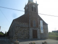
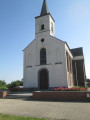
Start from Bettignies church.
(S/E) Follow the D159 towards Villers-Sire-Nicole for a few hundred metres, leaving the RN2 and the church behind you.
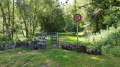
(1) Just after a very sharp left-hand bend, take the dirt track on your left. This leads north to nearby Belgium.
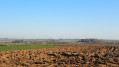
(2) After the shed, head down the same track and then climb the path on the right; from here, you’ll have a view of the Borinage region. On a clear day, you might even catch a glimpse of the Belfry of Mons. Without realising it, you’ll have crossed the border. Walk past the plantations of spruce and American oak trees.
(3) An old blue stone marker indicates that you’re back in France. After 2 km, you’ll reach the village of Villers-Sire-Nicole, passing to the right of the Solmont hill. Follow the signposts carefully.
(4) Once you reach the square, carry on straight ahead along Rue du 8 mai 1945. Walk past the Notre-Dame de Grâce Chapel and continue straight on along Rue des Roblins.
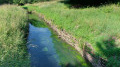
(5) Before the bridge over the Ruisseau de l’Hôpital, turn right onto the grassy path and follow it to the old Salmagne mill. Carry on straight towards the RD 228, then head down to the left along Rue de Villers-Sire-Nicole towards Bersillies, where you’ll turn right before Place Saint-Pierre d’Hautmont. On the way, note the Fort de Bersillies on your right, which forms part of Maubeuge’s defensive belt.
(6) At the crossroads, opposite Sainte-Aldegonde Church, head up to the right. Built in 1554, this church is the oldest in the area. It is the only one whose bell, dating from 1540, was not recast by the Germans in 1916.
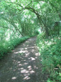
(7) Take the path on your left and, after about 500 metres, turn right so that you have your back to Bersillies Fort. It’s just another 1.5 km’s walk to pass by the (1) once more and return to Bettignies Church, whose bell tower you can already see (S/E).

 Visorando Member

 AONB
AONB
 Moderate